Map size in jpg-format: 8.38178MiB
Click to open in high resolution (open in new tab).
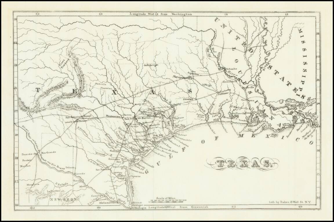
Fine example of Chester Newell's early map of the Republic of Texas, published in 1838.
The map shows all of Texas north to the Red River, providing an early look at the Republic, including a fine accounting of its early roads and settlements. The Alamo is noted just east of San Antonio, as are a number of other early towns.
The map shows the area from New Orleans westwards to about 102 degrees longitude, and south to the Rio Grande. There is considerable detail devoted to the settlements from Goliad north to Austin, and then east to Liberty. The map locates the 7 temporary capitals (San Felipe de Austin, Washington-on-the-Brazos, Harrisburg, Galveston Island, Velasco, Columbia, and Houston).
As noted by the History of Texas on Line:
Handbook of Texas Online:
NEWELL, CHESTER (1803-1892). Chester Newell, Episcopal clergyman, was born in Massachusetts on July 8, 1803; he graduated from Yale in 1831 and from the Episcopal Theological Seminary in Virginia in 1834. After serving as a missionary in Tennessee he moved to Texas in 1837. For a year he operated a school at Velasco, then spent some time at Houston gathering material for a history, after which he returned to New York.
In 1838 he published The History of the Revolution in Texas, Particularly of the War of 1835 & 1836; Together with the Latest Geographical, Topographical and Statistical Account of the Country.... In that year he applied for appointment as a missionary to Texas, but he was refused because of complaints from Texas that he had neglected his ministerial duties while there. . . .
If you are a student, write to us in telegram: @antiquemaps and indicate what material you need and for what work you need a map in high detail. We are ready to provide material on special terms. For students only!


