Map size in jpg-format: 32.366MiB
Click to open in high resolution (open in new tab).
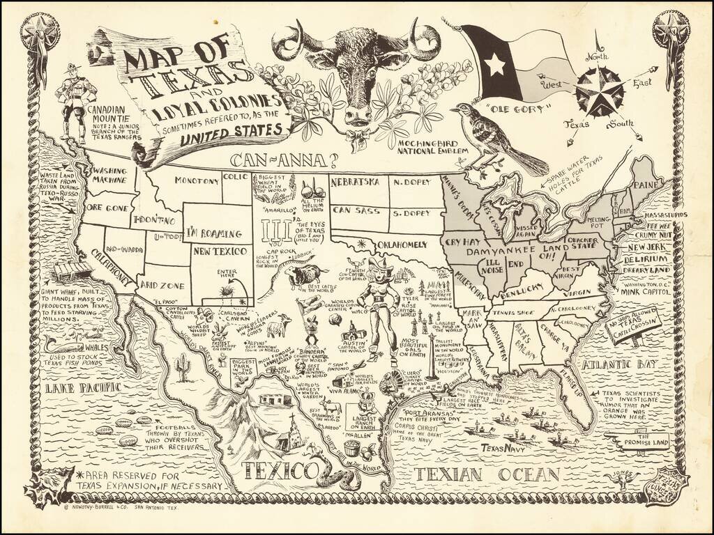
Lone Star Humor
Previously unrecorded pictorial map of Texas, published in San Antonio by Nowotny-Burrell & Co.
Entertaining pictorial map of Texas, with a fun variety of Texas humor and wit. The map is filled with clever notes and cute twists on state names, etc. Some of the better historical notes include bits of humor relating to:
Some of the state names are also quite entertaining:
The humor doesn't stop at the border, with the Canadian Mountie called a junior branch of the Texas Rangers, Mexico called Texico and the Great Lakes "spare water holes for Texas Cattle). Even the Compass Rose includes a fifth fleur d'lis for Texas.
The artist of the map is listed simply as Jones.
If you are a student, write to us in telegram: @antiquemaps and indicate what material you need and for what work you need a map in high detail. We are ready to provide material on special terms. For students only!


