Map size in jpg-format: 29.7058MiB
Click to open in high resolution (open in new tab).
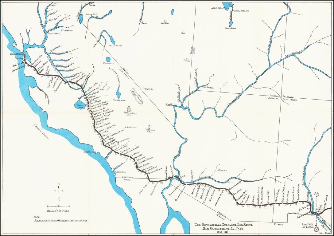
Rare historical / pictorial map of Western portion of the Butterfield Mail Route, drawn by Robert A. Hanson.
The map was likely published by the Western Cover Society, a California based society which published the Western Express. Hanson's maps were advertised for sale in this journal as early as 1969.
The map provides an elegant overview route, with daily stops and distances given from Hueco Tanks and El Paso to San Francisco.
Rarity
The map is now apparently quite rare. We were unable to locate another example.
If you are a student, write to us in telegram: @antiquemaps and indicate what material you need and for what work you need a map in high detail. We are ready to provide material on special terms. For students only!


