
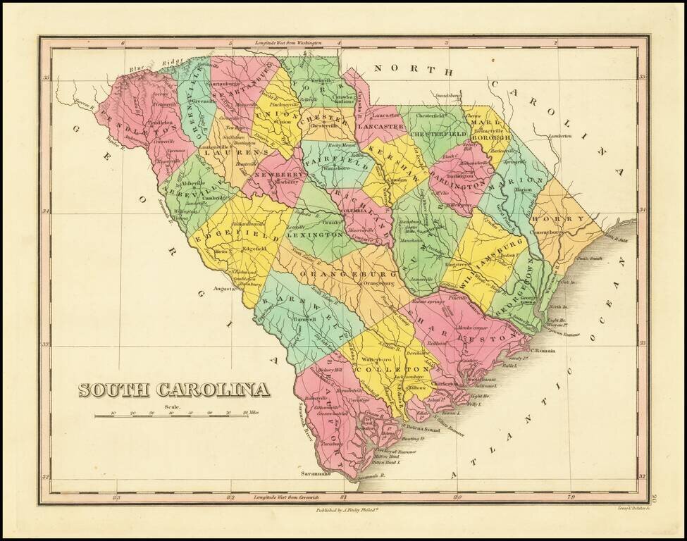
First edition of Anthony Finley's map of South Carolina from Finley's atlas. The map is hand colored by counties and shows towns, roads, rivers, mountains and other geographical features. Early county configurations.
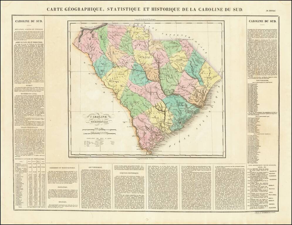
The First Map of the State of South Carolina published in France. The map is hand colored by counties and shows the various towns, roads, rivers, bridges, and a host of other details. Surrounded by text describing the state, its population,...
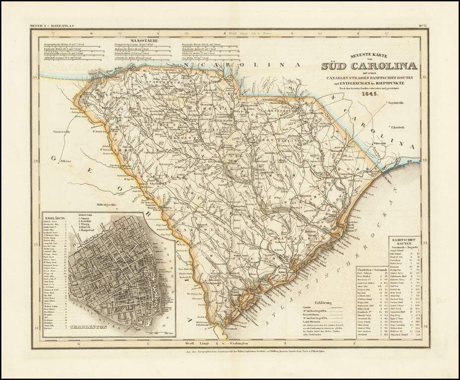
An antique map of South Carolina with German-language description based upon H. S. Tanner's map. The map purports to show the routes, railroads, and distances in the state, though it also locates various other features including rivers, canals, and...
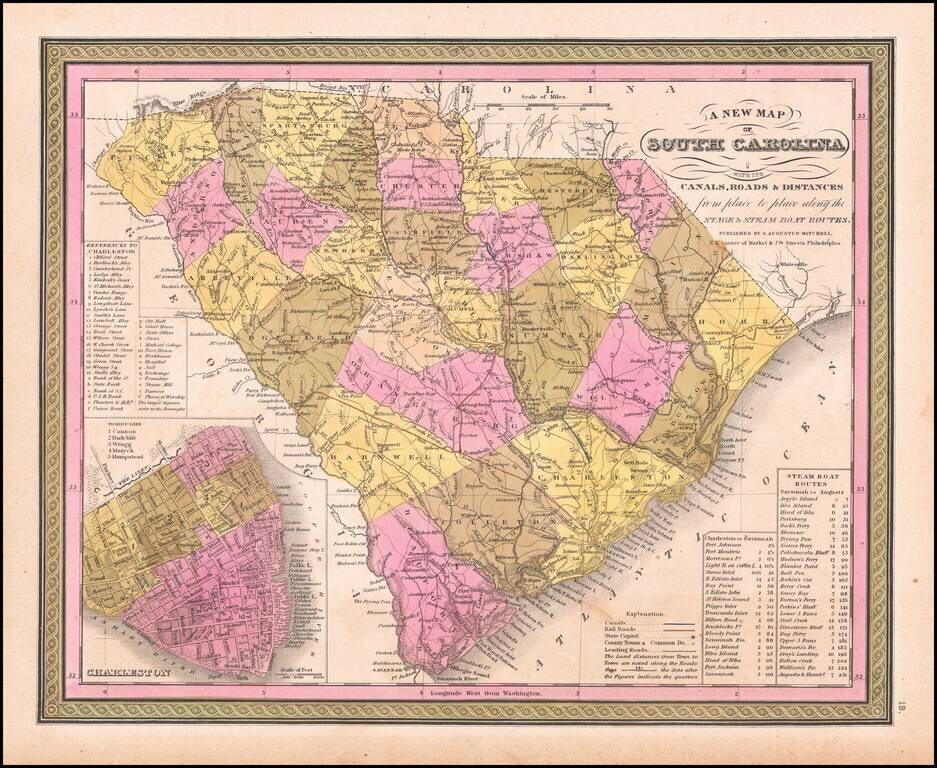
A fine map of South Carolina from the Antebellum Era. This interesting map depicts all of South Carolina, as it appeared in 1846, during an era of rising political tensions, which would eventually lead to the U.S. Civil War (1861-5). However, it was...
![Colton's South Carolina [Charleston Inset]](/map/small/69996.jpg)
Antique map of South Carolina from one of the most prolific American mapmakers of the 19th century. The map shows the routes, railroads, and settlements in the state, though it also locates various other features including rivers, canals, and even...