Map size in jpg-format: 27.0254MiB
Click to open in high resolution (open in new tab).
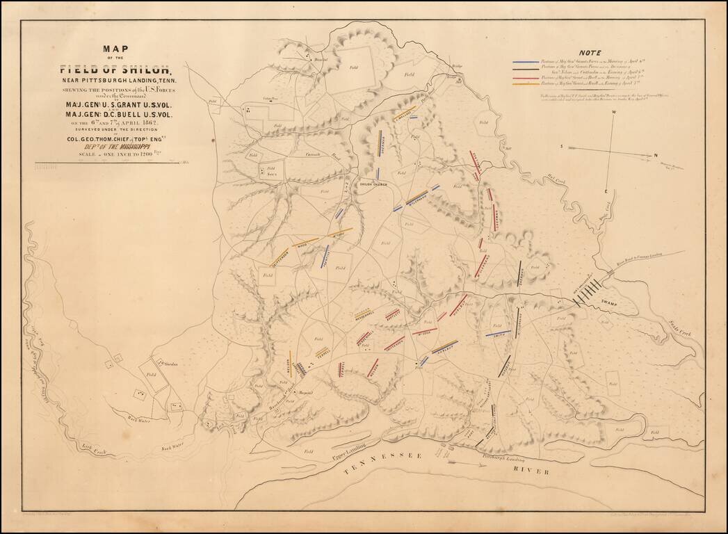
Rare St. Louis-Published First Edition of the Map of the Field of Shiloh.
Important separately-issued hand-colored lithographed map of the Battle of Shiloh lithographed by Chas. Robyn & Co. of St. Louis, Missouri in 1862.
This is the first edition of the map and can be differentiated from the more common Julius Bien edition by the following imprint information which is situated under the bottom neatline: "Surveyed Under The Direction Of Col. Geo Thom. Chief of Topl. Engrs. Drawn by Otto H. Matz, Asst. Topl. Engr. Lith. by Chas. Robyn & Co. cor. Chestnut and 3d St, St. Louis Mo."
The map includes troop positions for both armies, the Union and Confederate field headquarters, roads, railroads, drainage, vegetation and topographical features, plus the local residents in the vicinity of the battle.
The map includes a manuscript note under Colonel Thomas's name "Dept of the Mississippi".
If you are a student, write to us in telegram: @antiquemaps and indicate what material you need and for what work you need a map in high detail. We are ready to provide material on special terms. For students only!
![The United States of North America with the British Territories And Those of Spain, according to the Treaty of 1784 . . . 1793 [shows Franklinia!]](/map/small/64978.jpg)

