logo

1936. Industrial Map of the Kentucky & Indiana Terminal Railroad Company, Louisville

  • Industrial Map of the Kentucky & Indiana Terminal Railroad Company, Louisville
  • Industrial Map of the Kentucky & Indiana Terminal Railroad Company, Louisville
  • Industrial Map of the Kentucky & Indiana Terminal Railroad Company, Louisville
  • Industrial Map of the Kentucky & Indiana Terminal Railroad Company, Louisville

Industrial Map of the Kentucky & Indiana Terminal Railroad Company, Louisville information:

Year of creation: 
Resolution size (pixels): 
 30204x18002 px
Disk Size: 
 129.004MiB
Number of pages: 
 4
Place: 
 Louisville, KY
Author: 

Print information. Print size (Width x height in inches):
Printing at 72 dpi 
  419.5 х 250.03
Printing at 150 dpi 
 201.36 х 120.01
Printing at 300 dpi 
 100.68 х 60.01

An example of detailing the file of this map of in a printable high-resolution:

Click to open in high resolution (open in new tab).
Attention! this is just the central piece (central area 960x960 px) of the map file!
This is an example, so that you can see and study the level of detail of a given map. The entire Map will be fully available after payment!

Industrial Map of the Kentucky & Indiana Terminal Railroad Company, Louisville

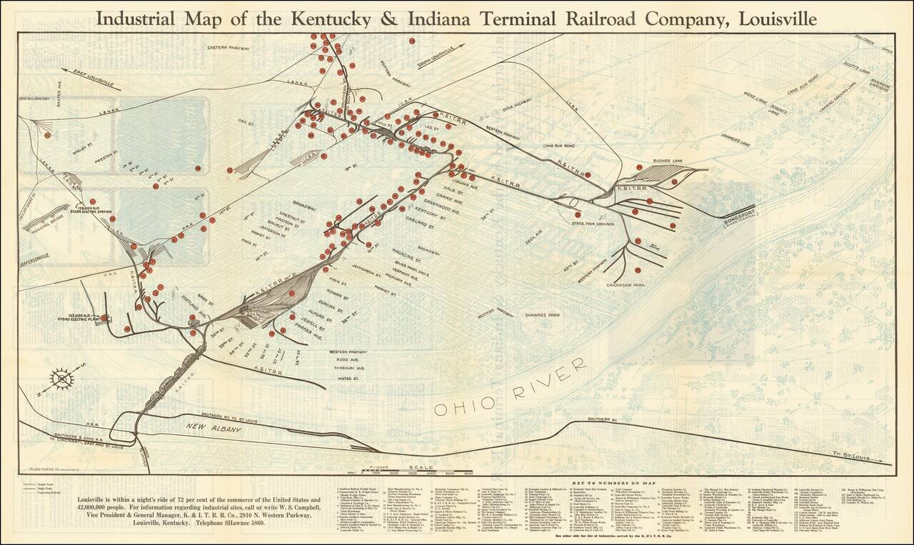
Louisville is within a night's ride of 72 per cent of the commerce of the United States and 42,000,000 People

Interesting map of Louisville, Kentucky, highlighting the location of the railroad lines, major manufacturers, and freight houses in metropolitan Louisville, Kentucky. The map's major features are overlaid in black and red, over a map of Louisville on the Ohio River, which is presented in a faint pale blue, in order to highlight the locations of importance.

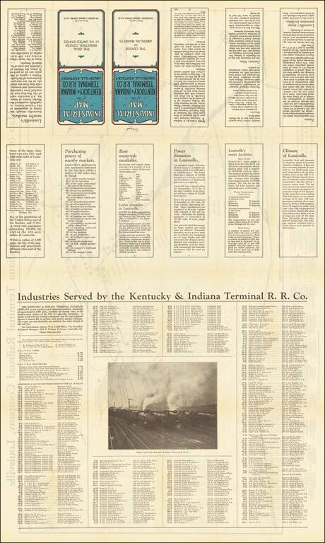
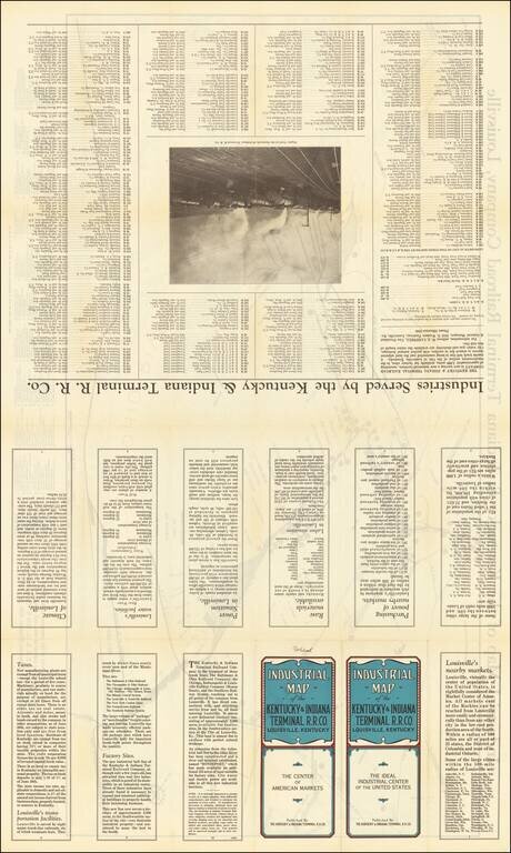
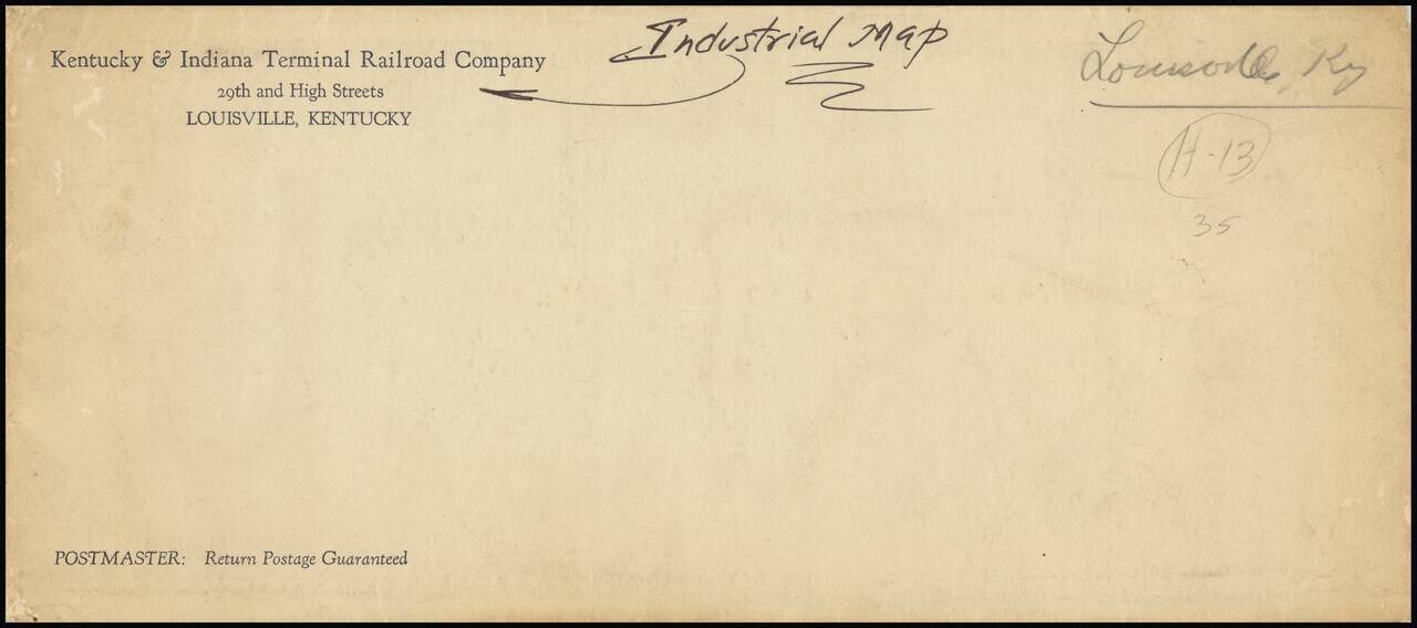
On the verso are photographs and a long list of the industries served by the Kentucky & Indiana Terminal Railroad Company, with promotional information extolling the virtues of Louisville.

Rarity

OCLC locates 1 example (Indiana Historical Society), which they date to 1928. We date our example 1936 based upon the date which appears on panel #10 on the verso of the map.


Special conditions for students!

If you are a student, write to us in telegram: @antiquemaps and indicate what material you need and for what work you need a map in high detail. We are ready to provide material on special terms. For students only!

Item information:

Year of creation:
Size:
30204x18002 px
Disk:
129.004MiB
Number of pages:
4
Place:
Louisville, KY
Author:
Bush-Krebs Company.
$29.99

Related item