Map size in jpg-format: 6.03014MiB
Click to open in high resolution (open in new tab).

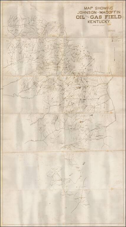
Detailed map showing the Johnson-Magoffin Oil and Gas Field in Kentucky.
The map identifies property owners, oil wells, gas wells, drilling wells, dry holes, gas & oil wells and "Show of Oil." The creeks and rivers in the area are also located.
If you are a student, write to us in telegram: @antiquemaps and indicate what material you need and for what work you need a map in high detail. We are ready to provide material on special terms. For students only!