Map size in jpg-format: 21.2459MiB
Click to open in high resolution (open in new tab).
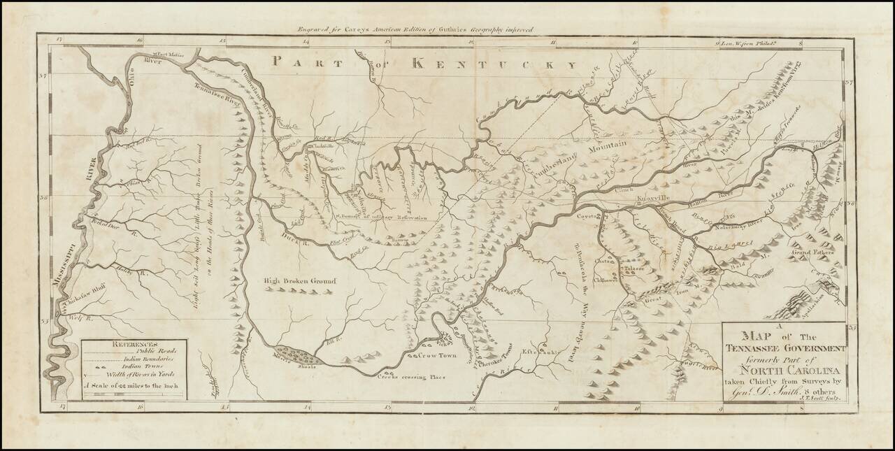
Nice example of the first state of Mathew Carey's map of Tennessee, published in Carey's American Atlas.
This is the first state of the map, issued in 1795 and distinguishable from the second state by the words "Tennassee Government" in the title, rather than Tennassee State.
An excellent topographical map, showing settlements, trails, roads, Indian boundaries and Indian Towns. Reference table also indicates that the width of rivers in yards are shown. The map was first advertised in conjunction with Carey's publication of Daniel Smith's A Short Description of the Tennassee Government… in 1793, but was not issued in that work and was first available as an insert to the work in January 1794. The map includes wonderful annotations concerning the soil, grass, timber and other details of Western Tennessee, the south boundary of a military reservation, the Kentucky Road etc. The boundaries of 8 early counties are also noted. An essential map for Tennessee collectors.
Carey's American Atlas was the first atlas published in the United States, compiling a number of excellent maps from indigenous sources in the first compilation of American maps.
If you are a student, write to us in telegram: @antiquemaps and indicate what material you need and for what work you need a map in high detail. We are ready to provide material on special terms. For students only!
![The United States of North America with the British Territories And Those of Spain, according to the Treaty of 1784 . . . 1793 [shows Franklinia!]](/map/small/64978.jpg)

