Map size in jpg-format: 34.7737MiB
Click to open in high resolution (open in new tab).

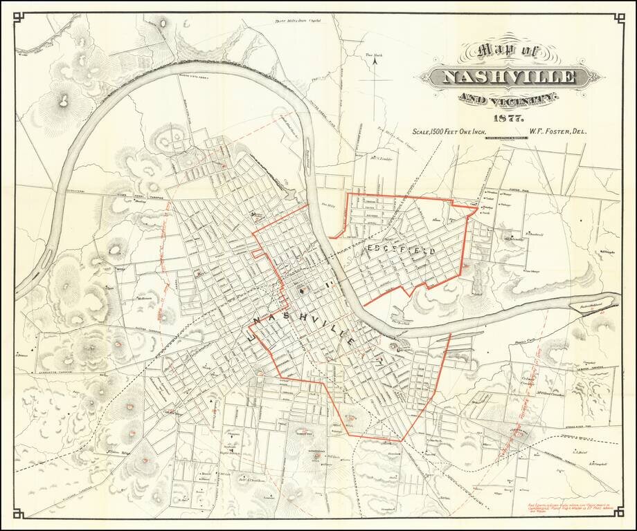
Showing Flooding Region of the Cumberland River
Scarce early map of Nashville, with redlines illustrating the High Water Mark of the Cumberland River -- 57 feet above the low water mark.
A highly detailed map of Nashville, showing streets, public buildings, topographical features and a host of other details.
Railroad lines shown include:
A number of early turnpikes are also shown, radiating outward from the city center.
The map also identifies a number of early land owners.
If you are a student, write to us in telegram: @antiquemaps and indicate what material you need and for what work you need a map in high detail. We are ready to provide material on special terms. For students only!
![The United States of North America with the British Territories And Those of Spain, according to the Treaty of 1784 . . . 1793 [shows Franklinia!]](/map/small/64978.jpg)

