
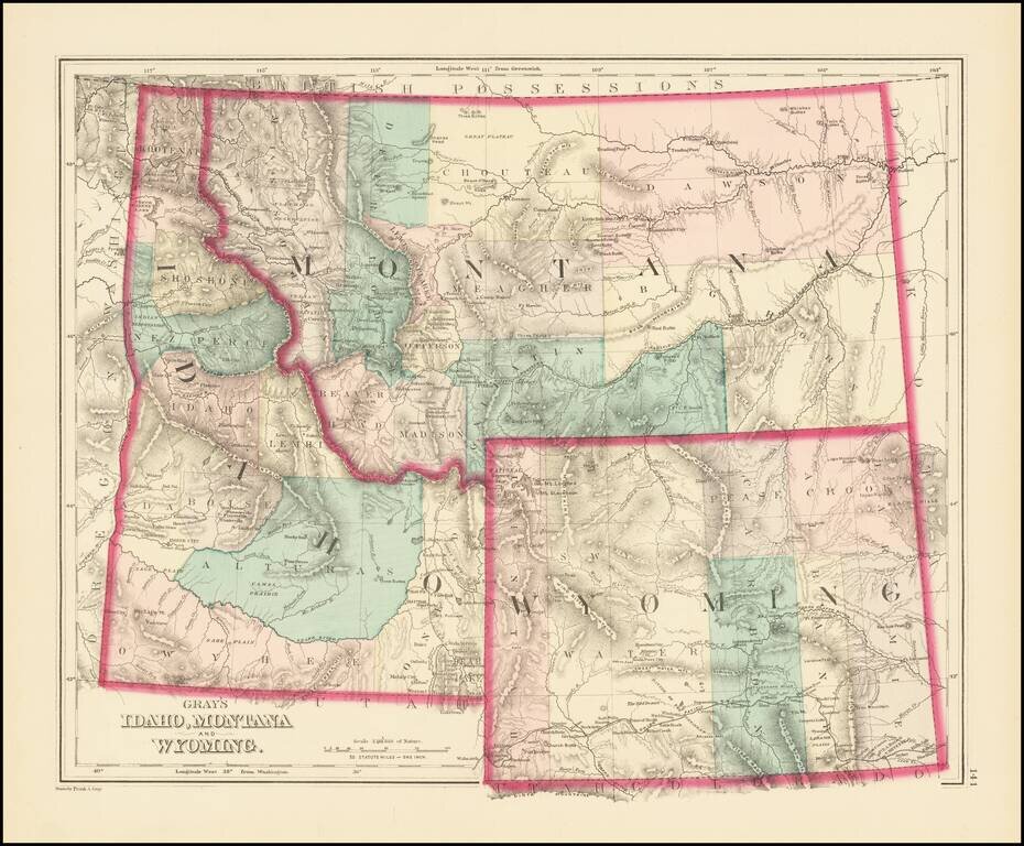
Excellent early map of Idaho Territory, Wyoming Territory and Montana Territory, published by OW Gray. Wyoming is shown with only 7 counties. Idaho has 10 counties and Montana has only 11. Yellowstone National Park is noted as a proposed national...
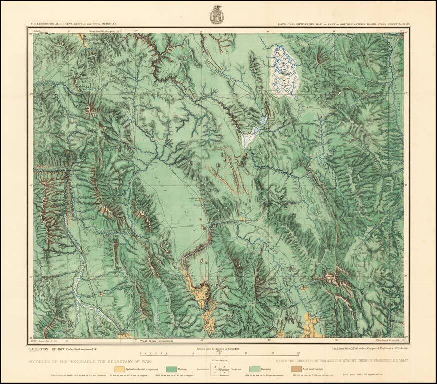
Fine regional map of Southeastern Idaho, based upon reconnaissance done in the Wheeler Survey Expedition of 1877, "Atlas sheet No. 32 (D) U.S. Geological surveys west of the 100th Meridian. Expedition of 1877 under command of 1st. Lieut. Geo. M....
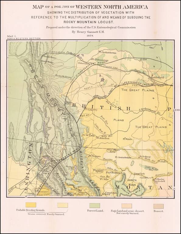
Detailed Vegetation Map of northern Montana, Idaho, Western Washington and contiguous parts of Alberta and British Columbia, from the Second Report of the United States Entomological Commission for the years 1878 and 1879. The map is relatedto the...
Early and highly detailed map showing railroads, towns, cities and mountain ranges. Early county configurations. Many early roads, rivers, mining areas, Indian names and other details.
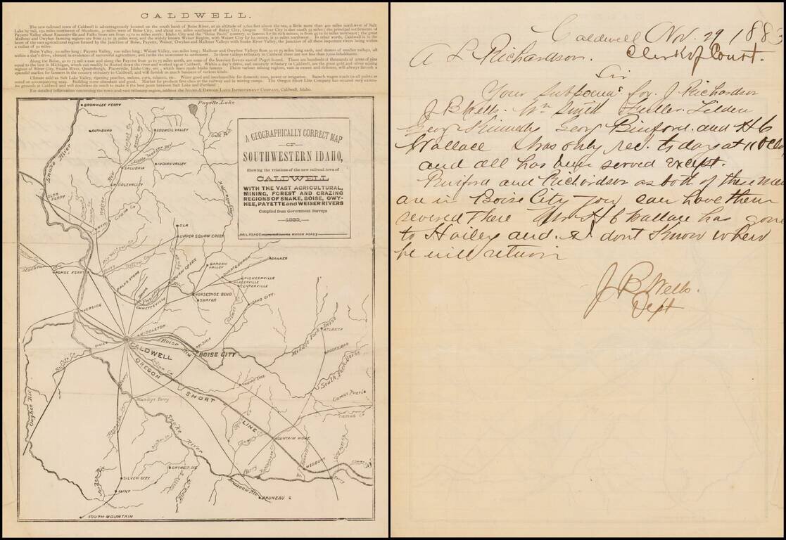
Fascinating early Idaho letter sheet, promoting the newly formed town of Caldwell, Idaho, published by its promoter, the Idaho & Oregon Land Improvement Company. The lettersheet provides a brief description of the location and advantages of...
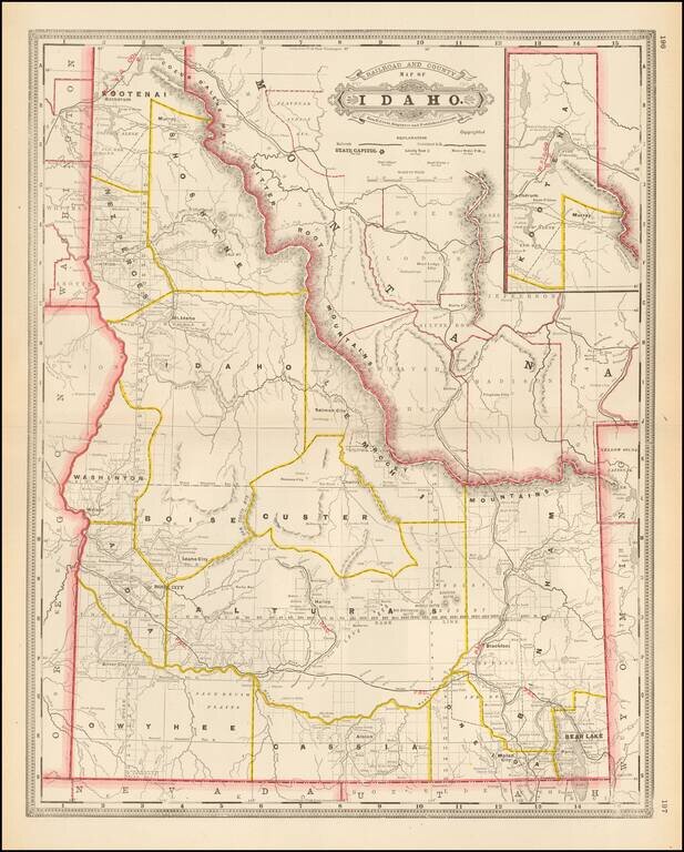
Early separate map of Idaho Territory. Highly detailed, showing towns, mines, roads, railroads, mountains, rivers, Indian Reservations, military reserves, post offices, forts, lakes, etc.
Early and highly detailed map of Idaho showing railroads, towns, cities and mountain ranges. Includes early county configurations. Includes many early roads, rivers, mining areas, Indian names and other details.
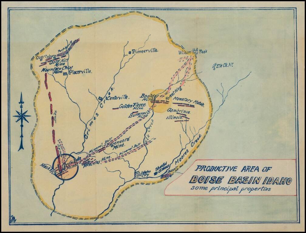
Fascinating mining map, showing the mining regions north of Idaho City, centered on Centerville, Idaho, in the area of the Boise National Forest. The map is centered on Grimes Creek and shows the mining regions between Moore Creek and Placerville....
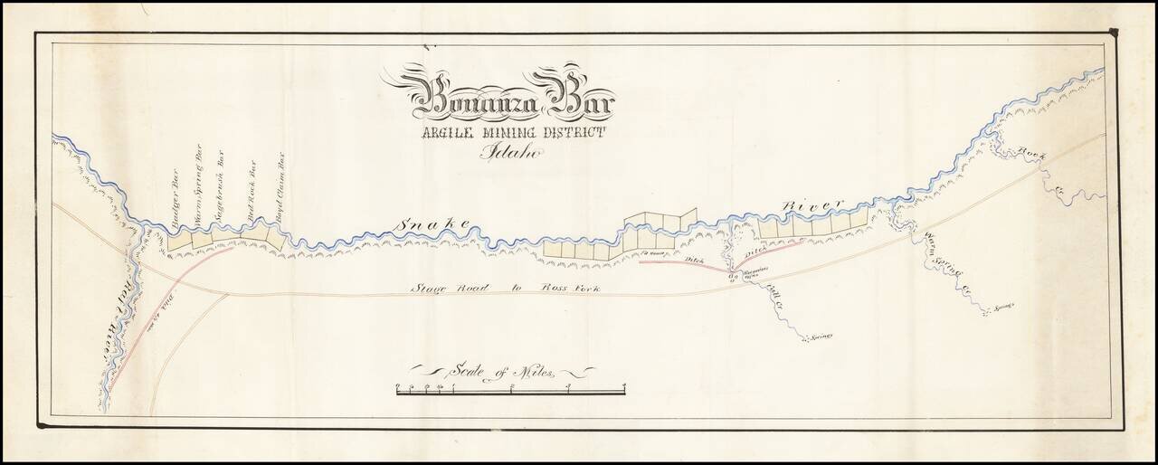
Fine hand drawn map of a section of the Snake River, tracking also the Stage Road to Ross Fork and illustrating Bonanza Bar. Bonanza Bar was centered on the mouth of Fall Creek, with Badger Bar, Warm Springs Bar, Sagebrush Bar, Bed Rock Bar and Boyd...
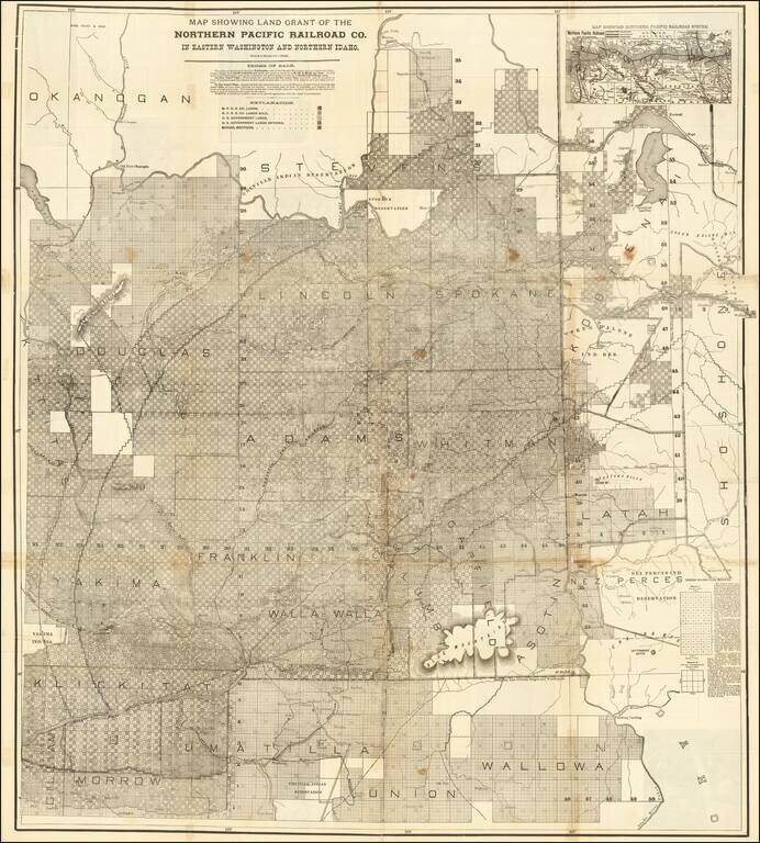
Rare large lithographed folding map showing land ownership opportunities in eastern Washington State and western Idaho, published to promote the lands owned and serviced by the Northern Pacific Railroad. The map is focused on the the growing...
![[Central Idaho & Eastern Oregon Letter Sheet Map] This Is Not A Map Of The World . . . The Weiser Commercial Club, Weiser, Idaho.](/map/small/40601.jpg)
Interesting promotional letter sheet map of the area around Weiser, Idaho, with a letter on the verso referencing the Weiser Irrigation District -- Washington County, Idaho. The map is centered on Weiser, Idaho, and extends southeast to Boise, Idaho,...
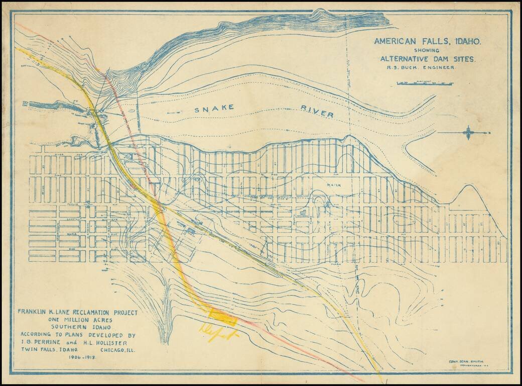
Relocating A Town To Construct the American Falls Dam Topographical plan of the area around American Falls, Idaho and the American Falls, Dam on the Snake River, drawn by Edna Dean Smith. The map was prepared in connection with the "Franklin K. Lane...
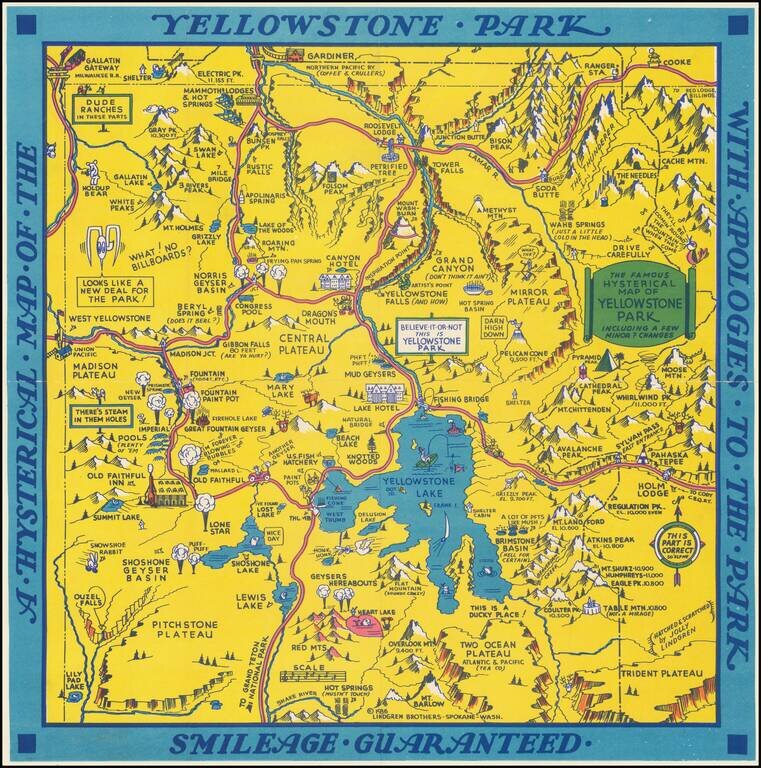
"Hatched & Scratched by Jolly Lindgren," this comic pictorial map is full of puns and comic vignettes related to Yellowstone and environs. The Lindgren Brothers issued a number of other silly whimsical maps of national parks and other parts of the...
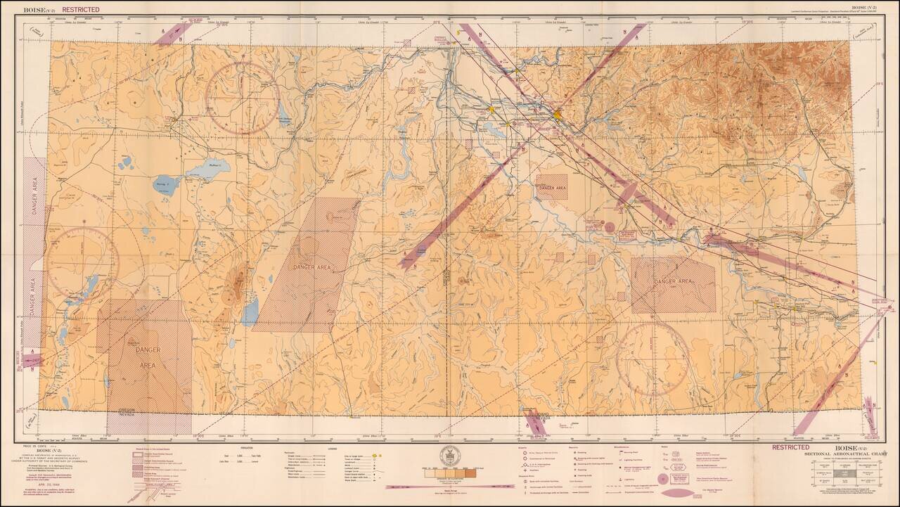
Restricted World War II Aviation Map Detailed aeronautical map of the Boise area. The chart is a font of information about civil and military aviation during WWII. It was intended for civil aviators flying by visual navigation and so includes data...
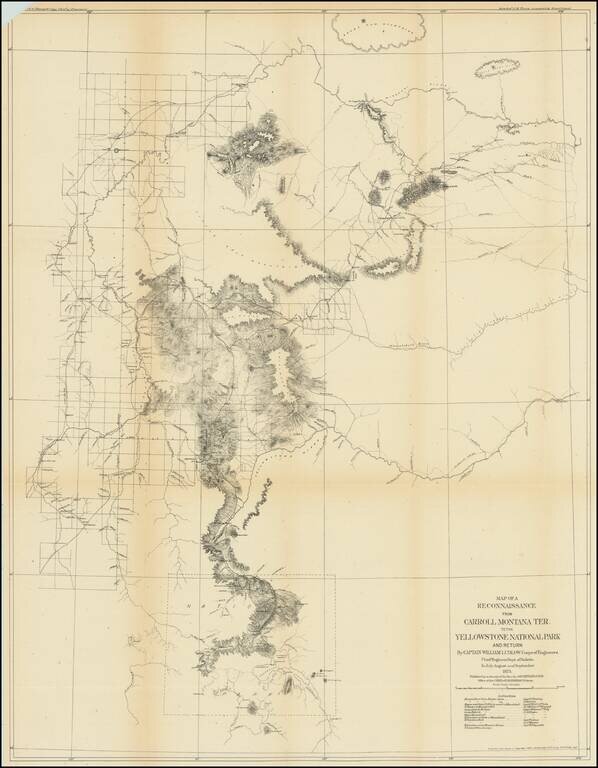
Captain William Ludlow's Expedition To Yellowstone From Montana in 1875 Important early exploration and survey of the route from Carroll, Montana to Yellowstone, undertaken by Captain William Ludlow in 1875. Carroll, Montana was described by Ludlow...
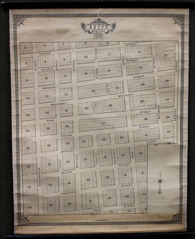
Rare Variant Edition Rare variant of Baker & Harper's "Plat of the town site of the town of Butte, Deer Lodge County," published in 1876. As noted at the bottom, the map was published by H.B. Stranahan & Co. Engravers of Cleveland, Ohio....