Map size in jpg-format: 162.105MiB
Click to open in high resolution (open in new tab).

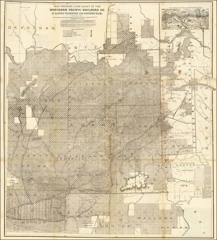
Rare large lithographed folding map showing land ownership opportunities in eastern Washington State and western Idaho, published to promote the lands owned and serviced by the Northern Pacific Railroad.
The map is focused on the the growing agricultural regions of Eastern Washington and Northwestern Idaho, and specifically the land available for purchase from either the Northern Pacific Railroad or neighboring US Government Lands, with a key identifying the status of each township and section. The fast majority of the region has been surveyed into townships, but a few unsurveyed areas remain. A number of early towns appear on the map.
In the north, the Colville Indian Reservation and Spokane Indian Reservation are shown, with the Coeur D'Alene Indian Reservation and Nez Perce Indian Reservation appearing in the east and the Yakima and Umatilla Reservations shown in the southwestern part of the map.
An inset map in the upper-right corner shows the full breadth of the Northern Pacific Railroad System.
The map differentiates between N.P.R.R. Co. Lands, N.P.R.R. Co. Lands Sold, U.S. Government Lands, U.S. Government Lands Entered, and School Sections.
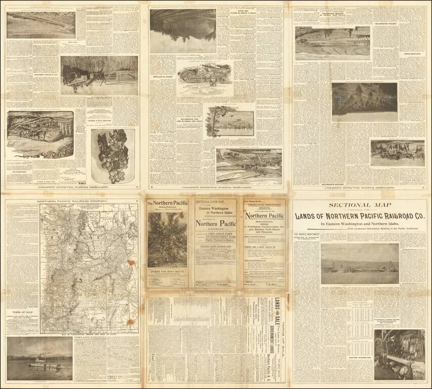
When folded the pamphlet reads: "The Northern Pacific Railroad. With Its Connecting Lines," and includes a description of Washington, the Evergreen State, promoting immigration and farm land opportunities. The text includes descriptions of government land programs and terms of sale for interested purchasers, along with a large overview map of Washington and Oregon and numerous black and white photos and engraved illustrations.
If you are a student, write to us in telegram: @antiquemaps and indicate what material you need and for what work you need a map in high detail. We are ready to provide material on special terms. For students only!