
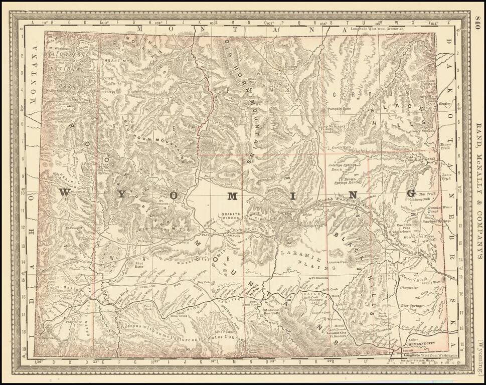
Highly detailed map of Wyoming Territory, showing towns, rivers, railroads, mountains, lakes, etc. One of the earliest seperately issued maps of Wyoming to appear in a commercial atlas.
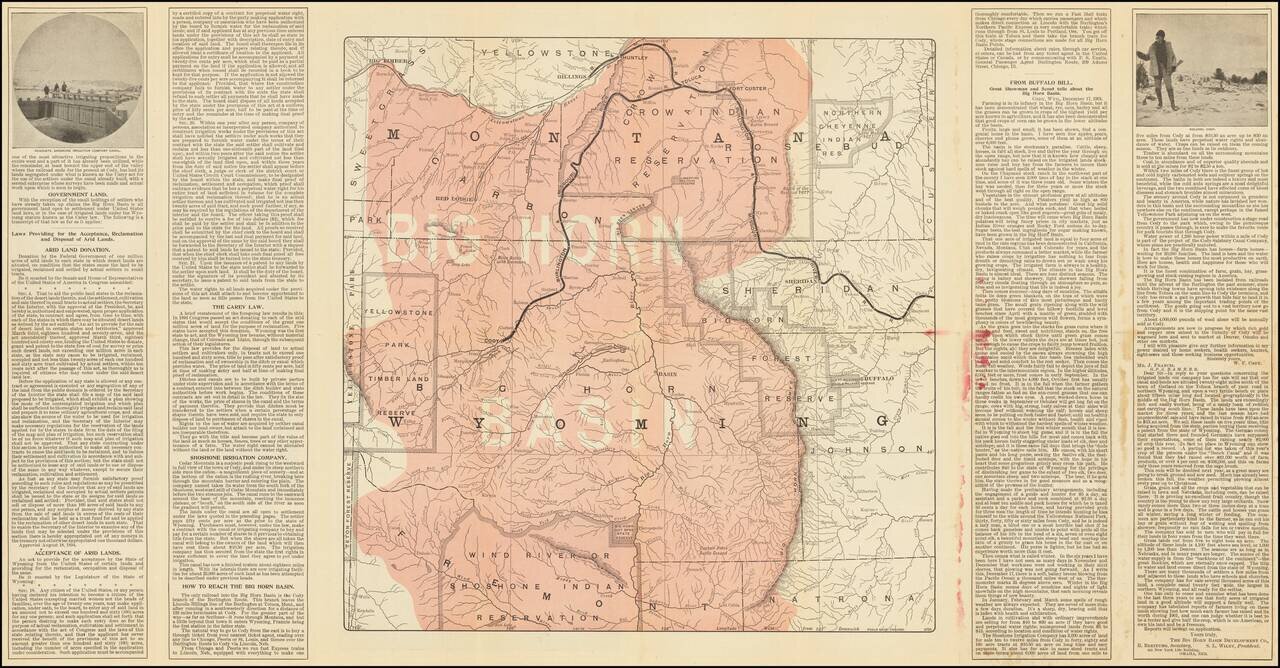
Promotional brochure and map promoting the Burlington Route. Includes a number of photographs and a smaller map on the verso.
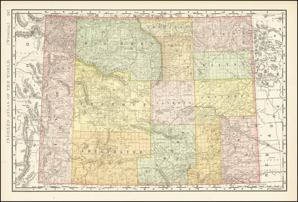
Highly detailed map of Wyoming Territory showing towns, rivers, railroads, mountains, lakes, etc. A fine early map of Wyoming Territory.
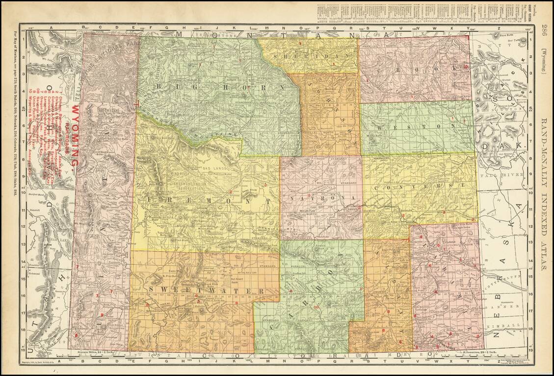
Highly detailed map of Wyoming Territory showing towns, rivers, railroads, mountains, lakes, etc. Includes a list of 9 Railroads at the top left.
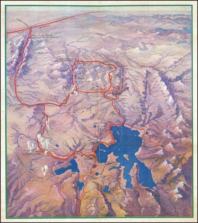
Attractive vintage pictorial bird's-eye view map of the Yellowstone National Park, produced by the Poole Brothers firm for the Chicago Milwaukee and St. Paul Railway in 1927. The map shows all of Lake Yellowstone and the surrounding region, with...
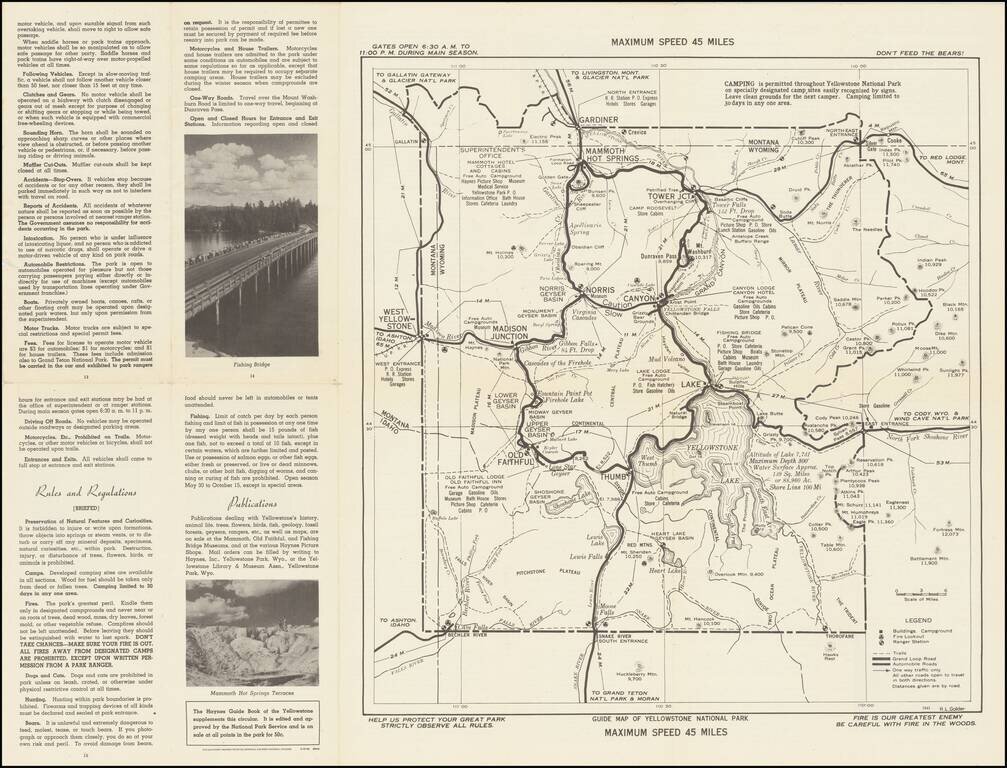
Don't Feed The Bears! Detailed 1941 map of old Yellowstone in Wyoming, published by the US Department of the Interior. Provides a fine overview of the roads, trails, campgrounds, hotels, geysers, and major points of interest in the park.
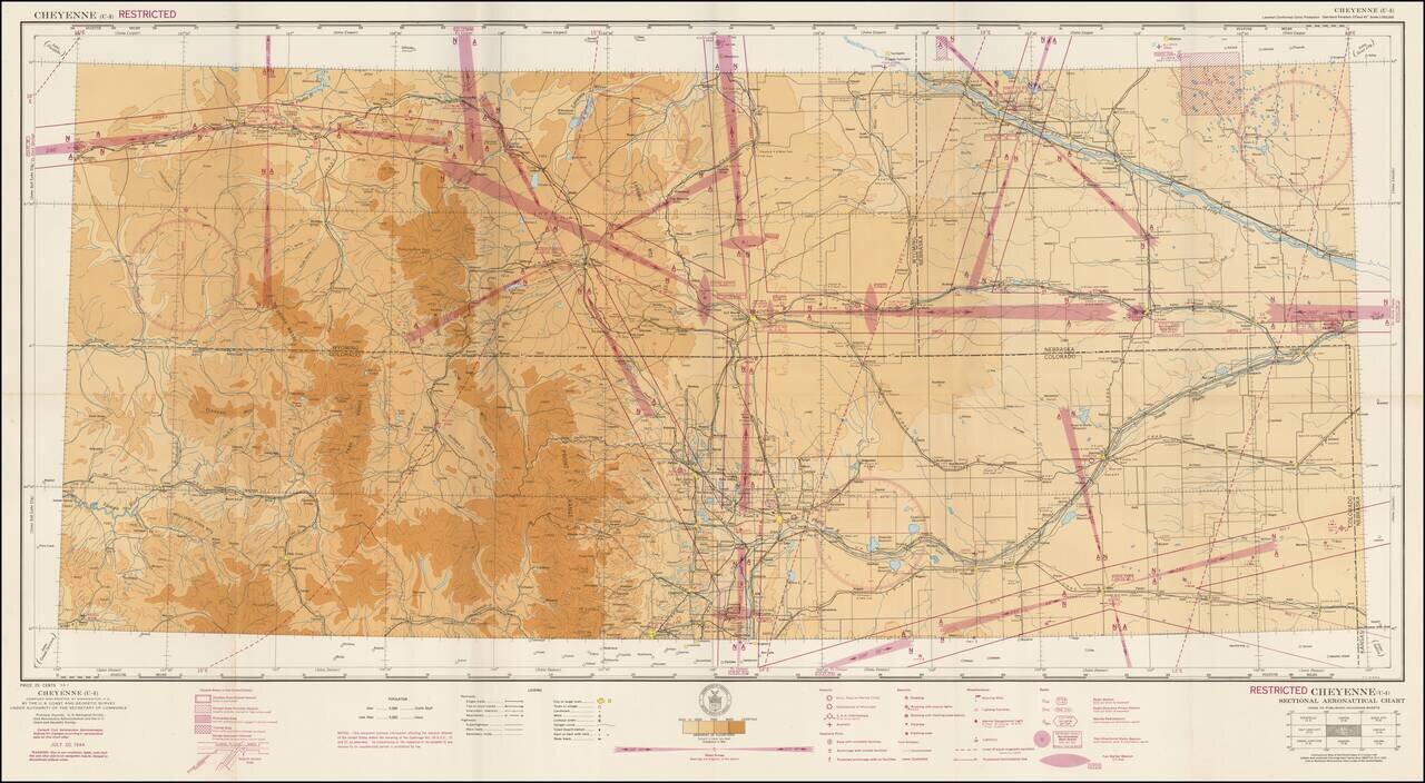
Restricted World War II Aviation Map Detailed aeronautical map of the Cheyenne, Wyoming region. The chart is a font of information about civil and military aviation during WWII. It was intended for civil aviators flying by visual navigation and so...
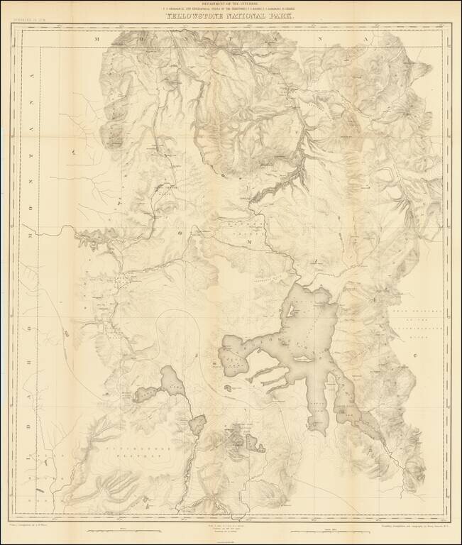
Second Hayden Survey Map of Yellowstone National Park A nice example of this fine large map of Yellowstone, prepared by the Department of the Interior. The map was prepared in connection with the second survey of the park by Ferdinand V. Hayden, the...
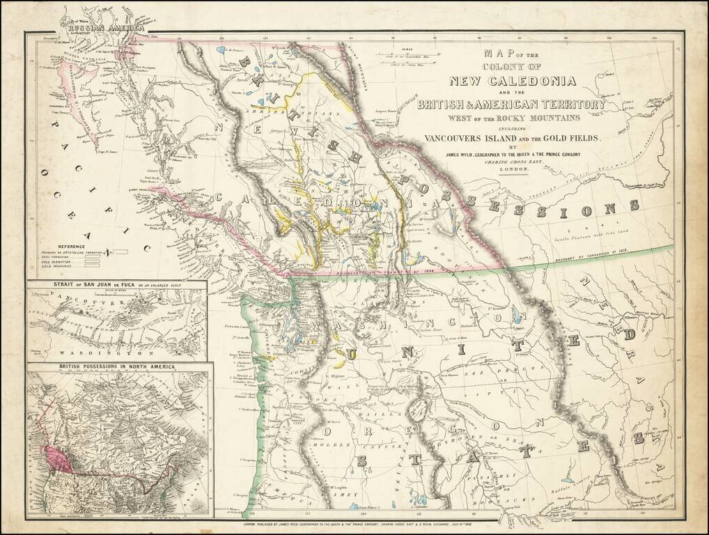
First State of this Exceptional Fraser Canyon Gold Rush Rarity One of the great early mappings of the Pacific Northwest, covering Oregon Territory, Washington Territory, and British Columbia (which was then still "New Caledonia") with information...
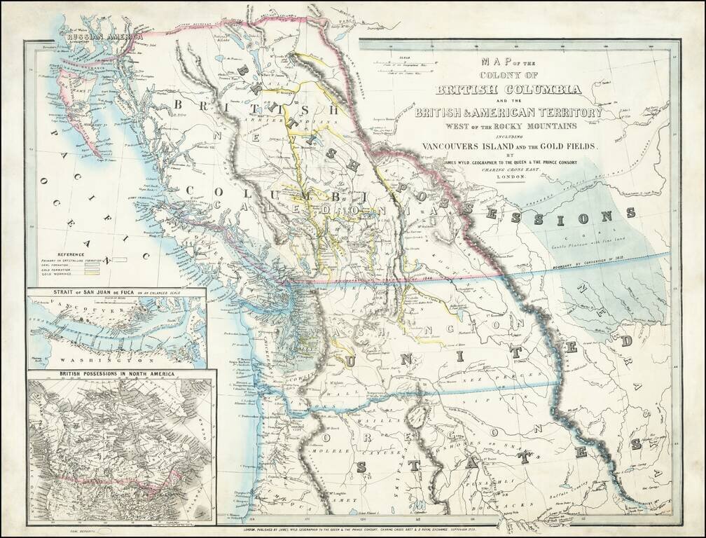
An Exceptional Fraser Canyon Gold Rush Rarity. One of the great early mappings of the Pacific Northwest, covering Oregon and Washington Territories, and British Columbia ("New Caledonia") with information derived from the Hudson Bay Company and Royal...