
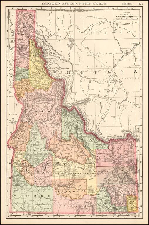
Large format detailed map showing towns, rivers, railroads, mountains, lakes, etc. Beautifully colored with many statistics. From Rand Mc Nally & Sons Business Atlas.
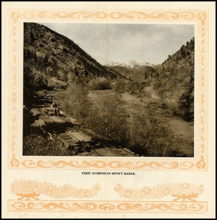
Early photographic view of the Snowy Range in Colorado, from the turn of the Century.
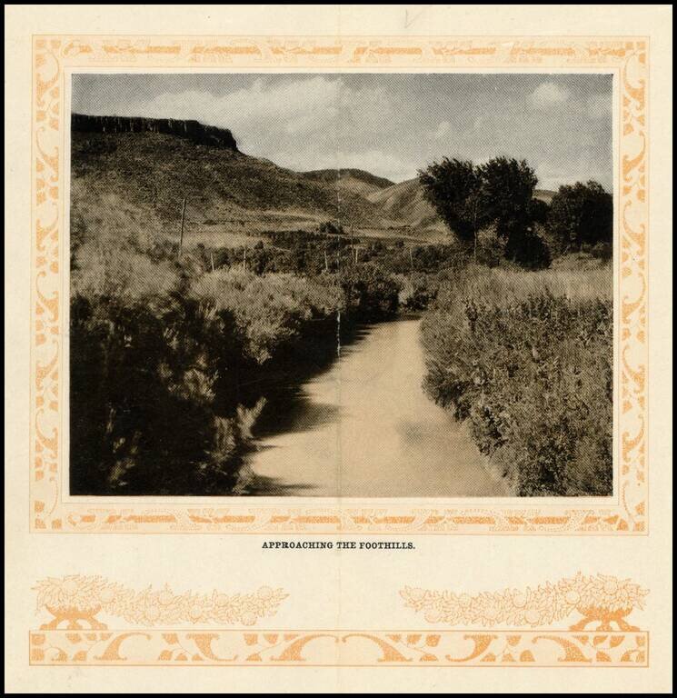
Early photographic view of the foothills on route to Georgetown, Colorado, from the turn of the Century.
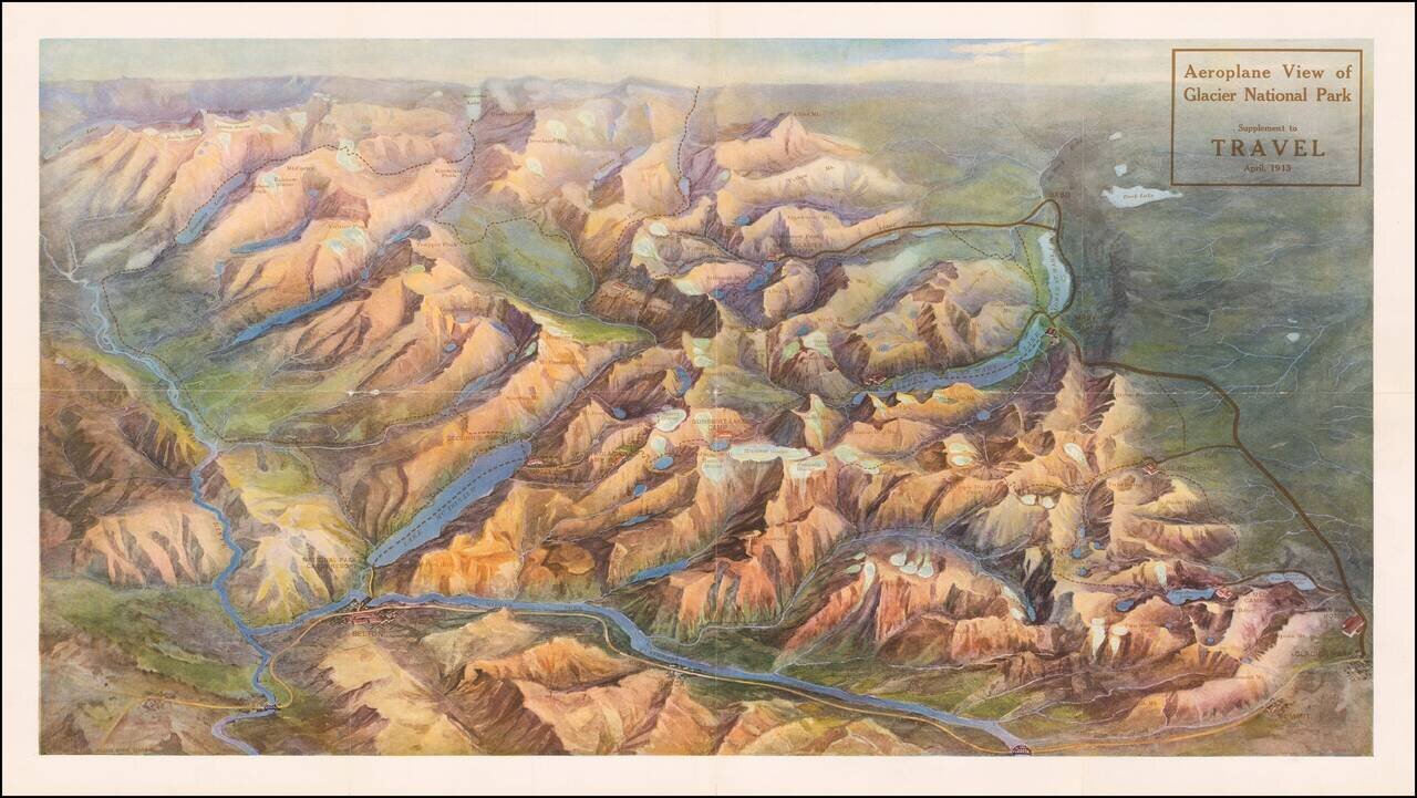
Rare birdseye view illustrating Glacier Park and environs. The present example is a separately issued example, which was a Supplement to the April, 1913 edition of Travel Magazine. The view would later be re-issued with different coloration in 1914....
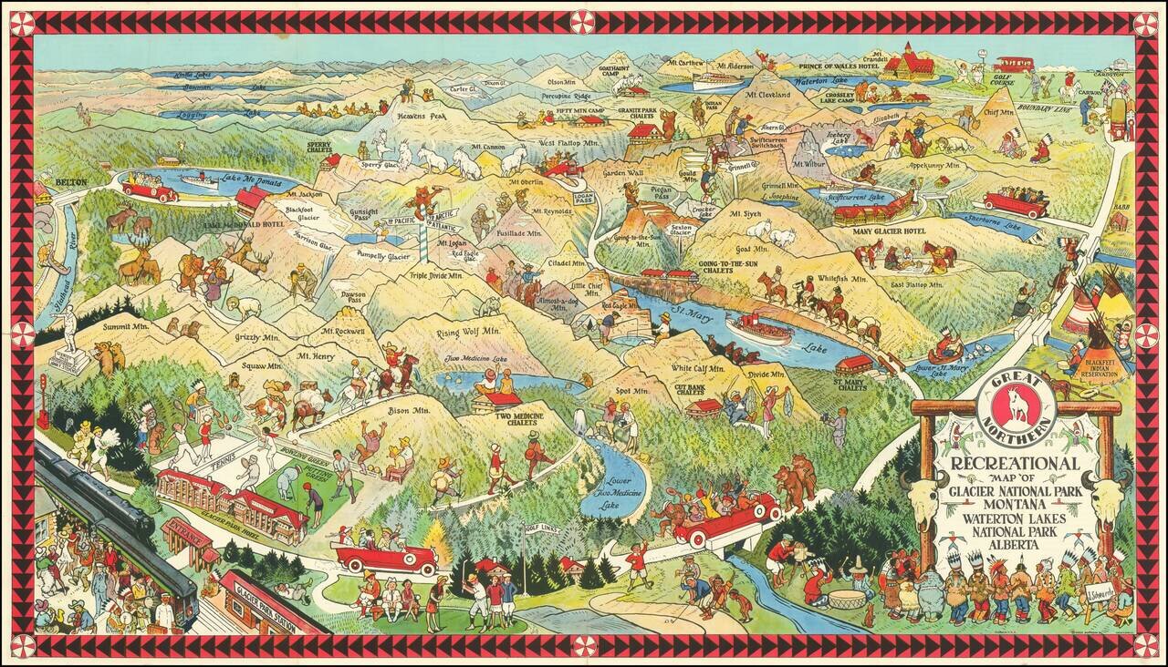
Fine early pictorial map promoting the Great Northern Railway. The map includes a lively offering of park scenes, including Grizzly Bears confronting tourists on a bridge, yacht rides in the major lakes, and another Grizzly Bear dumping Champagne (?)...
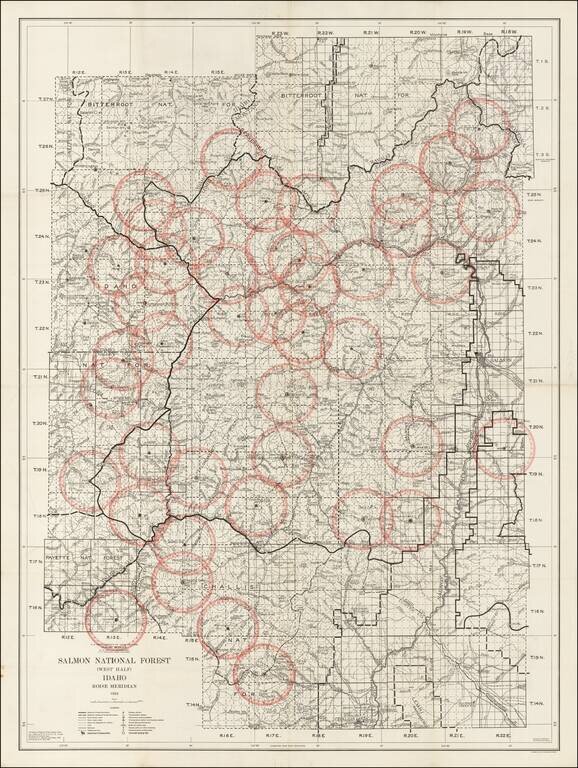
Detailed map of the Salmon National Forest, published by the Department of Agriculture in 1934. The Salmon National Forest was originally established in November 5, 1906 and renamed on March 4, 1907. On July 8, 1908, it was combined with the Challis...
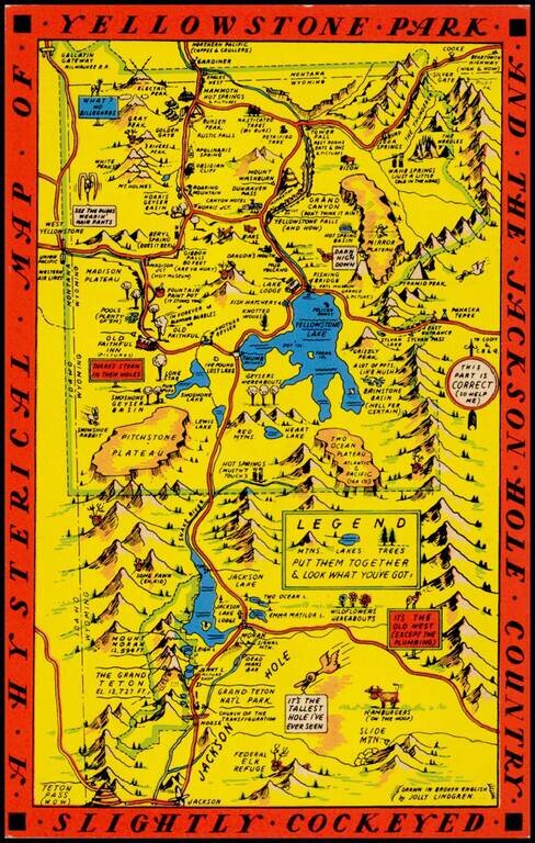
"Drawn in Broken English by Jolly Lindgren," this comic pictorial map is full of puns and comic vignettes related to Yellowstone and environs. The Lindgren brothers issued a number of other silly whimsical maps of national parks and other parts of the...
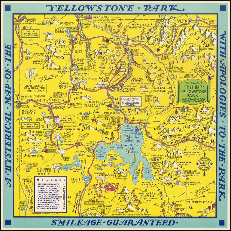
Scarce 1948 edition of the Jolly Lindgren map of Yellowstone, "Hatched & Scratched by Jolly Lindgren." This edition adds the table of miles at bottom left, among other changes, including the addition of Pilot Peak at the top right corner. This...
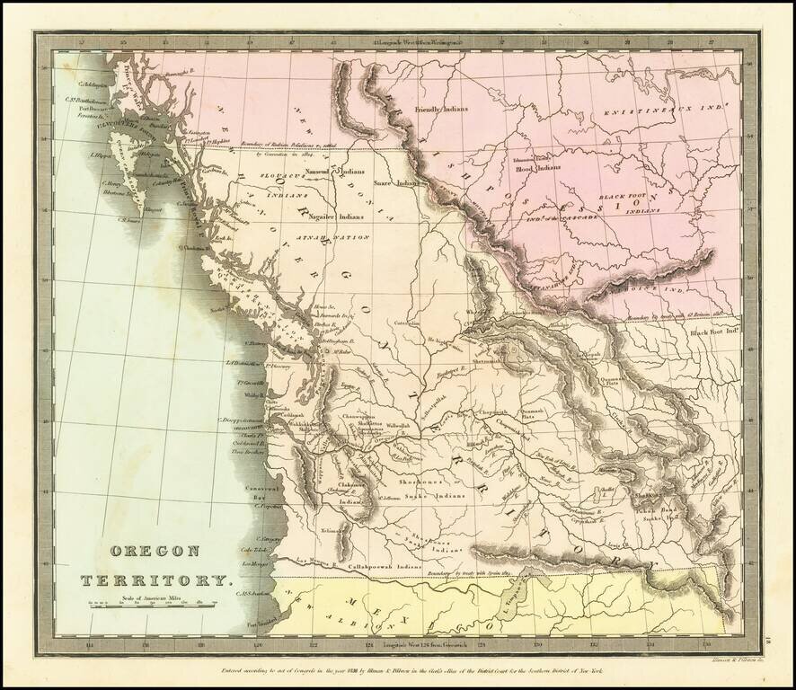
The First Map of Oregon Territory to Appear in a Commercial Atlas Striking example of the first edition of David Burr's map of Oregon Territory, which appeared in Burr's New Universal Atlas, first published in 1835. As is typical of Burr’s style,...
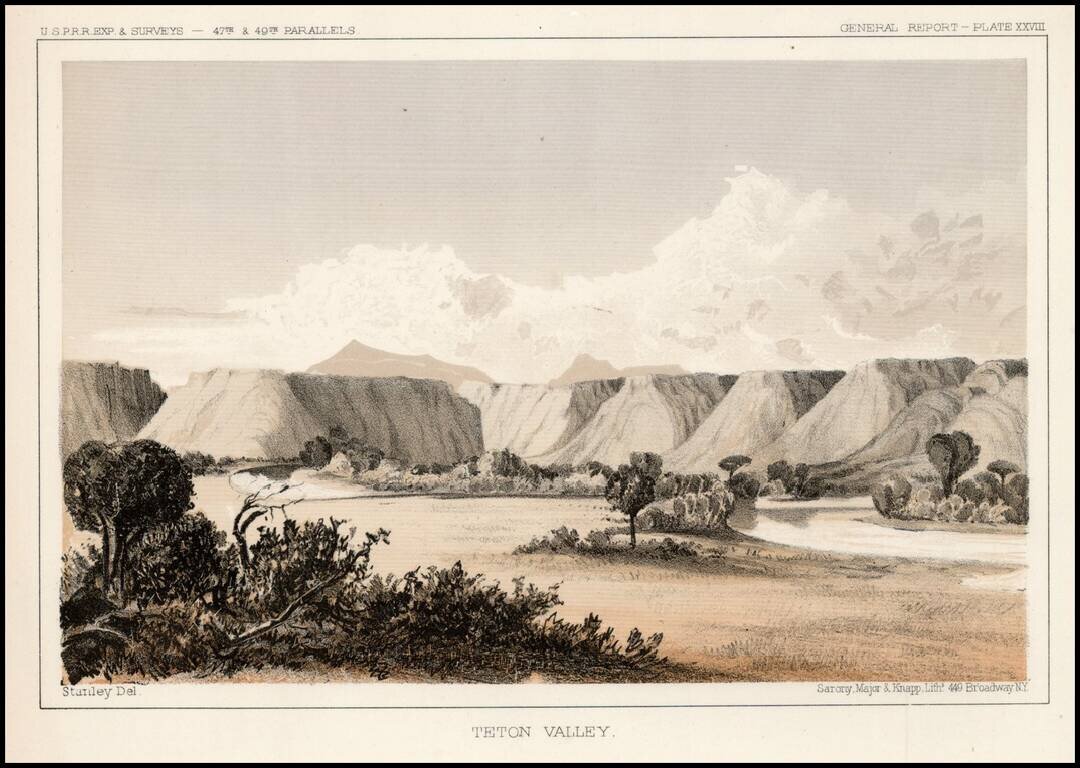
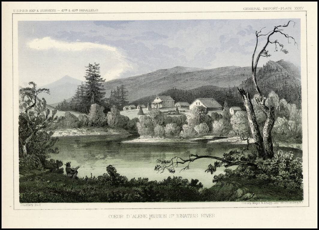
Striking view from the Pacific Railroad Surveys. The survey notes: "The mission is located upon a hill overlooking extensive prairies stretching to the east and west toward the Coeur D'Alene Mountains and the Columbia River. About a hundred acres of...
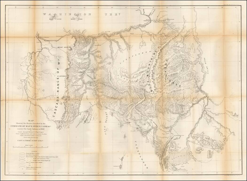
Important early map of Eastern Oregon, bounded by the Willamette, Columbia, and Snake Rivers. Major Enoch Steen, commander of the U.S. Dragoons, was sent to the area in 1860 to determine the feasibility of routes from the Willamette Valley to...
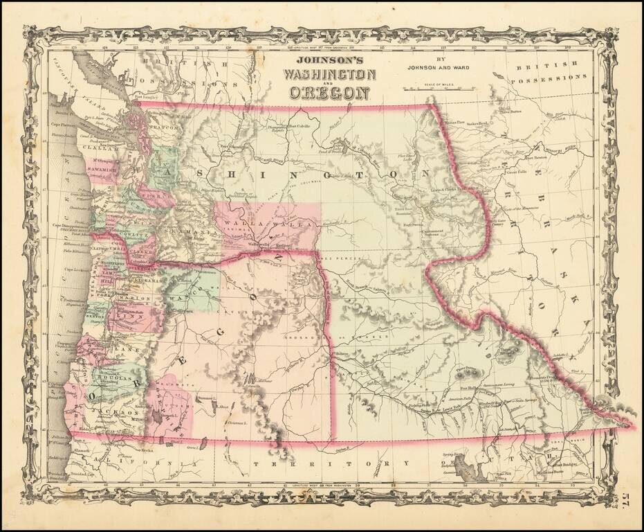
Scarce early edition of Johnson's Washington & Oregon. The map is colored by counties. Washington wraps around Oregon to the east of the Oregon State line, including the yet to be formed Idaho Territory. Includes many Indian tribes, forts, roads...
![(Nothern Half) [Bancroft's Map of the Pacific States]](/map/small/54924.jpg)
Previously Unkown 1863-64 Second State. "Bancroft's, in scope, was probably the most important map yet produced by a publisher of the Pacific coast." - Streeter (TMW 1061) Two northern sheets of an engraved proof of the previously-unknown 1863 second...
![(Northern Half) [Bancroft's Map of the Pacific States]](/map/small/54923.jpg)
Rare Early State with a Massive Idaho Territory Upper half of HH Bancroft's rare map of the Pacific States, first published in 1863. The map includes all of Oregon, Washington, Idaho, and most of Montana and Wyoming, with a large inset of Hawaii. The...
![(Notherneastern Sheet) [Bancroft's Map of the Pacific States]](/map/small/54925.jpg)
Engraved Proof Sheet. "Bancroft's, in scope, was probably the most important map yet produced by a publisher of the Pacific coast." - Streeter (TMW 1061) Engraved proof of the 1867 edition of H.H. Bancroft's Map of the Pacific States. The detail in...