
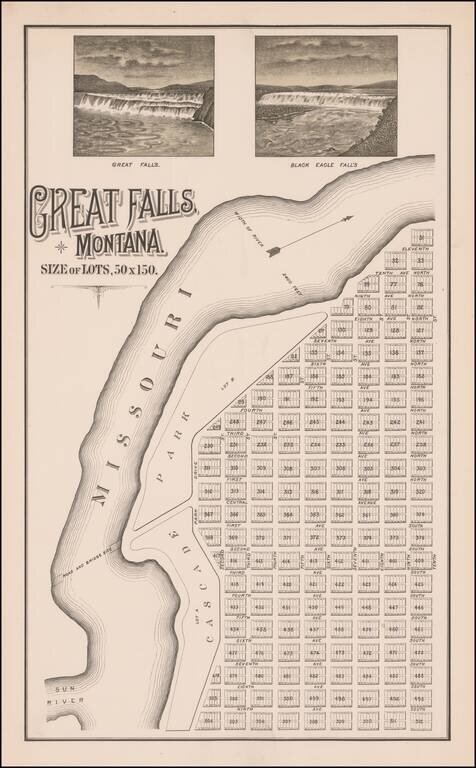
The Lost Original Map of the Townsite of Great Falls, Montana Flawless example of this previously unknown map of Great Falls, Montana, almost certainly published by its original founders (Great Falls Townsite Company) in December 1883. The map...
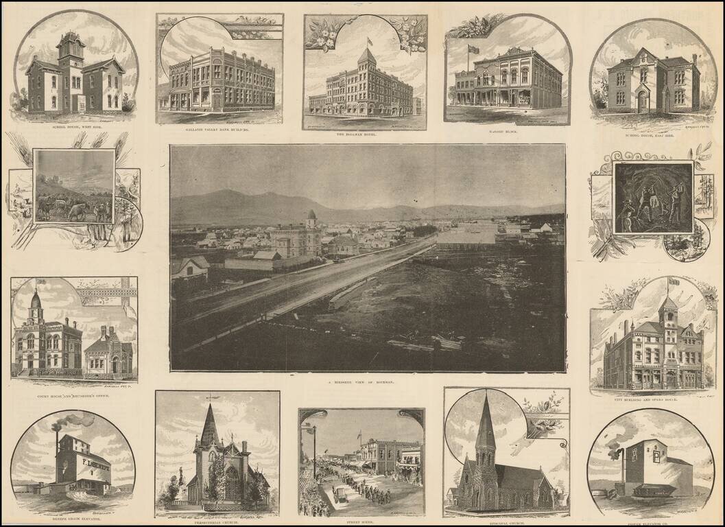
edRare Photographic Birdseye View of Bozeman, Montana Very rare promotional work, illustrated with a photographic view of Bozeman, Montana, surrounded by 14 views showing buildings, street scenes and other illustrations of contemporary life....
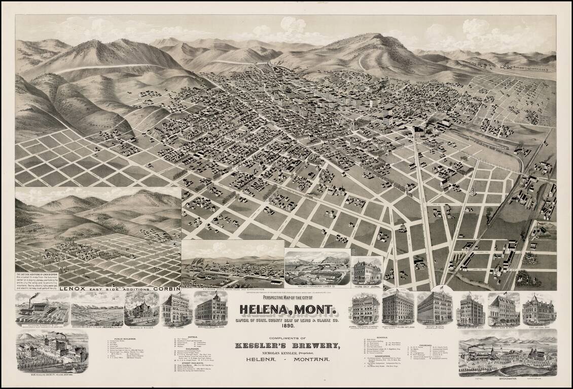
Striking birds-eye view of Helena, Montana. A large two-stone lithographic view of Helena, Montana, with streets named and all the buildings shown in perspective. There are seventeen inset views of outlying subdivisions, and specific buildings...
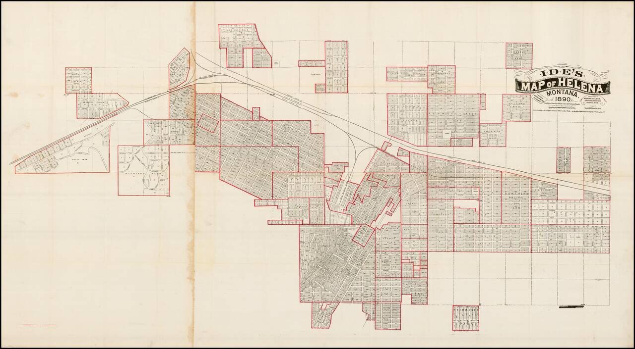
Highly detailed map of Helena, Montana , along with a number of its early additions, published in Helena by Arthur Ide and engraved by Bramblett & Beygem in Minneapolis. Nice example of Arthur Ide's map of Helena, Montana, published shortly after...
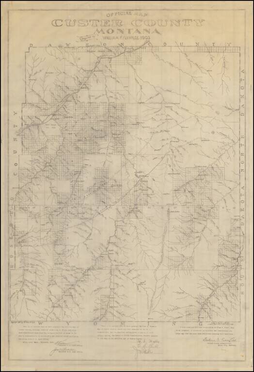
Manuscript Example of the First Map of Custer County, Montana Rare Manuscript Copy of the William Flynn's map of Custer County, Montana, drawn in 1903. This is an exact facsimile copy of the original printed version of Flynn's map of Custer County....
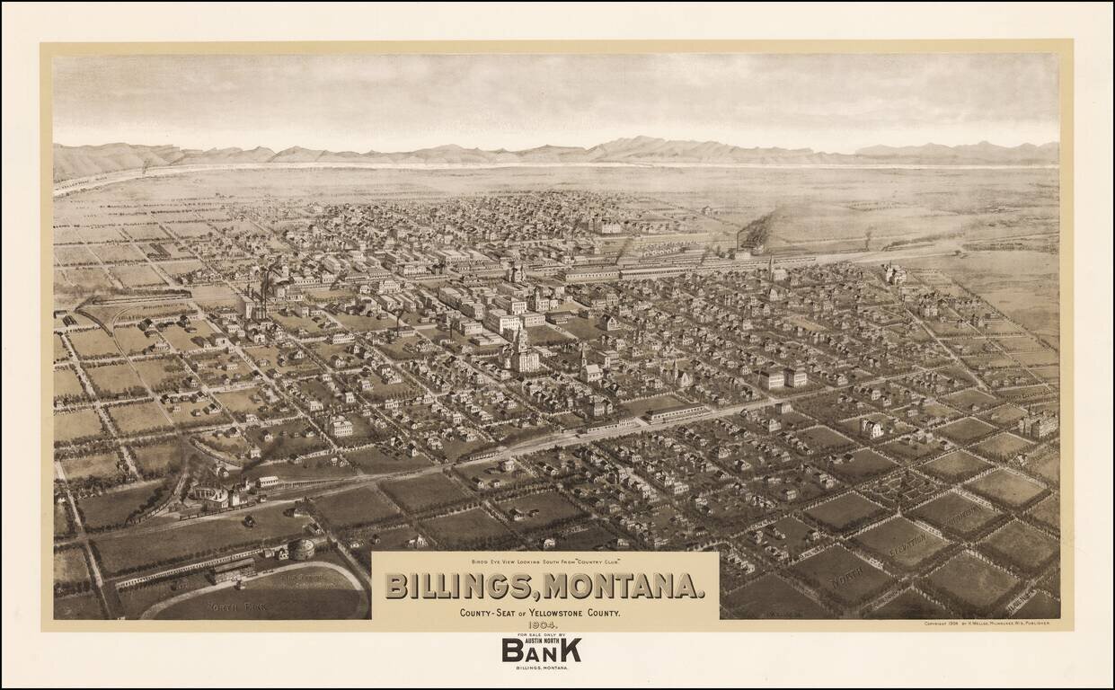
Rare highly detailed lithographic view of Butte, Montana, published in Milwaukee by Henry Wellge. An exceptionally rare view of Billings, showing the town in its infancy. The map identifies streets, railway lines, manufacturing facilities and the...
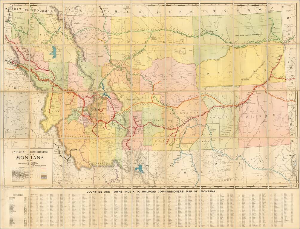
Fine large format map of Montana, published by the Montana Railroad Commission and printed by Rand McNally & Co. of Chicago. Rare detailed map of Montana, colored by counties and featuring the routes (existing and proposed) of a number of early...
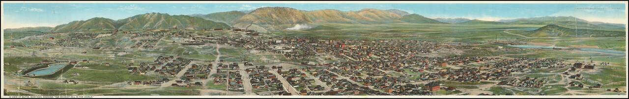
Rare Chromolithographic Panorama View of Butte -- Published in Montana Rare Panoramic View of Butte, Montana, published by "Published by Keefe Bros. Post Office News Stand Butte, Mont." and lithographed by Todd Photo & Film Co. The view provides...
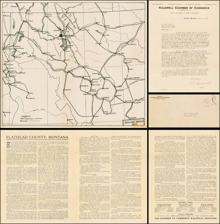
Fascinating map, brochure and letter, promoting the town of Kalispell, Montana, to a prospective Homesteader, H. Edward Moore of Janesville, Wisconsin. The map and brochure were published by the Kalispell Chamber of Commerce. The letter, written by...
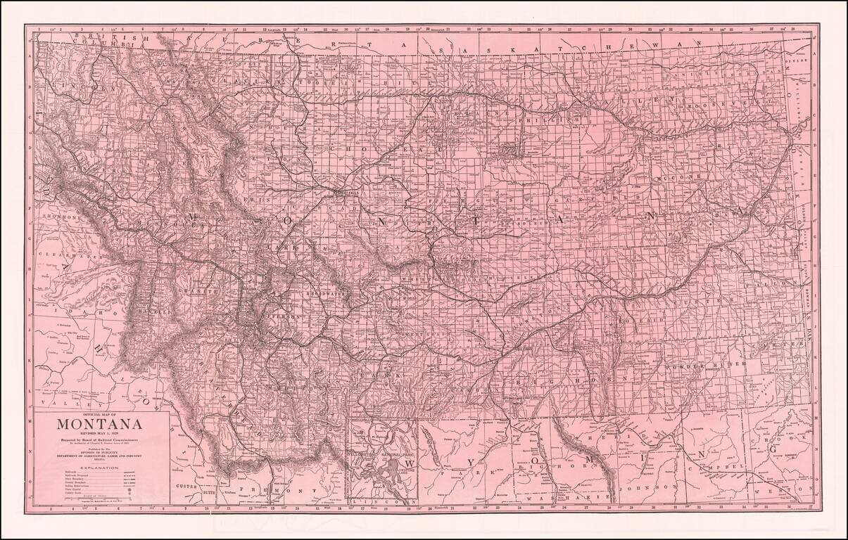
Fine large format map of Montana, published by the Board of Railroad Commissioners. Shows Railroads, Proposed Railroads, and Indian Reservations shown. Automobile Roads on the verso.
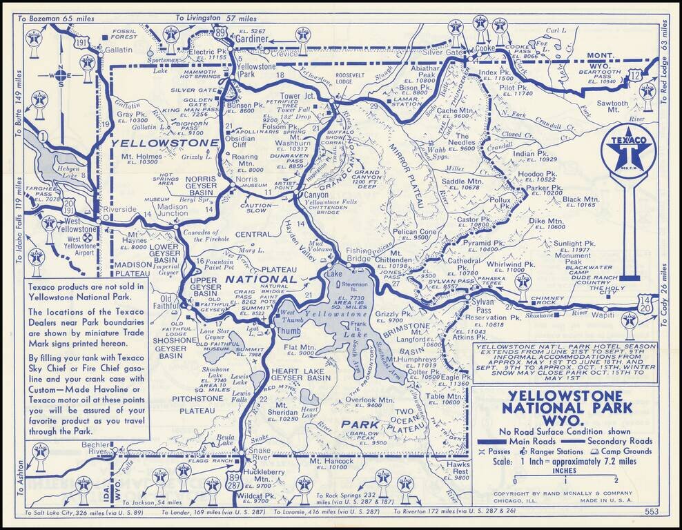
Detailed Texaco Road map covering Yellowstone National Park and Glacier National Park. This an early example of the major oil companies using auto touring in the National Parks as a medium for product promotin.
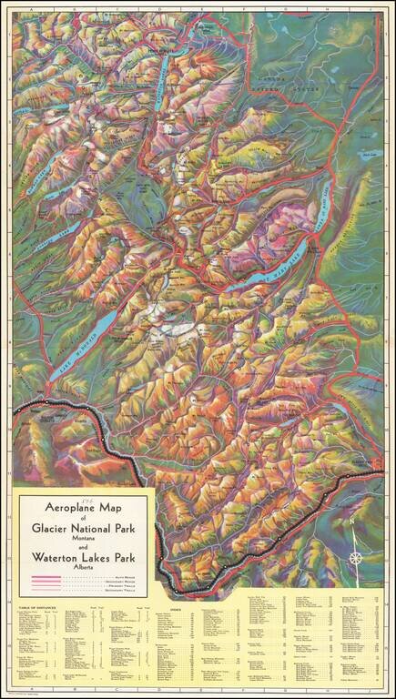
Rare birdseye view illustrating Glacier Park and environs, intended to promote the Great Northern Railway. Provides a fantastic topographical illustration of the area between Flathead River and the Glacier Park Hotel, with towns, mountains, roads,...
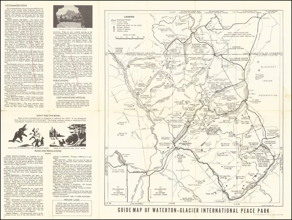
Rare early state of this road map of Glacier Park area, published for the United States National Park Service. The map includes roads through the park, distances, important points of interest, elevations, etc., including a delineation of the...
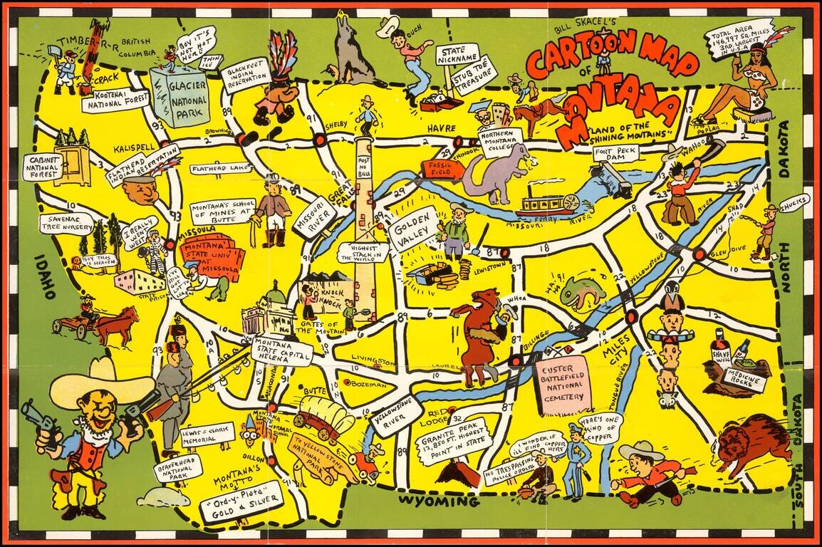
Scarce pictoiral map of Montana, which is printed to become a self mailing letter. The map provides a whimsical image of Montana's iconic national parks, national forest, Indian reservations, roads, trails, waterways, and recreational activities. On...
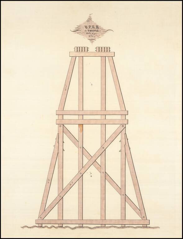
Neatly executed hand-drawn design for the wooden trestle of a Union Pacific Railroad bridge, executed by Henry Harding, an important UPRR engineer.
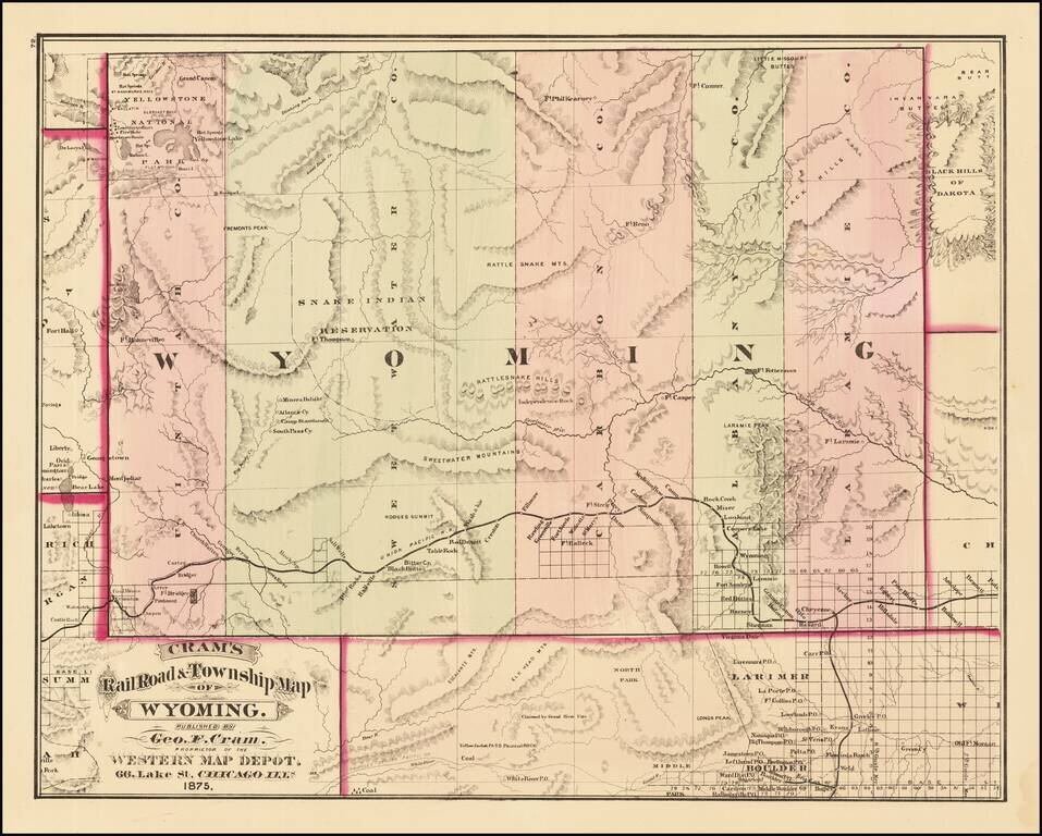
First edition of Cram's first map of Wyoming Territory. One of the few obtainable maps of Wyoming showing only 5 counties, illustrating the earliest township surveys within the Territory. The map shows Wyoming shortly before Custer's expedition...