Map size in jpg-format: 33.7693MiB
Click to open in high resolution (open in new tab).
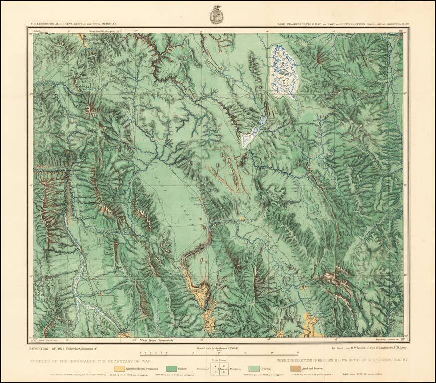
Fine regional map of Southeastern Idaho, based upon reconnaissance done in the Wheeler Survey Expedition of 1877, "Atlas sheet No. 32 (D) U.S. Geological surveys west of the 100th Meridian. Expedition of 1877 under command of 1st. Lieut. Geo. M. Wheeler. Corps of Engineers, U.S. Army."
Centered on Soda Springs, the map locates the Mormon Salt Works, Georgetown, Bennington, Red Rock Pass, the Nine Mile Settlement and the Elkhorn Mail Station.
The map includes portions of the Snake and Bear River drainage, the latter tributary to the Great Salt Lake Basin.
If you are a student, write to us in telegram: @antiquemaps and indicate what material you need and for what work you need a map in high detail. We are ready to provide material on special terms. For students only!