
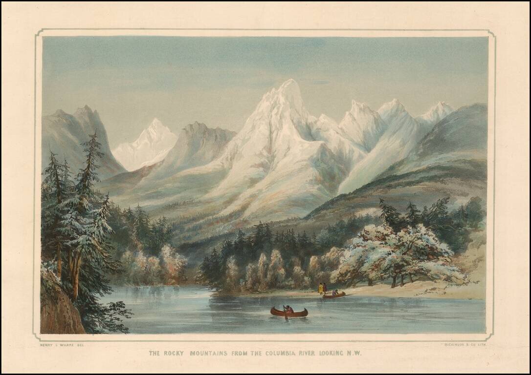
Striking image of the Rocky Mountains, with the Columbia River in the foreground and native Americans with two canoes. One of the earliest obtainable images of a scene from Oregon Territory, based upon actual observations of an earlier traveler,...
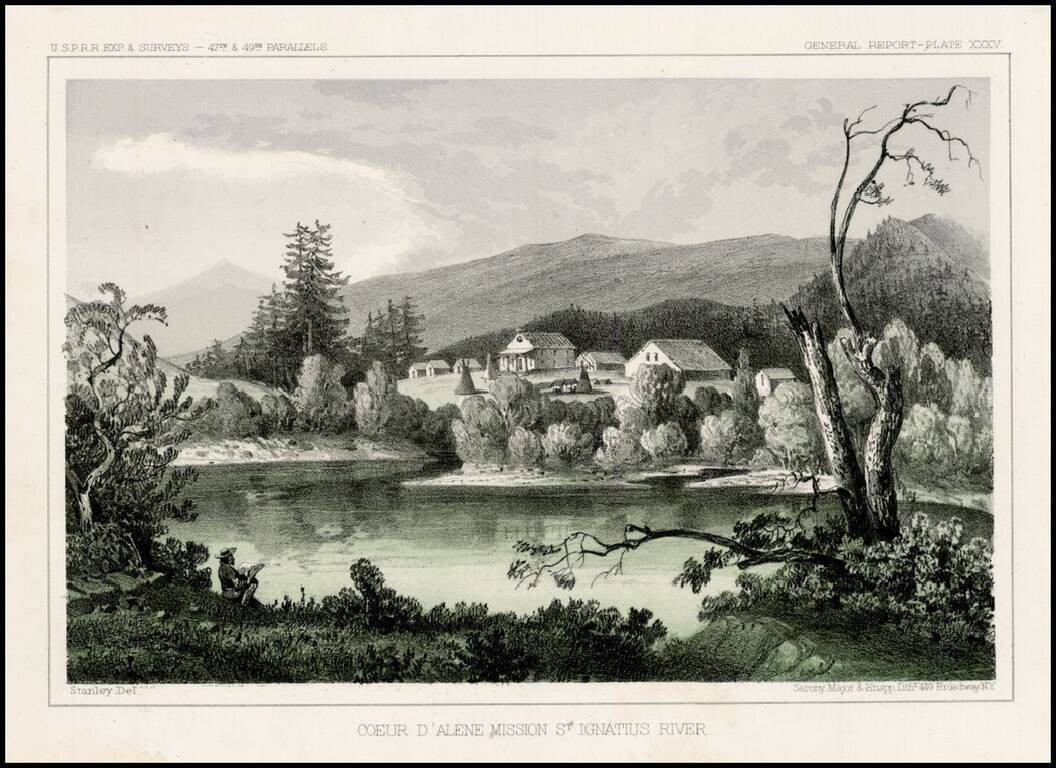
Striking view from the Pacific Railroad Surveys. The survey notes: "The mission is located upon a hill overlooking extensive prairies stretching to the east and west toward the Coeur D'Alene Mountains and the Columbia River. About a hundred acres...
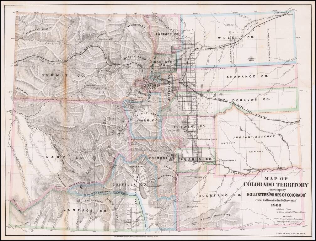
Detailed Map of Colorado Territory in 1866, with original text. Scarce map of Colorado Territory, showing sixteen counties and a large Indian Reserve. The reserve is divided into Cheyenne and Arapahoe tribes. Extensive watershed information and...
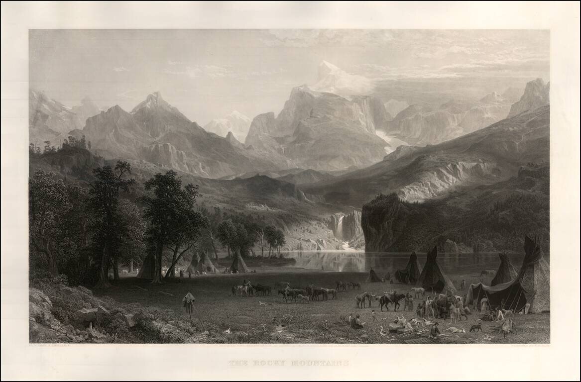
Magnificent view of Lander's Peak in Wyoming by Edward Bierstadt, the original of which now resides in the New York Metropolitan Museum of Art. As noted on the New York Metropolitan Museum on line exhibition: This painting is the major work that...
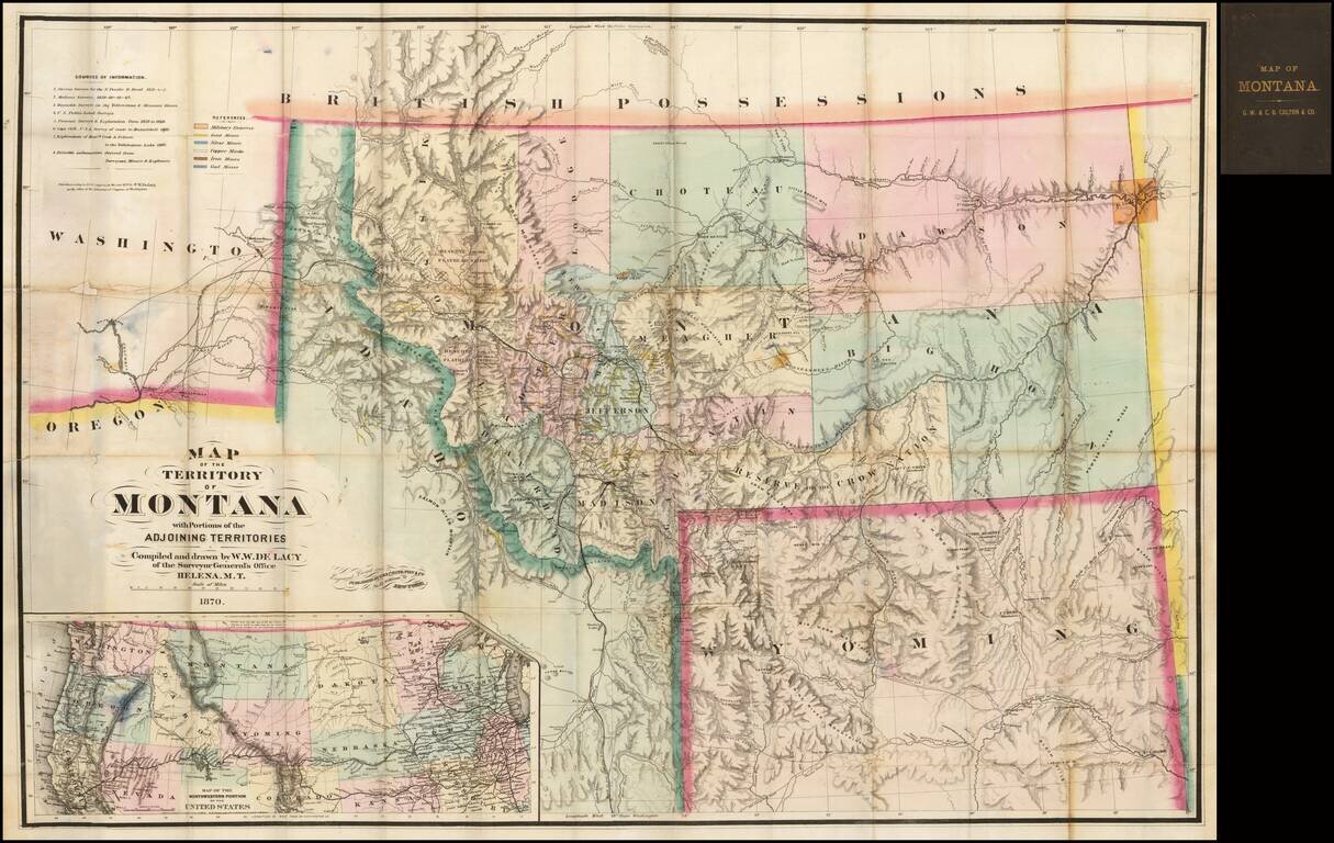
One of the great maps in the record of Western Cartography Nice example of the 1870 edition of the W.W. De Lacy map of Montana, referred to by Carl Wheat as "one of the great maps in the record of Western Cartography." The present example is the...
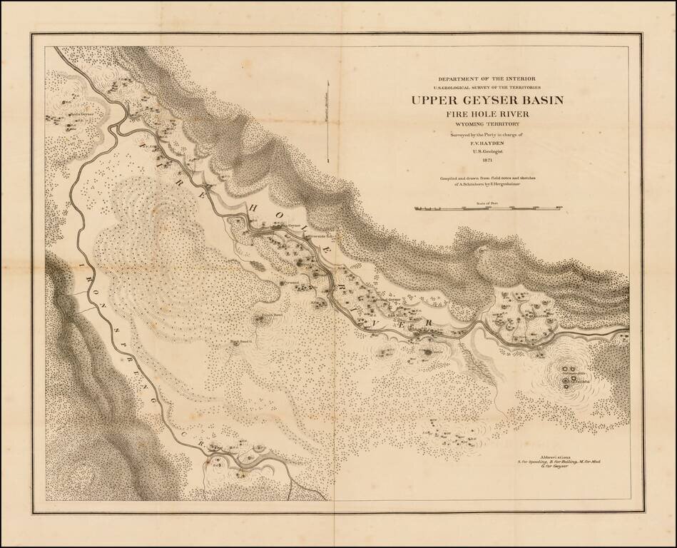
Scarce separately issued large format map of the Lower Geyer Basin in Yellowstone Park, compiled and drawn from field notes and sketches of A. Schonborn, by E. Hergeshiemer. The map is one of two maps of the Fire Hole River area published. This map...
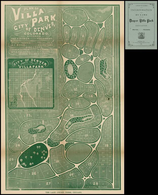
Fine early map of Villa Park, in the Barnum part of Denver, published by the Villa Park Association, showing land owned by PT Barnum and his daughter. Map shows proposed streets, (not named), parks, creeks, small bodies of water, and plan of lots....
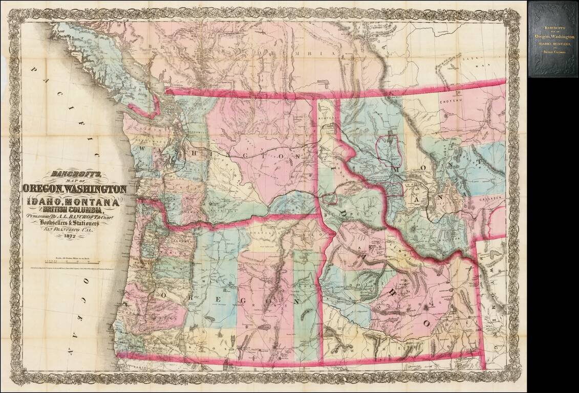
Rare separately issued map of the northwestern United States and British Columbia, issued in 1872 by A.L. Bancroft & Co. in San Francisco. Bancroft's map was first issued by HH Bancroft in 1868. The map was drawn from a section of Bancroft's...
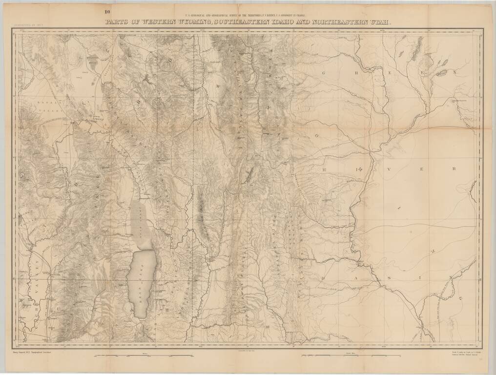
Fine large format map of the region just south of Yellowstone National Park, as surveyed in 1877 by the Hayden Survey. The map extends from Logan, Utah and the Black Foot Marsh (now Reservoir) in the West, to Fremont Lake Wyoming, and the confluence...
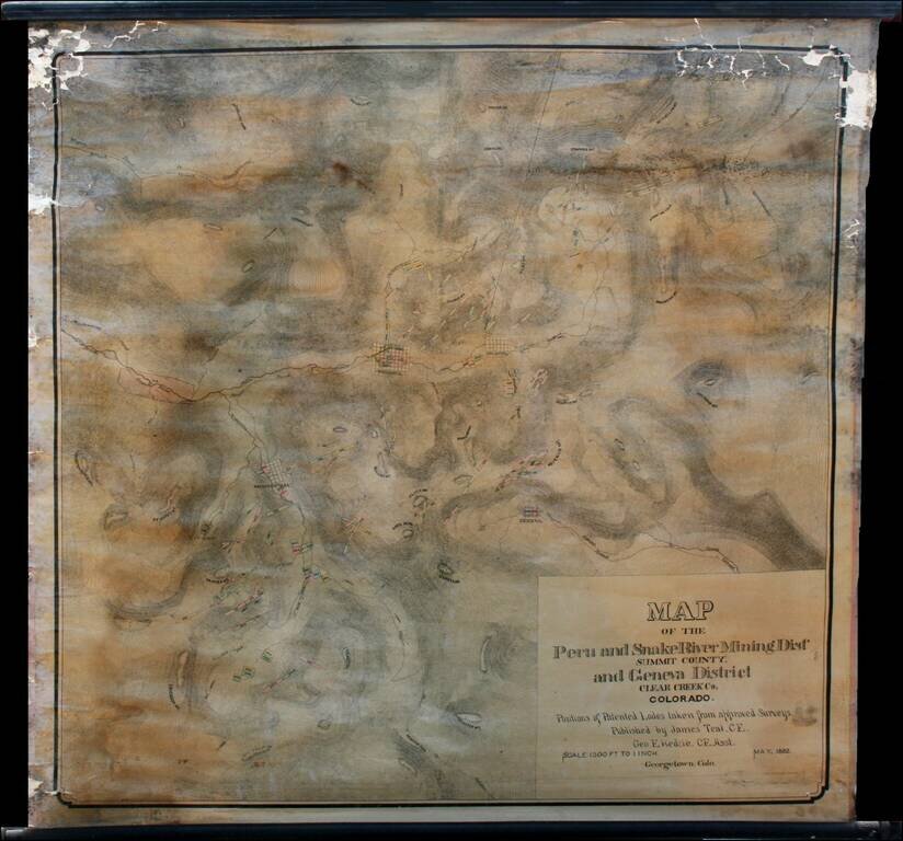
Highly detailed wall map of the area immediately south of Georgetown, Colorado, in the Peru Mining District, Snake River Mining District and Geneva Mining District, Summit County and Clear Creek County Colorado. Teal's map provides in fine detail the...
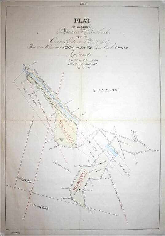
Fascininating Clear Creek County, Colorado Plat Map and GLO Mineral Certificate, confirming the mining claim of Marcus W. Rasbach to mining rights first claimed on June 30, 1881. A fine example of a General Land Office Mineral Certificate, consisting...

Excellent early map of Idaho, Montana and Wyoming Territories, published by SA Mitchell Jr. Includes early county configurations for each: Wyoming has only 7 counties; Montana has 11 counties; Idaho has 13 counties. The map shows Indian...
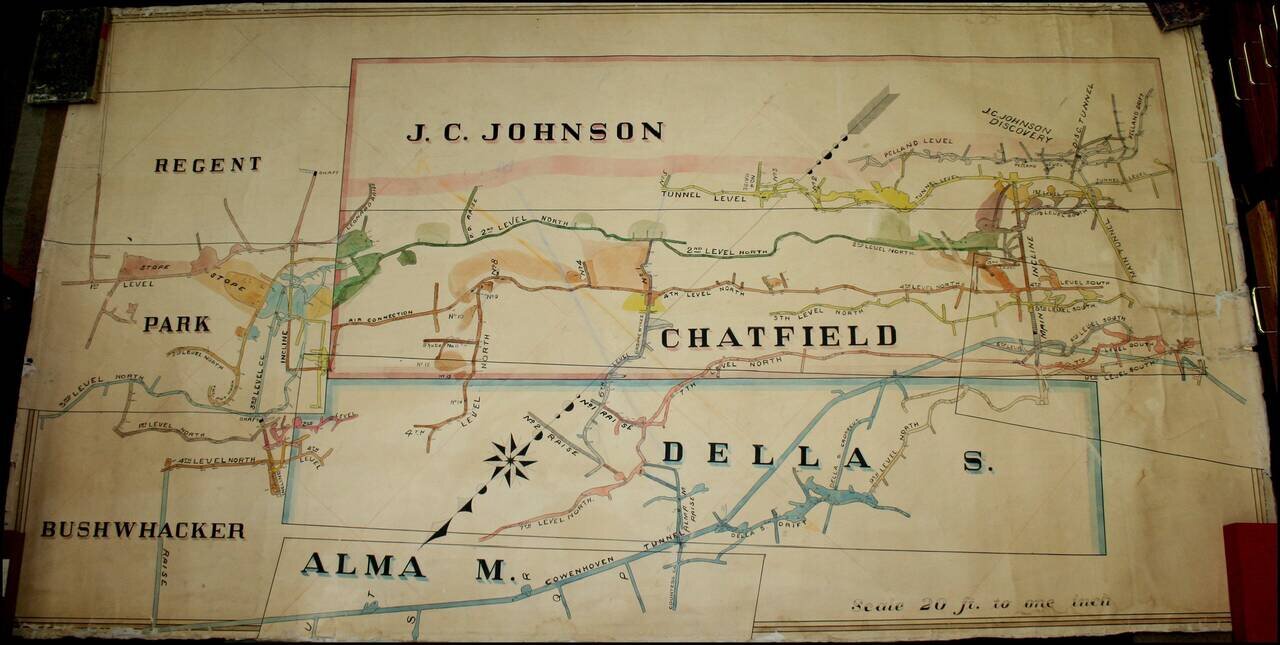
A Remarkable Aspen Mining Map -- Smuggler Mountain Large map illustrating the competing mining claims of several silver mines in Aspen, Colorado, which resulted in litigation between John C. Johnson and the Standard Mining Company of Kansas City,...
![[Yellowstone National Park]](/map/small/37103.jpg)
Highly detailed early map of Yellowstone National Park, which accompanied the Annual Report of the Superintendent of Yellowstone National Park for 1892. A note at the top of the map provides a key for identifying the roads which existed prior to 1891...
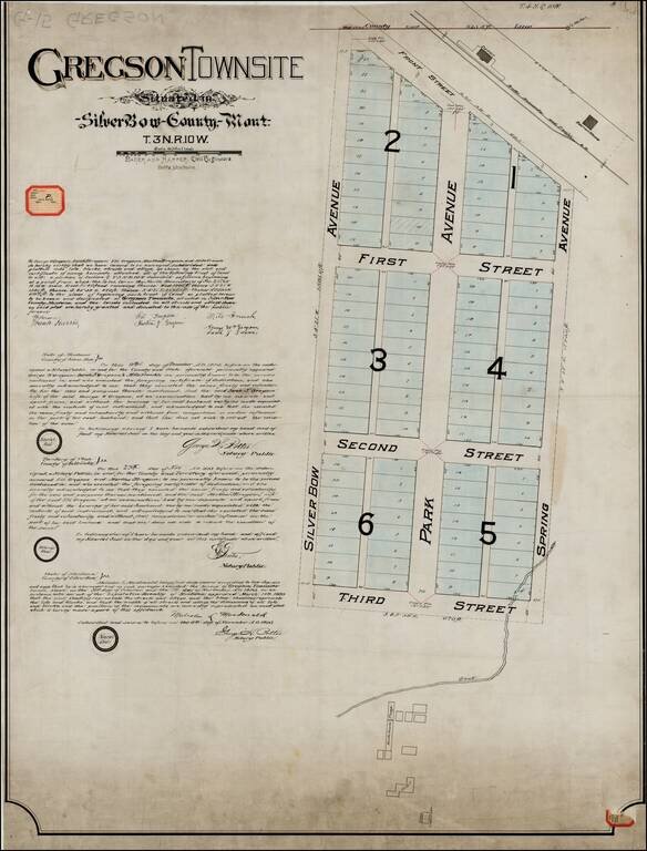
Original Plan For Gregson Townsite -- Locating The Original Hotel and Bathhouses for Upper Deer Lodge Hot Springs Resort ( aka Gregson Hot Springs Resort), One of the Earliest Resorts in Montana Territory. Unique example of the original...
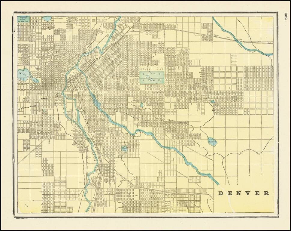
Scarce 19th-century city plan of Denver, Colorado, showing streets, buildings, train lines, public places, rivers etc. Cram was one of the pre-eminent American mapmakers of the late-19th century, relying upon a cerographic printing process first...