Map size in jpg-format: 732204B
Click to open in high resolution (open in new tab).
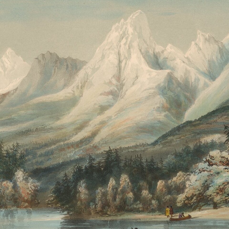
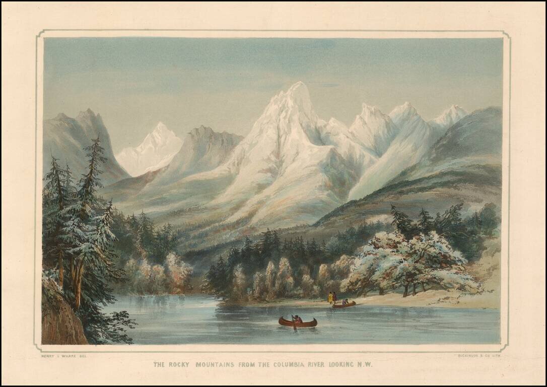
Striking image of the Rocky Mountains, with the Columbia River in the foreground and native Americans with two canoes.
One of the earliest obtainable images of a scene from Oregon Territory, based upon actual observations of an earlier traveler, General Sir Henry James Warre. Warre was one of two British Officers leading a spy mission in Oregon Territory.
Henry James Warre
Lieutenant-General Sir Henry James Warre KCB (1819 - 1898) was a British Army officer, educated at the Royal Military College, Sandhurst. Warre was commissioned into the 54th Regiment of Foot in 1837. He became aide-de-camp to Sir Richard Downes Jackson, Commander-in-Chief of the Forces in British North America in 1839.
In 1845 he was sent on a secret military reconnaissance mission with Mervin Vavasour to the Oregon Country to prepare for a potential Anglo-American war over the territory. Hudson's Bay Company officer Peter Skene Ogden traveled with the British officers. As noted in Wagner-Camp:
Captain Warre and Lieutenant [Mervin] Vavasour of the Royal Engineers were agents of the British government who were sent out [as spies] to Oregon at the height of the controversy between the United States and Great Britain over the sovereignty of that territory. The two officers crossed Canada by the Hudson's Bay Company's route as far as the Rockies, where they turned south to cross the mountains, probably through Crow's Nest Pass, to Kootenai Lake. They reached Fort Vancouver on August 25, 1845, and visited the Willamette Valley, the mouth of the Columbia River, Puget Sound and Vancouver Island before returning to England, where they found that the territorial dispute had been settled during their absence.The two British Officers were tasked with assessing American military strength in the Oregon territory. During the journey, Warre composed nearly 100 watercolor drawings, many of which included subjects of military importance. After the expedition became moot, Warre published his artwork and a narrative which has become a legendary rarity and one of the most important early illustrated works for the Northwest.
Howes described Warre's illustrations as "the only western color-plates comparable in beauty to those by Bodmer accompanying Maximilian's Travels".
If you are a student, write to us in telegram: @antiquemaps and indicate what material you need and for what work you need a map in high detail. We are ready to provide material on special terms. For students only!

![Carte Du Mexique et de la Floride des Terres Angloises et des Isles Antilles du Cours et des Environs de la Riviere Mississipi . . . Rue Des Canettes . . . 1703 [1st State]](/map/small/66307op.jpg)