Map size in jpg-format: 1.15604MiB
Click to open in high resolution (open in new tab).
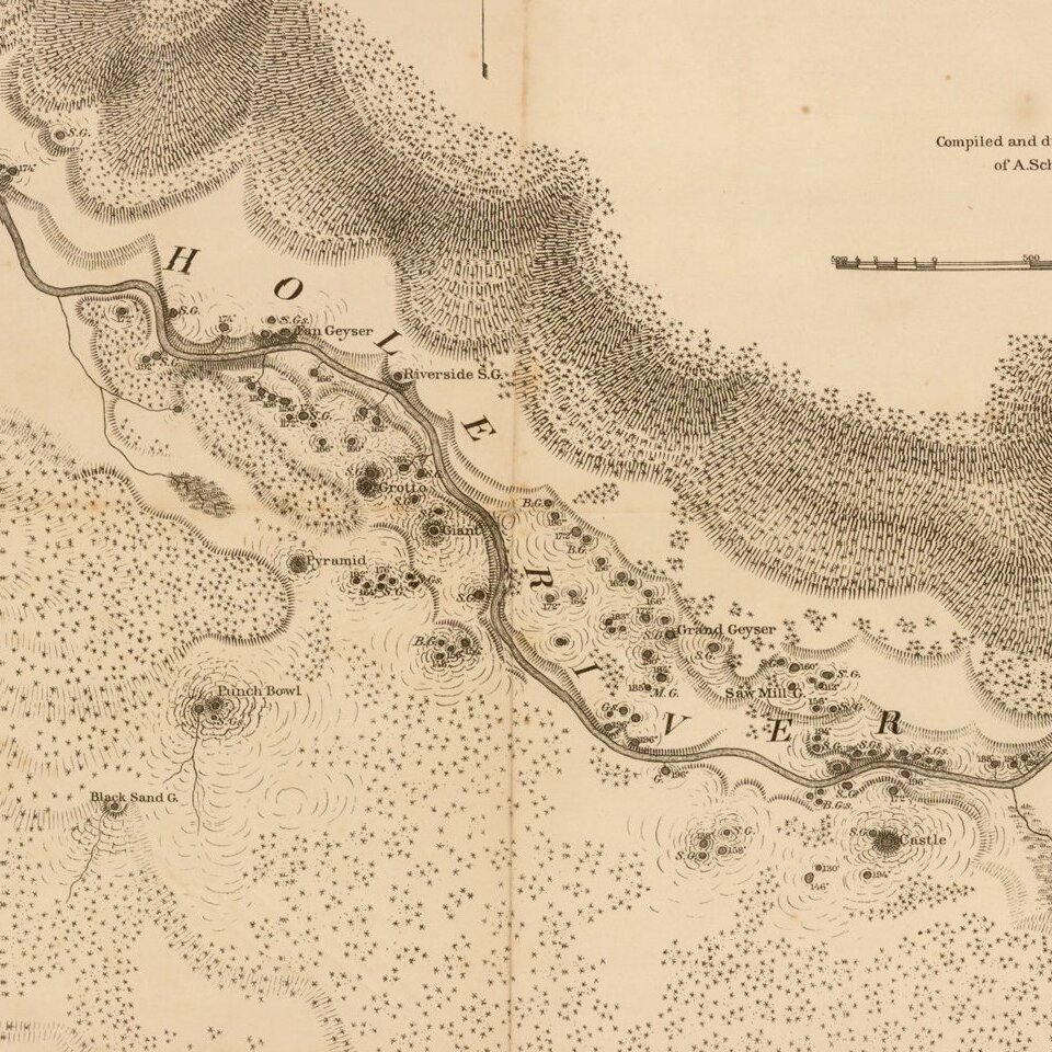
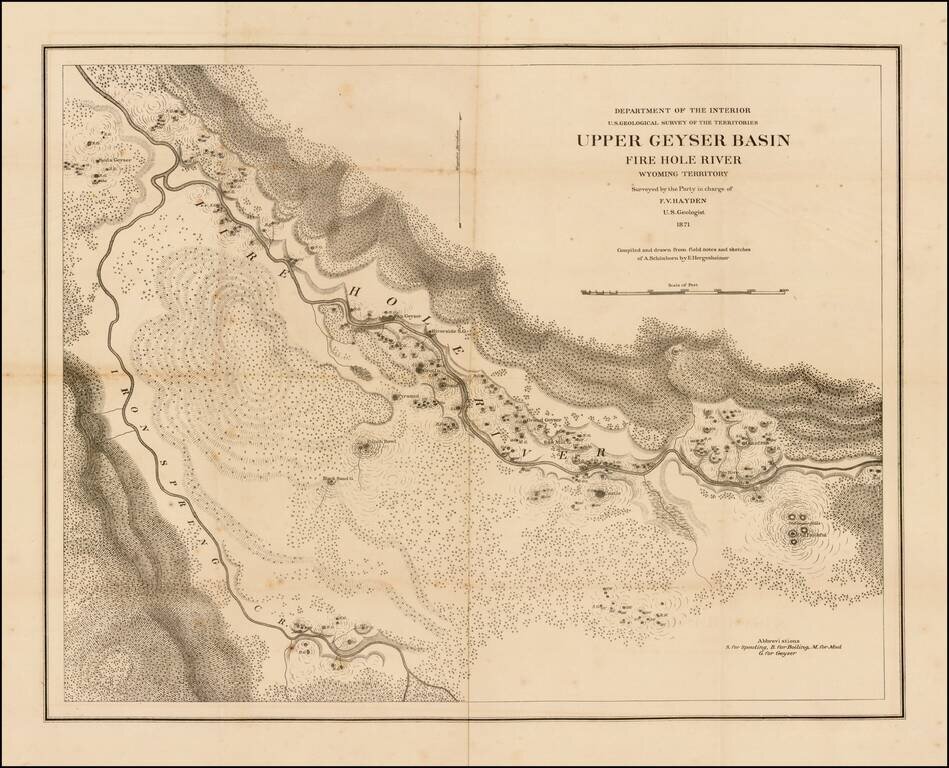
Scarce separately issued large format map of the Lower Geyer Basin in Yellowstone Park, compiled and drawn from field notes and sketches of A. Schonborn, by E. Hergeshiemer.
The map is one of two maps of the Fire Hole River area published. This map extends from the area of Biscuit Basin in the north.
This is the sheet which includes Old Faithful, at the bottom right corner, the West Fork of Iron Springs Creek in the southwest and Old Faithful in the Southeast.
If you are a student, write to us in telegram: @antiquemaps and indicate what material you need and for what work you need a map in high detail. We are ready to provide material on special terms. For students only!

![Carte Du Mexique et de la Floride des Terres Angloises et des Isles Antilles du Cours et des Environs de la Riviere Mississipi . . . Rue Des Canettes . . . 1703 [1st State]](/map/small/66307op.jpg)