logo

1882. Map of the Peru and Snake River Mining Dist' Summit County, and Geneva District Clear Creek Co. Colorado. Positions of Patented Lodes taken from approved Surveys. Published by James Teal. C.E. . . . May 1882

  • Map of the Peru and Snake River Mining Dist' Summit County, and Geneva District Clear Creek Co. Colorado.  Positions of Patented Lodes taken from approved Surveys.  Published by James Teal. C.E. . . . May 1882

Map of the Peru and Snake River Mining Dist' Summit County, and Geneva District Clear Creek Co. Colorado. Positions of Patented Lodes taken from approved Surveys. Published by James Teal. C.E. . . . May 1882 information:

Year of creation: 
Resolution size (pixels): 
 2688x2504 px
Disk Size: 
 1.1216MiB
Number of pages: 
 1
Place: 
 Georgetown, Colorado
Author: 

Print information. Print size (Width x height in inches):
Printing at 72 dpi 
  37.33 х 34.78
Printing at 150 dpi 
 17.92 х 16.69
Printing at 300 dpi 
 8.96 х 8.35

An example of detailing the file of this map of in a printable high-resolution:

Click to open in high resolution (open in new tab).
Attention! this is just the central piece (central area 960x960 px) of the map file!
This is an example, so that you can see and study the level of detail of a given map. The entire Map will be fully available after payment!

Map of the Peru and Snake River Mining Dist' Summit County, and Geneva District Clear Creek Co. Colorado.  Positions of Patented Lodes taken from approved Surveys.  Published by James Teal. C.E. . . . May 1882

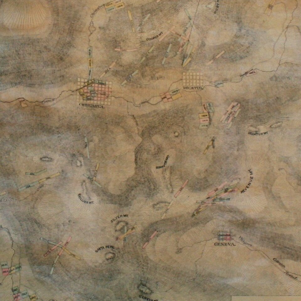
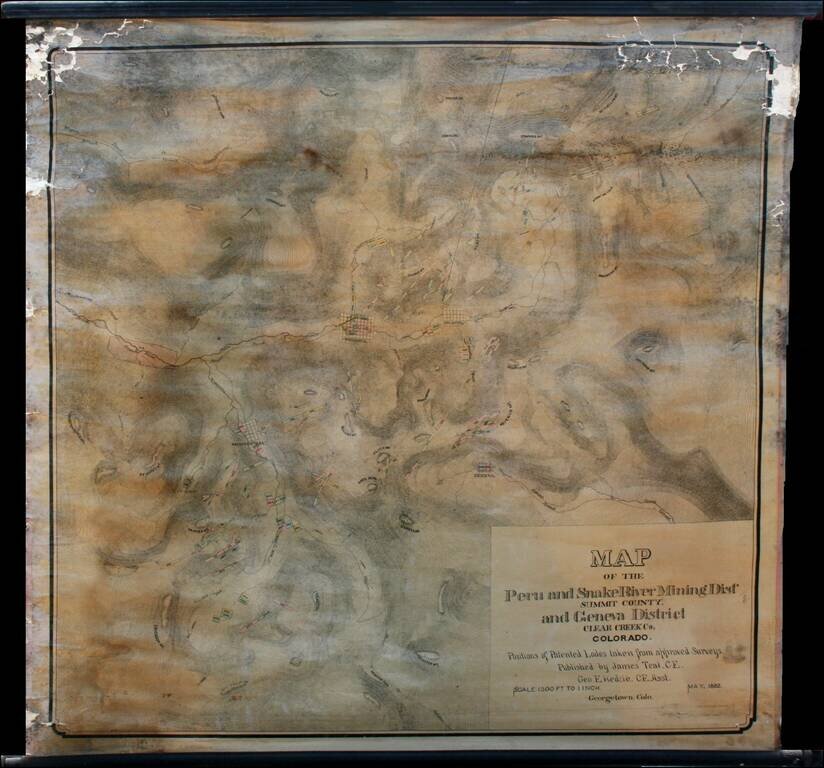
Highly detailed wall map of the area immediately south of Georgetown, Colorado, in the Peru Mining District, Snake River Mining District and Geneva Mining District, Summit County and Clear Creek County Colorado.

Teal's map provides in fine detail the topography of the region, lode claims, mountains, rivers, mountain passes, and town plats for Geneva, Montezuma, Chihuahua, and Decatur. Mountain passes listed include Webster, Loveland, and Argentine.

James Teal was a civil engineer and mining engineer who was listed by Fossett as a member of the faculty at Colorado School of Mines in 1870. Teal also produced a map of the town of Chihuahua in Summit County, dated June 11, 1880.

OCLC locates two copies (Denver Public Library and Colorado Historical Society).


Special conditions for students!

If you are a student, write to us in telegram: @antiquemaps and indicate what material you need and for what work you need a map in high detail. We are ready to provide material on special terms. For students only!

Item information:

Year of creation:
Size:
2688x2504 px
Disk:
1.1216MiB
Number of pages:
1
Place:
Georgetown, Colorado
Author:
James Teal.
$14.99

Related item