Map size in jpg-format: 13.5828MiB
Click to open in high resolution (open in new tab).
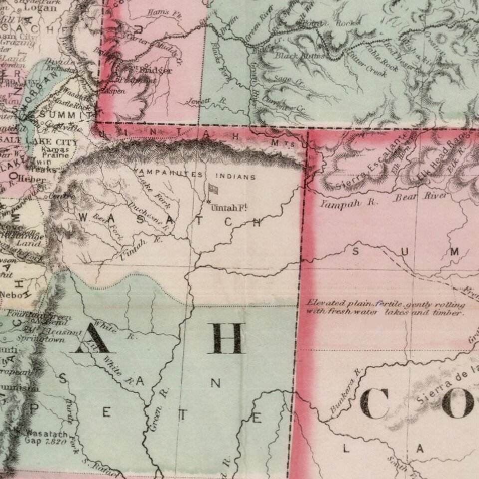
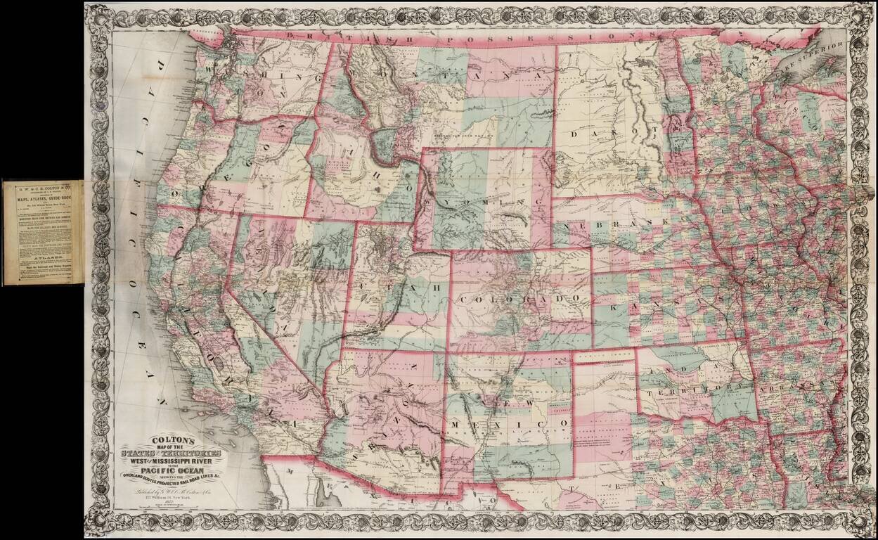
Large scale pocket map of the Transmississippi West.
Fine example of Colton's large format map of the West, colored by Counties and focusing on the projected railroad lines west of the Mississippi River, shortly before the first appearance of Yellowstone National Park. The map also shows the strip of land above Texas labeled "Public Lands," which would become the Oklahoma Panhandle. Also includes a fine detailed treatment of Indian Territory, showing the lands reserved for the various Indian Nations relocated to the region.
Wheat suggests that this Colton map and an earlier smaller Colton map of the West under a different title (covering a smaller area - Wheat 1098), were Colton's response to maps of the West by H. H. Bancroft & Co. of San Francisco, published the same year.
G. W. & C. B. Colton was a prominent family firm of mapmakers who were leaders in the American map trade in the nineteenth century. The business was founded by Joseph Hutchins Colton (1800-1893) who bought copyrights to existing maps and oversaw their production. By the 1850s, their output had expanded to include original maps, guidebooks, atlases, and railroad maps. Joseph was succeeded by his sons, George Woolworth (1827-1901) and Charles B. Colton (1831-1916). The firm was renamed G. W. & C. B. Colton as a result. George is thought responsible for their best-known work, the General Atlas, originally published under that title in 1857. In 1898, the brothers merged their business and the firm became Colton, Ohman, & Co., which operated until 1901, when August R. Ohman took on the business alone and dropped the Colton name.
If you are a student, write to us in telegram: @antiquemaps and indicate what material you need and for what work you need a map in high detail. We are ready to provide material on special terms. For students only!