Map size in jpg-format: 8.8253MiB
Click to open in high resolution (open in new tab).
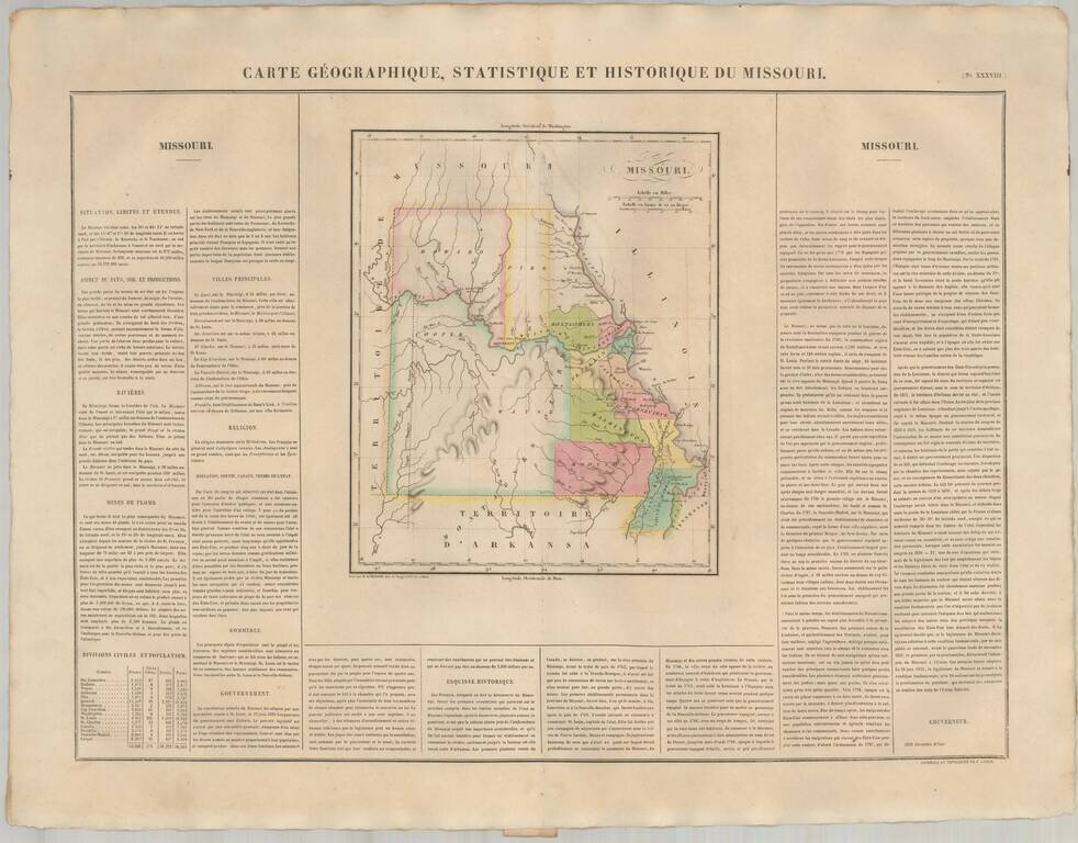
The First European Printed Map of Missouri .
Fine example of Buchon's map of Missouri, the first map of Missouri published outside of America.
Buchon's map appeared in his Atlas Geographique, Statistique, Historique et Chronologique ...., the first complete atlas of America to include maps of the individual United States published in Europe.
Buchon's map is also one of the earliest maps of Missouri, preceded only by maps published in the United States by Lucas, Carey & Lea and Finley.
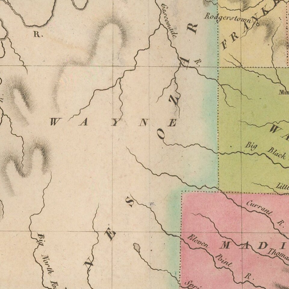
Only 16 counties are shown. The Osage line is still present in the west. The surrounding text includes a description of Missouri, including rivers, mines, county information, religion, commerce Goverment and history and names Missouri's first Governor, Alexander McNair.
Jean Alexandre Buchon (1791-1849) was a French scholar and historian. Born as the French Revolution raged, Buchon was dedicated to recovering France’s history in order to help the country heal and grow. He gathered French stories and published them as part of Collection des chroniques nationales franciases ecrites en langue vulgaire, du XIe au XVIe siècle (4 vols, 1824-1829). He also compiled and published an exploration collection and several histories, particularly about medieval France.
For geography, his most important contribution was publication of the French edition of Carey & Lea’s American Atlas in 1825. Each page of the atlas includes highly detailed text about the state or territory depicted, as well as a map of the area. The French edition is generally considered in high regard as compared to other editions, as it has quality paper and superior engraving.
If you are a student, write to us in telegram: @antiquemaps and indicate what material you need and for what work you need a map in high detail. We are ready to provide material on special terms. For students only!
![[Missouri named Jefferson] Etats-Unis par A.M. Perrot](/map/small/69488.jpg)
![[The Mississippi-Missouri: A Geographical Blunder -- An Illustrated Argument For Renaming The Lower Mississippi River Put Forth By A Prominent American Educator To The Author of a Best Selling American School Geography]](/map/small/56241.jpg)