
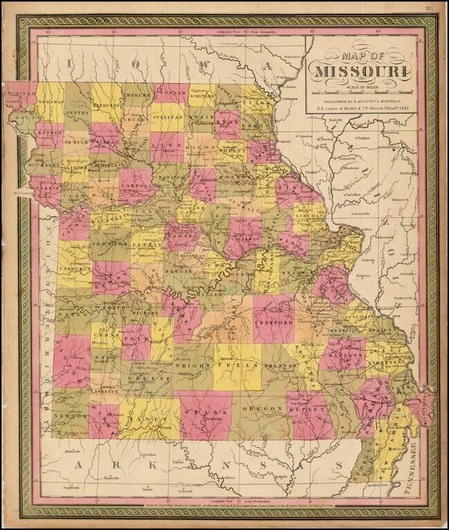
Detailed map of Missouri, hand colored by counties, and showing towns, roads, rivers, mountains, lakes, forts, Post Offices and other details. From one of the leading map makers of the mid-19th Century.
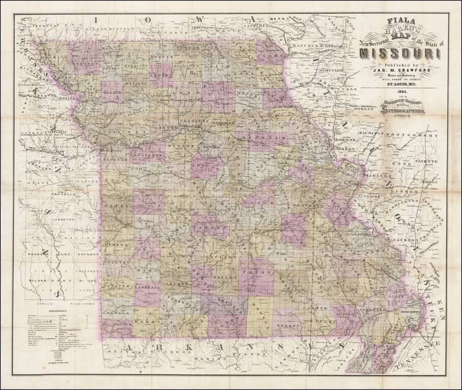
Rare separately published map of Missouri by Fiala and Haren, published in St. Louis by James M. Crawford. The map is hand colored by counties and subdivided by townships, with an extensive explanation of symbols at the bottom left corner. Among the...
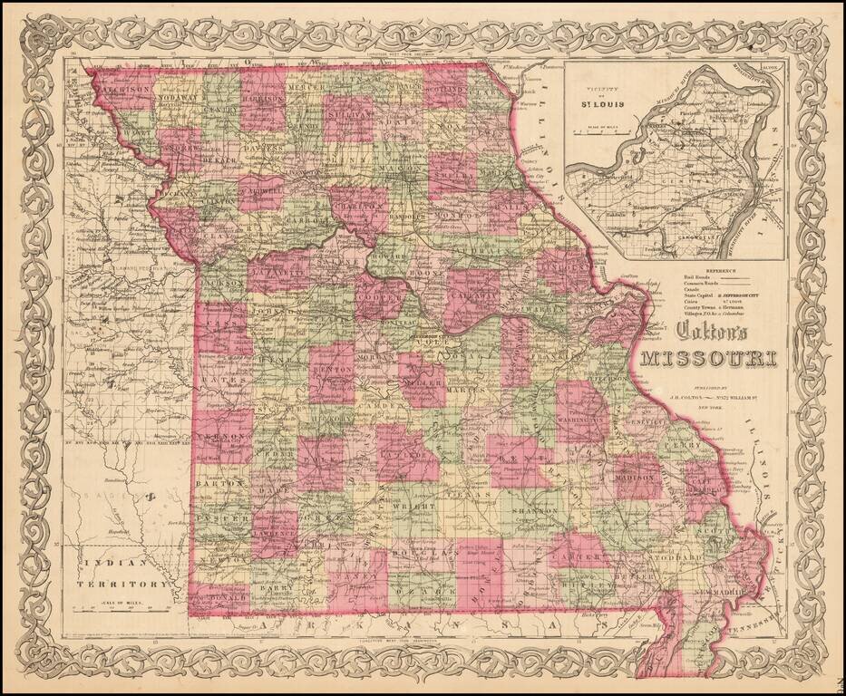
Detailed map of Missouri, colored by counties. Shows roads, railroads, towns, villages, post offices, rivers, lakes, stations and a host of other details. Inset of St. Louis vicinity in upper right corner. Decorative border. A terrific map, from JH...
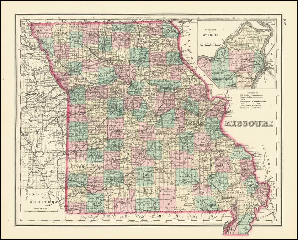
Detailed map of Missouri, hand colored by counties. Includes a large inset map of St. Louis. Excellent detail throughout, including counties, townships, towns, rivers, roads, railroads and a host of other details.
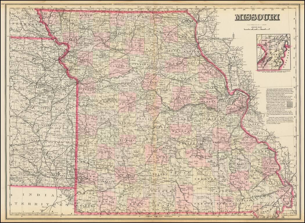
Highly detailed map of Missouri, published by OW Gray. The map is colored by counties and showing towns, roads, railroads, Post Offices, etc. Inset of the plan of the eastern portion of Missouri.
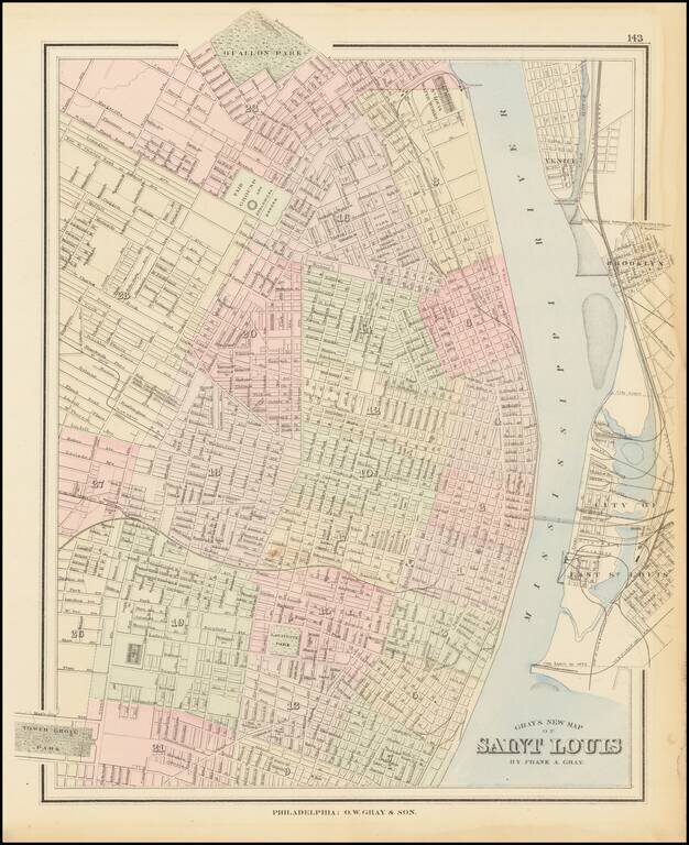
Detailed map of St. Louis, published by Gray. The map is colored by wards and showing streets, rail lines, parks, buildings, stations and a host of other details.
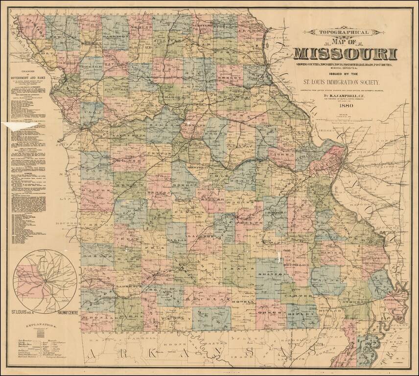
Rare separately published map of Missouri, published by the St. Louis Immigration Society. Inset map shows small map of Missouri, Illinois and nearby states, including the St. Louis railroad lines converging in St. Louis. The statistical table shows...
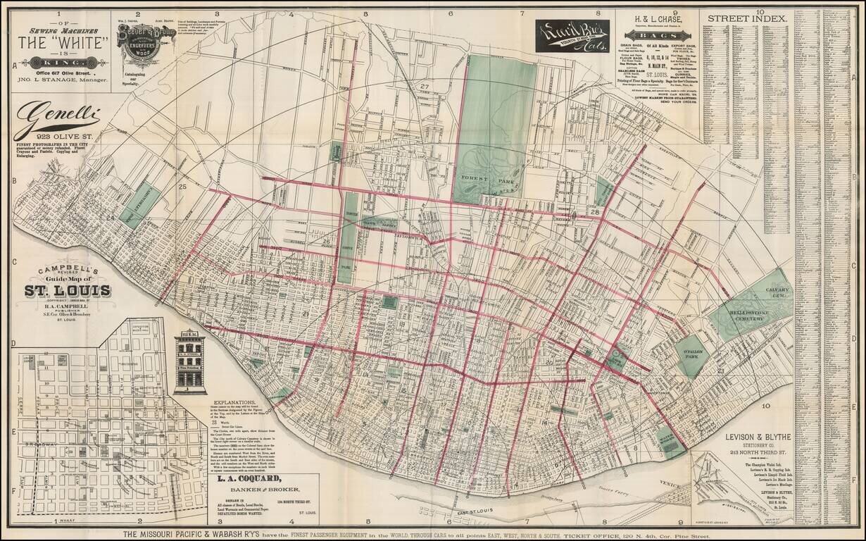
Scarce map of St. Louis, published by R. A. Campbell. Includes significant local advertising. Outline color highlighting each ward with parks in green. Street index included on map which folds into a 16x10 cardboard cover entitled "Campbell's Revised...
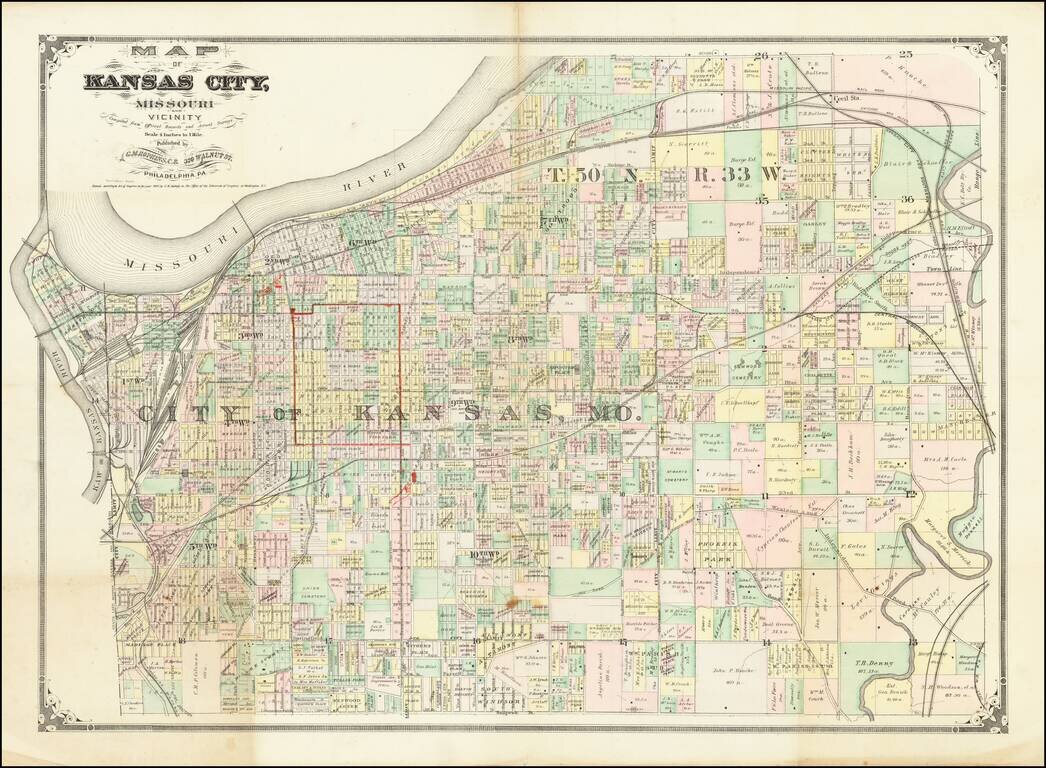
Scarce early map of Kansas City and environs, published by G.M. Hopkins of Philadelphia and promoting Geo. F. Winter & Co. The map shows the area around Kansas City in fine detail ad includes the names of many larger land owners.
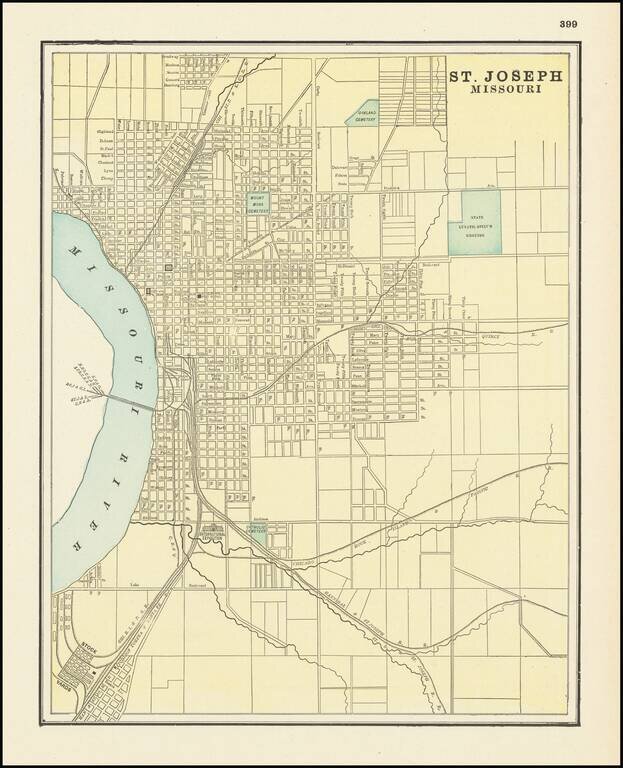
Detailed city plan of St. Joseph, showing streets, buildings, train lines, public places, rivers etc. Cram was one of the pre-eminent American Mapmakers of the late 19th Century, relying upon a cerographic printing process first applied to maps by the...
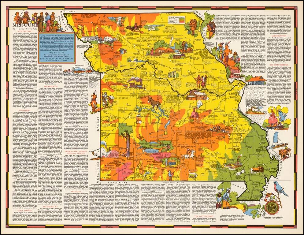
Rare pictorial map of Missouri by R.T. Aitchison, published by the Mentholatum Company. The map includes decorative vignettes illustrating the history and resources of Missouri with a detailed text history of the state. R.T. Aitchison was a Wichita,...