Map size in jpg-format: 14.6429MiB
Click to open in high resolution (open in new tab).
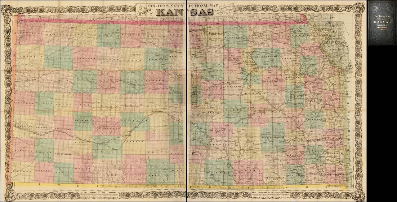
Nice example of Colton's 1878 edition of the New Sectional Map of Kansas.
This is a later issue of a beautiful large scale map of Kansas, first issued in 1867.
The map locates cities, towns, rivers, roads and railroad lines.
While the rectangular survey has been finished throughout the state, most of the state, particularly the western half, is largely unsettled. Most of the eastern counties have many towns shown, while most western counties have either no settlements of any kind or have one or two shown along a rail line.
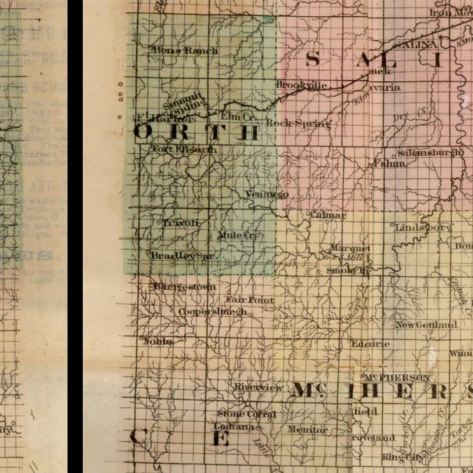
This map shows the state's boundaries in transition, with many county names, such as Kansas, Arapaho, Foote, Buffalo, and Sequoyan, destined to be eliminated in the coming years. County boundary lines would also shift tremendously. Even among those towns shown, many would disappear or move as railroads passed them by. Among these are the towns of Queen City and Sego in Reno County in the middle of the state.
A large map showing the changes being made in Kansas as the railroads extended deeper into previously undeveloped areas.
OCLC locates only a single example (Yale). This state is not in Printed Maps of the Midwest.
G. W. & C. B. Colton was a prominent family firm of mapmakers who were leaders in the American map trade in the nineteenth century. The business was founded by Joseph Hutchins Colton (1800-1893) who bought copyrights to existing maps and oversaw their production. By the 1850s, their output had expanded to include original maps, guidebooks, atlases, and railroad maps. Joseph was succeeded by his sons, George Woolworth (1827-1901) and Charles B. Colton (1831-1916). The firm was renamed G. W. & C. B. Colton as a result. George is thought responsible for their best-known work, the General Atlas, originally published under that title in 1857. In 1898, the brothers merged their business and the firm became Colton, Ohman, & Co., which operated until 1901, when August R. Ohman took on the business alone and dropped the Colton name.
If you are a student, write to us in telegram: @antiquemaps and indicate what material you need and for what work you need a map in high detail. We are ready to provide material on special terms. For students only!