
Rare old maps of the United States.
John Cary's First Printed Map Nice example of John Cary's map of the Southeastern United States, Florida and the Caribbean, published on August 1, 1783. Published in August, 1783, the map was issued one month prior to the signing of the Treaty of...
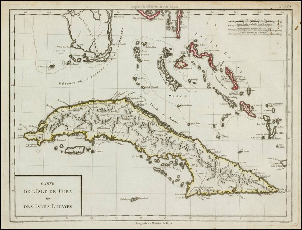
Striking wide margined example of this scarce map of Cuba, the Bahamas and the Southern tip of Florida. The map provides a fine depiction of the Western Caribbean. The dating of this map runs the gamut from 1784 to 1806, but it can be reliably traced...

Striking full color example of scarce 1792 edition of Thomas Jefferys' map of the Gulf Coast, from Jeffreys' West India Atlas. Jeffery's map is one of the earliest obtainable large format map to treat the Gulf Coast region with such remarkable detail,...
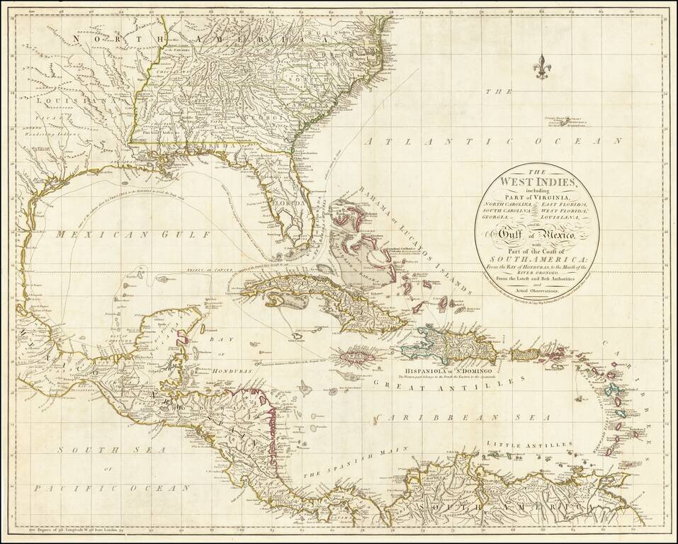
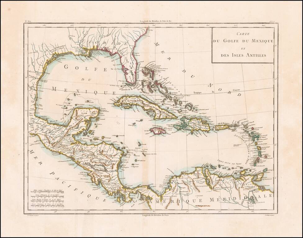
Fine large map of the South Florida and the Caribbean, published shortly after the American Revolution. The map extends from South Florida and the Florida (Gulf) Stream and the Bahamas in the north to the Yucatan, Mosquito Coast, Windward Islands and...
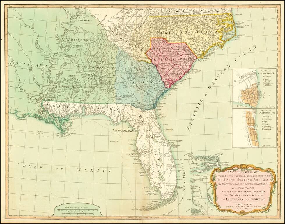
A Fine 18th Century Map of the Southern United States & Florida with Early Plans of Charleston and St. Augustine Laurie & Whittle's edition of this scarce map of the Southern States and Florida, originally compiled by Bernard Romans for the...
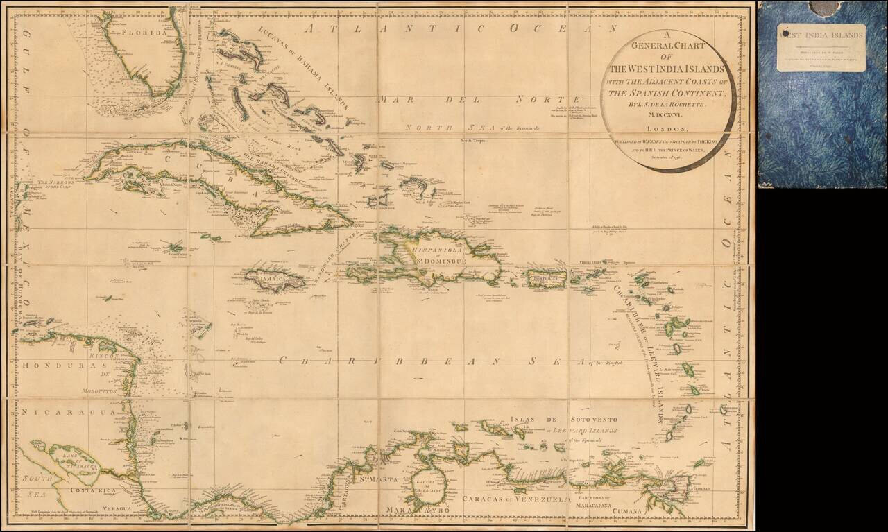
Rare Separately Issued Faden Map of the Caribbean &c. Detailed large format chart of the West Indies, Florida, Honduras, Nicaragua, Coast Rica, Panama and the Bahamas drawn by Louis Stanislas Delarochette, and published by William Faden in 1796....
Interesting map of the West Indies and Gulf Coast region, showing Florida, the Yucatan, coast of Central America and South America. Fort Louis and Lake St. Joseph are shown along with St. Louis Bay and Bernard's Bay, near modern Galveston. Nice detail...
Antique Map of the Caribbean and South Florida A striking color example of Cassini's scarce map of the Caribbean and south tip of Florida. The map is outlined in attractive reds, greens and yellows, while the cartouche is fully colored and appears to...
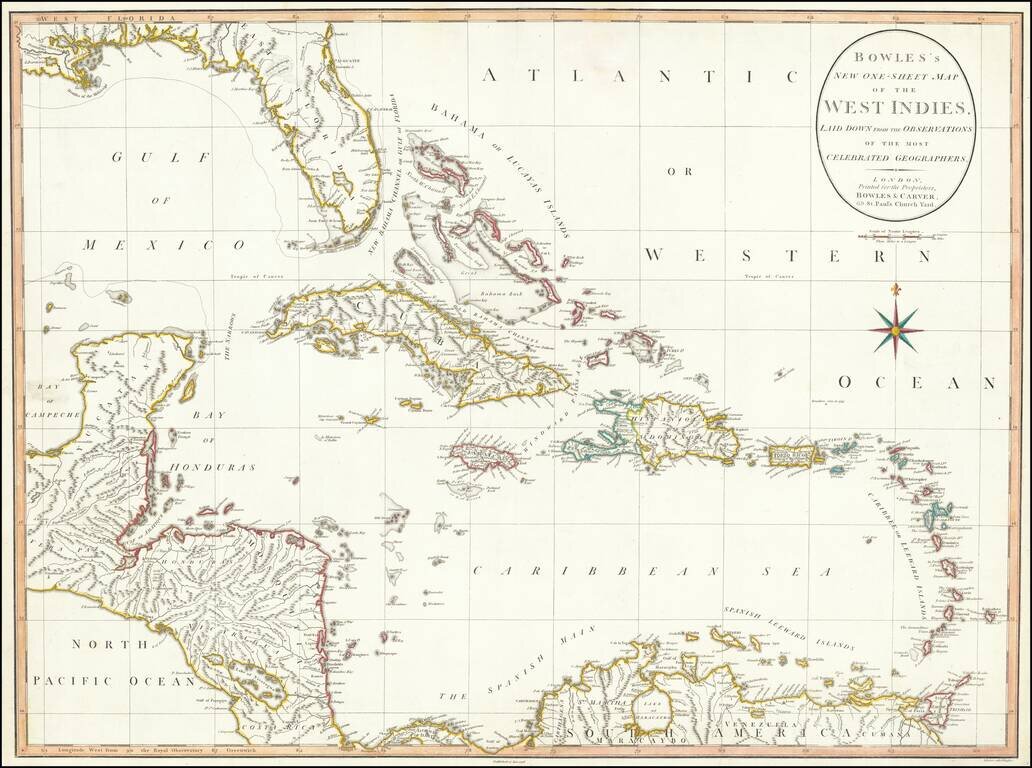
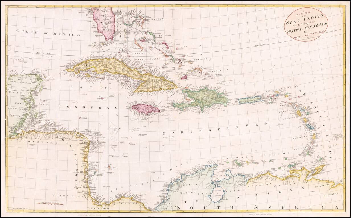
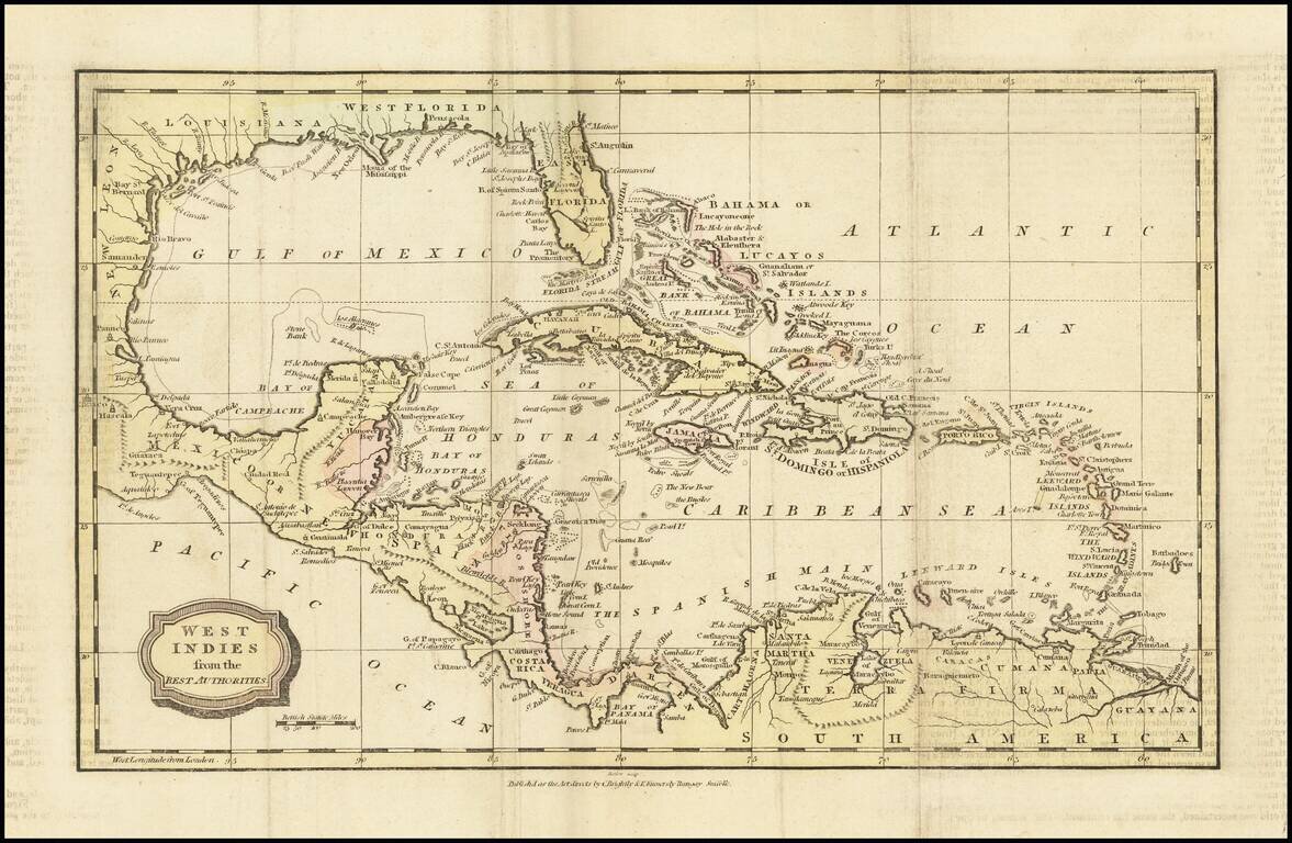
Large detailed map of Florida and the Caribbean, published by Bowles & Carver. The map extends from Florida, the Yucatan and Central America to the Windward and Leeward Islands. Centered on Cuba and the Bahamas. The map references the "Supposed...
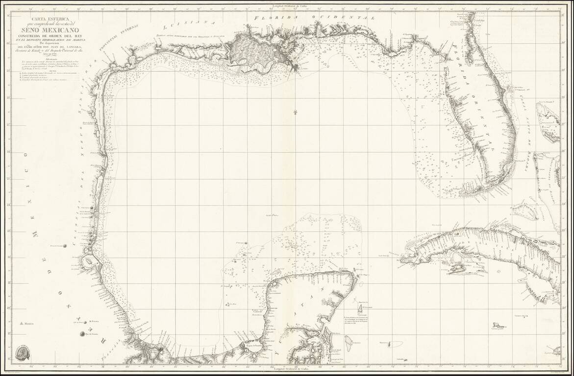
The foundational Spanish sea chart of the Gulf Coast, Florida, Texas, etc. -- One of the six most important maps of Texas (Streeter). This is the first large-scale printed chart of the Texas coast based upon actual soundings and explorations. The map...
Scarce antique map of Florida, the Gulf Coast, and the Caribbean from Mentelle & Chanlaire's Atlas Universel…, engraved by Tardieu and drawn by Valet. Includes nice detail throughout the map.
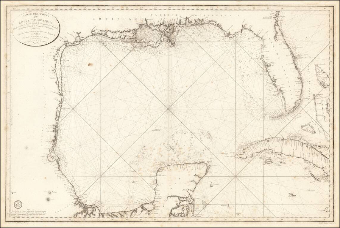
The First Modern French Sea Chart of the Gulf of Mexico Important early chart of the Gulf Coast and Florida, issued in the 9th Year of the French Revolution (An. IX.) The map was issued one year after the Spanish Carta Esferica and draws extensively...
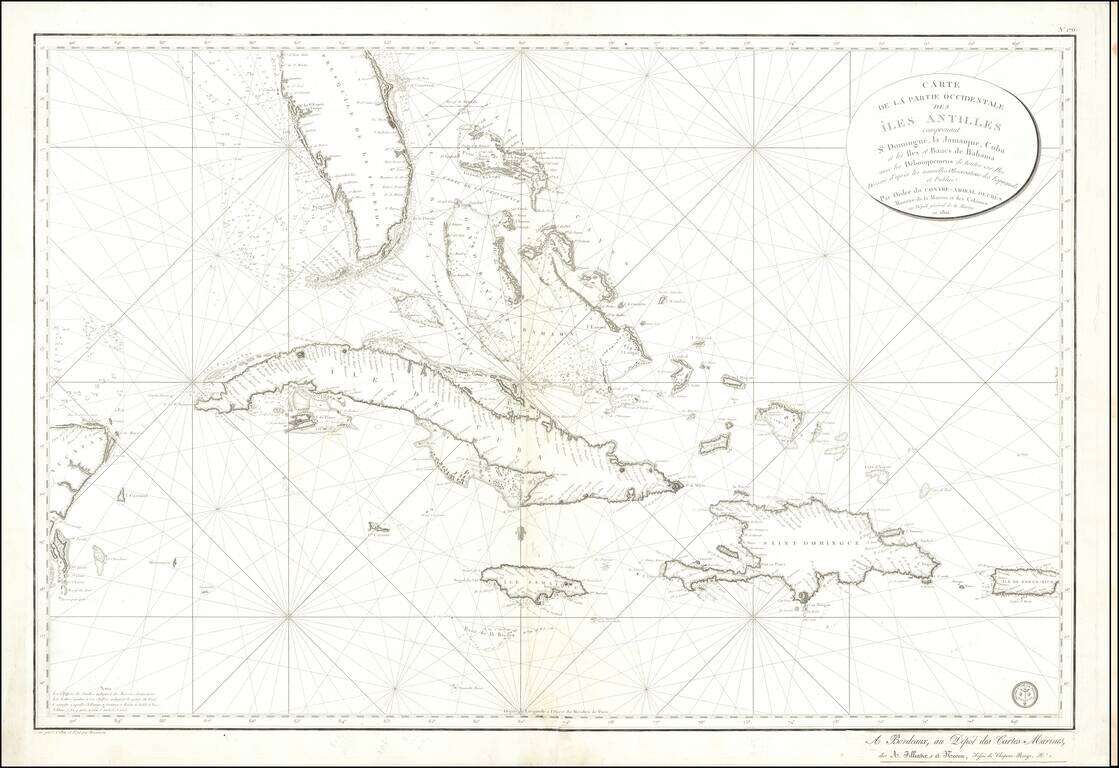
Detailed sea chart of South Florida, the Bahamas, Cuba, Jamaica, Cayman Islands, Puerto Rico, Santa Domingo and the part of the Yucatan Peninsula, published by the Depot De La Marine 1801. The chart is one of the most detailed maps of the region and...
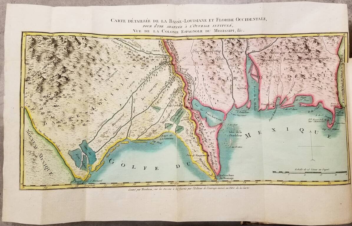
First Edition. Contemporary hand-color. First edition (1803) of this detailed work on Louisiana just before its acquisition by the United States in the Louisiana Purchase. The book was authored Pierre-Louis Berquin Duvallon, who was procureur du roi...
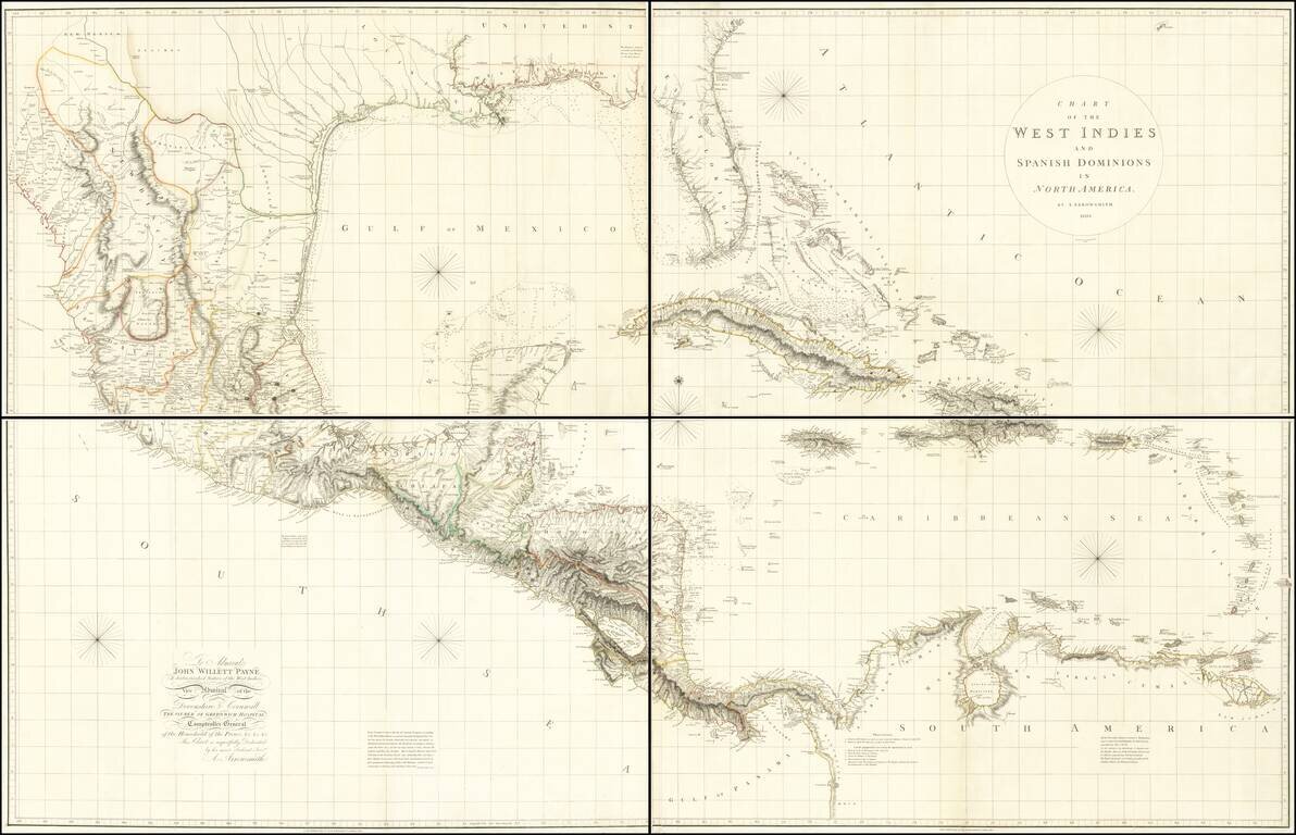
A Seminal Map of Florida, The Caribbean and Texas! First edition of Arrowsmith's map of Mexico & the West Indies, and the only edition to extend to the Pacific, thereby showing modern Texas and parts of New Mexico and Arizona. The map is...
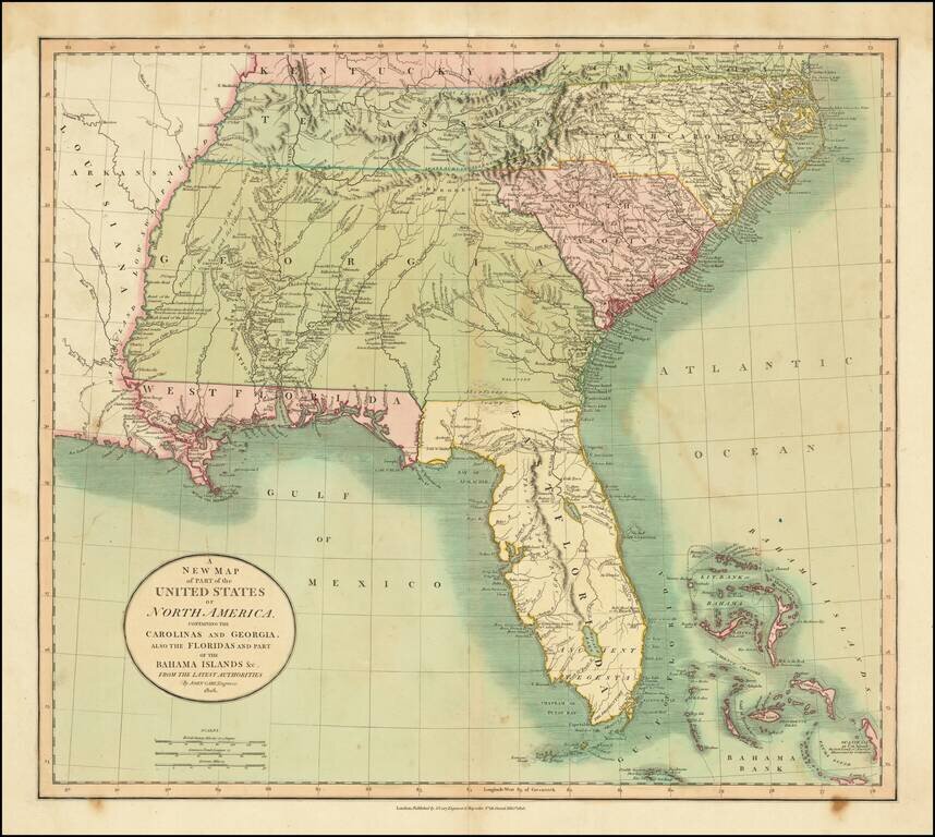
Fine example of the first edition of Cary's map of the Southern United States and Bahama Islands, extending the East Coast to the Mississippi River and from Tennessee and the Carolinas to Florida, the Bahamas and the Gulf Coast. A massive Georgia...