
Rare old maps of the United States.
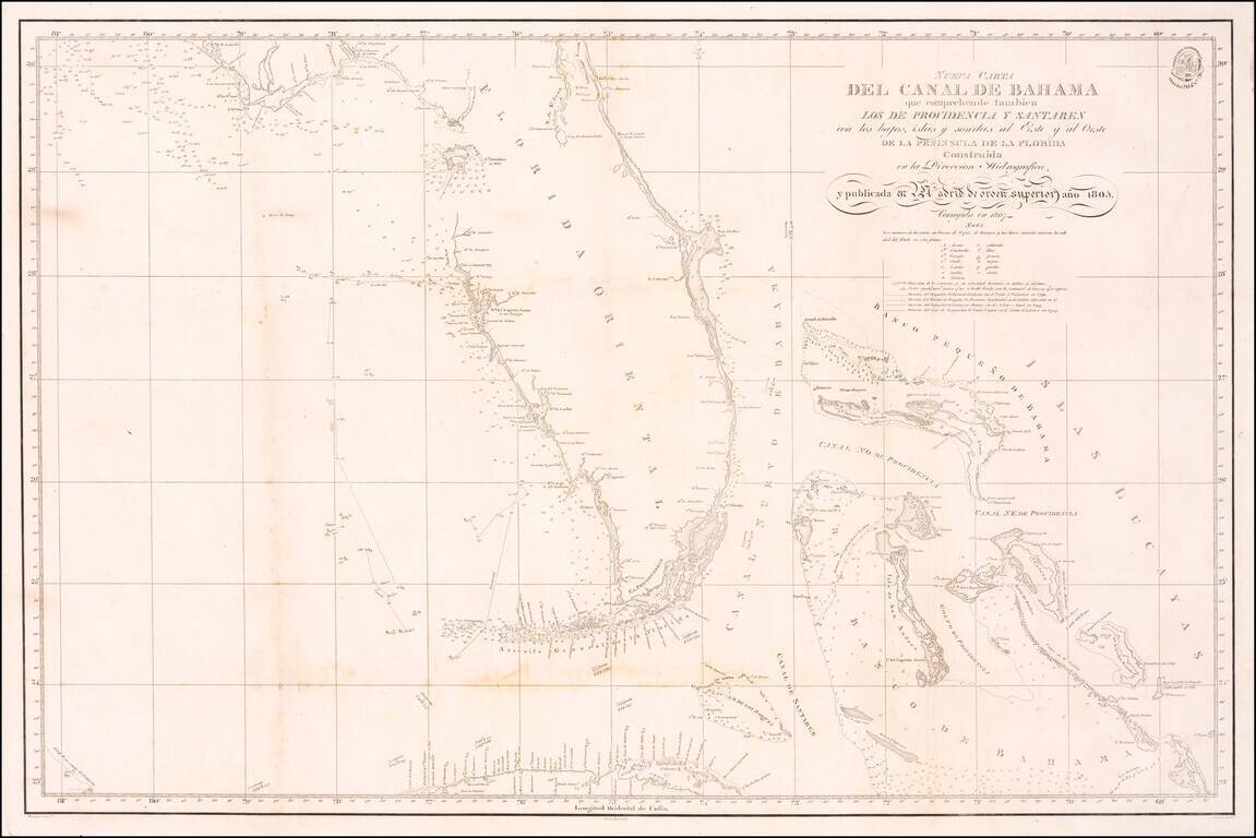
A Landmark Spanish Chart of Florida and the Bahamas Important early 19th Century Sea chart of Florida and the Bahamas, one of the earliest Spanish Sea Charts to focus on the coast of Florida and the Bahamas. The map offered here is identified as...
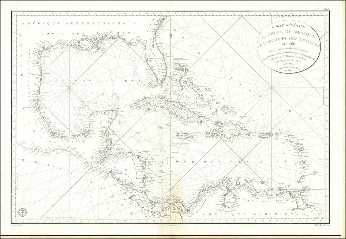
Detailed French Sea Chart of the Caribbean Fine and intricately-drawn French sea chart of the Spanish Main and the Caribbean, published in Paris in 1807. Drawn for the benefit of French vessels, as the cartouche in the upper right explains, the chart...
![[Florida] Boca y Barra Del Rio Sn. Juan..](/map/small/43864.jpg)
Rare early chart of the lower San Juan (St. Johns) River, Florida, published in the Portulano de la America Septentrional, under the auspices of the Direccion De Hidrografia in Madrid, in 1809. The Portulano de la America Septentrional The...
![Boca y Barra Del Rio Sta. Maria [Florida]](/map/small/43885.jpg)
Rare plan of the Mouth of the St Mary's River. Includes soundings, Ft. Arriando, Sta. Maria, Tiger, Cumberland and Amelia Islands, and a number of other geographical points and topographical details. Issued in the rare Portulano de la America...
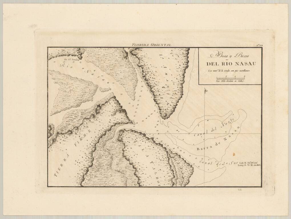
Rare Spanish Chart of the Mouth of the Nassau River and Part of Amelia Island and Talbot Island. Fine example of the first detailed chart of the Nassau Sound and the surrounding islands. Includes soundings, Point del Tenedero, Talbot and Amelia...
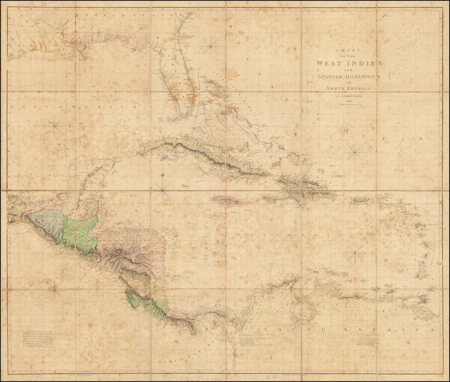
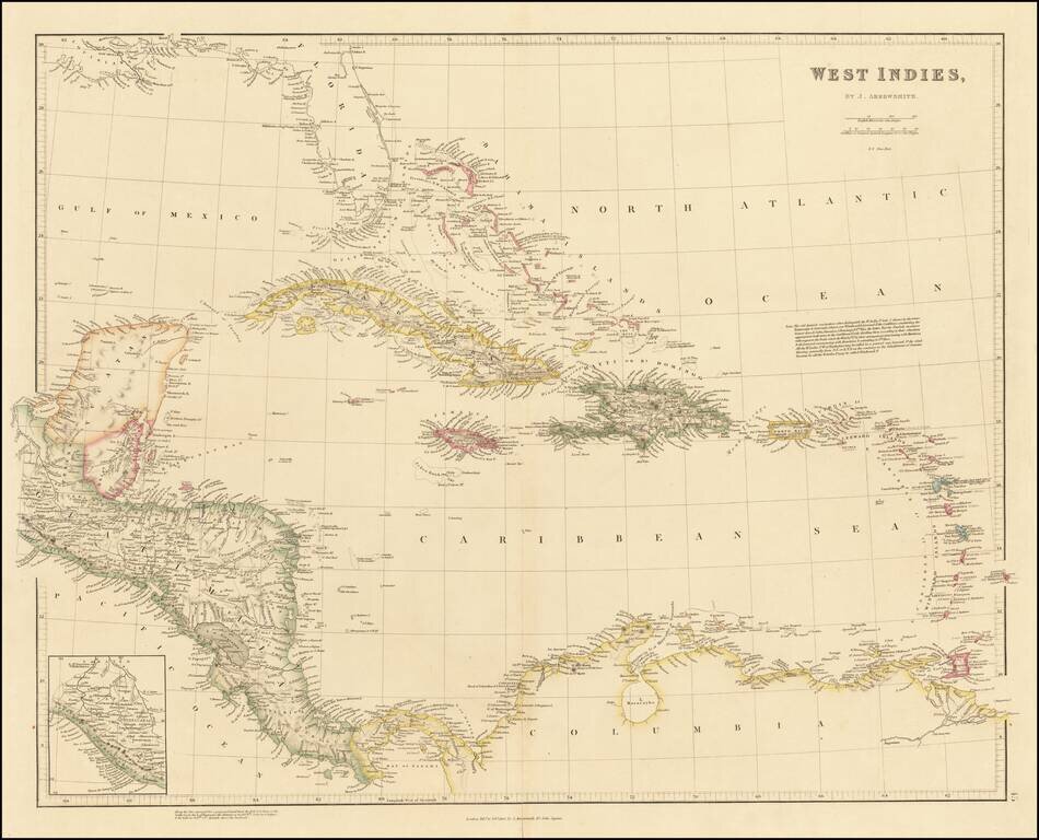
The Best Early 19th-Century Map of Central America and the Caribbean. Large hand-colored engraved antique map of Florida, the Gulf Coast, West Indies, and Central America, published by Aaron Arrowsmith in London in 1810. The map contains a detailed...
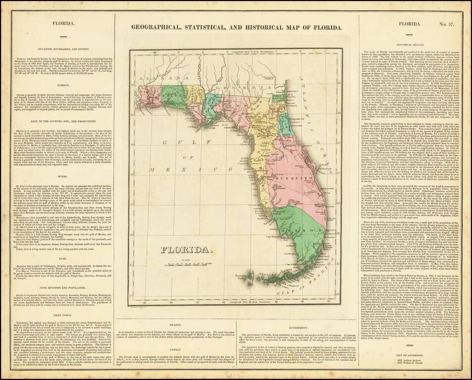
One of the Earliest Maps of Florida Territory An important early map of the Territory of Florida, published by Carey & Lea. This interesting map, issued in 1822, shows Florida only 3 years after it was acquired by the United States from Spain....
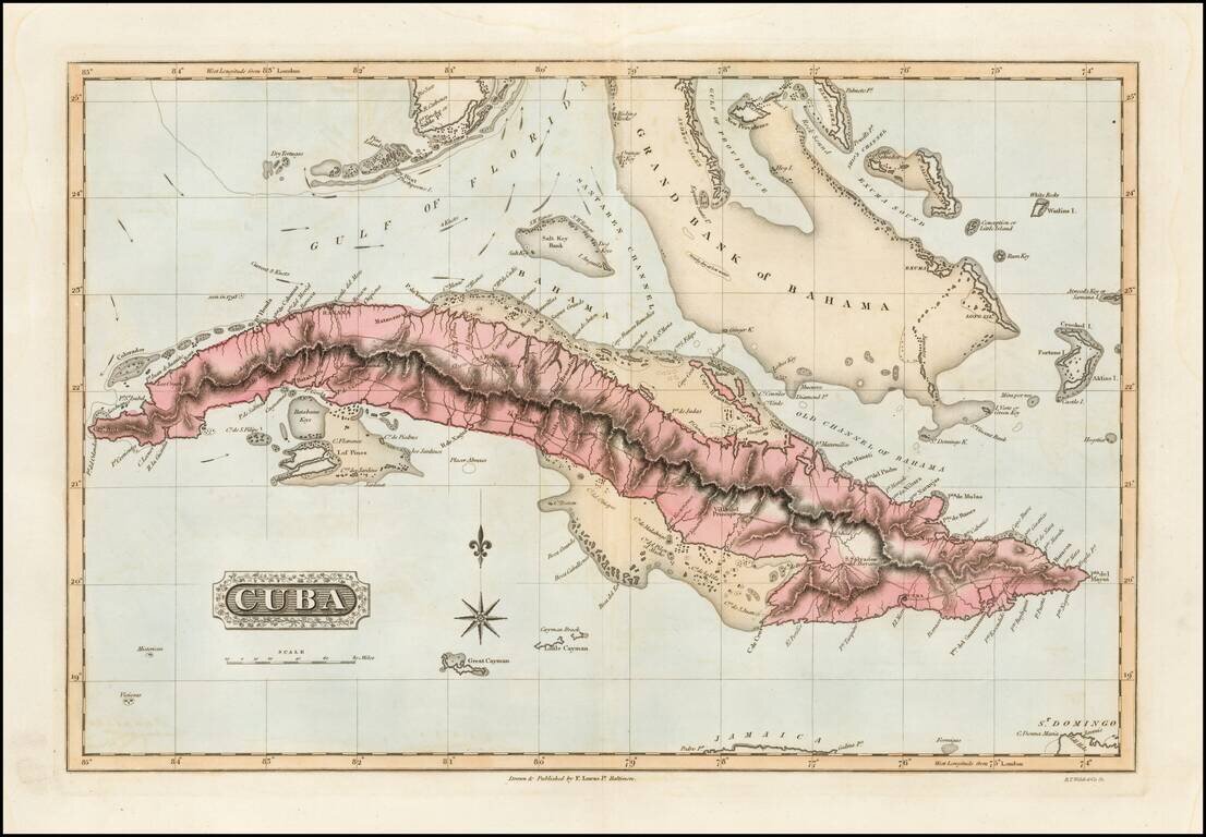
Detailed early American map of Cuba, the Bahamas and Florida Keys, published in Baltimore by Fielding Lucas Jr. The map includes topographical details, roads, and a host of other details. Fielding Lucas's New & Elegant General Atlas included a...
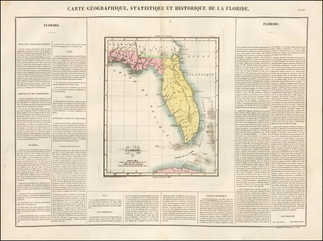
The Earliest Map of Florida Territory Published in France Very early territorial map of Florida, from the French edition of Carey & Lea's Atlas. Divided into East & West Florida. St. John River still shown in early mythical fashion. Shows...
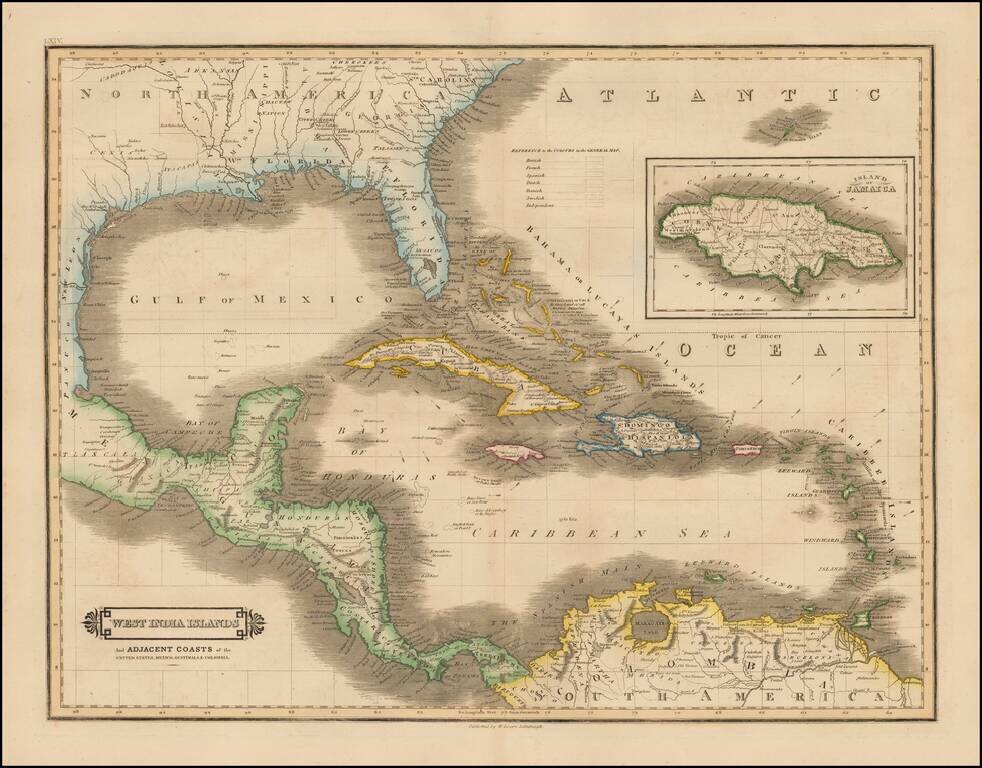
Scarce early edition of Lizars map of the Caribbean and contiguous coasts of Florida, the Gulf Coast, Central and South America, with a large inset of Jamaica. East and West Florida still appear, but both Missisippi and Alabama Territories are...
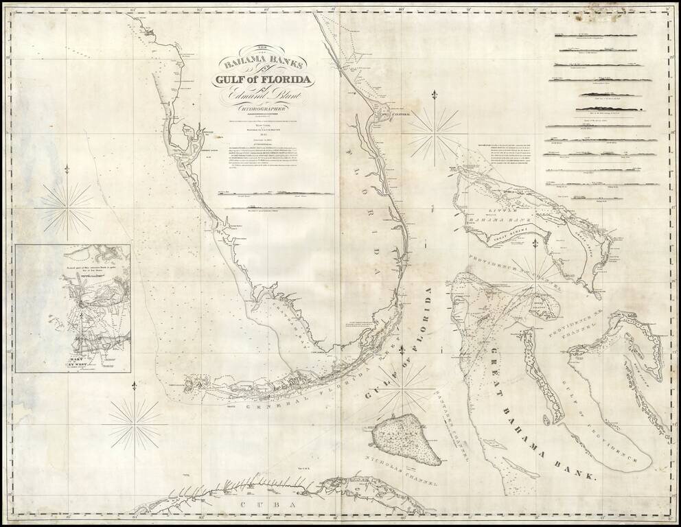
Rare early state of Blunt's sea chart of Florida and the Bahamas, first published in 1833. Nice coverage of the Bahama Islands. Has a small inset chart of Key West and twelve small recognition views of coastal approaches. The Coastline of Florida is...
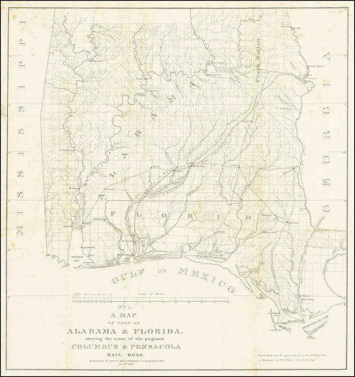
Detailed map of Alabama and western Florida, showing the route of the proposed Columbus & Pensacola Railroad, which accompanied the report of Major J.D. Graham, February 6, 1836. An early and important railroad map of parts of southern Alabama and...
Arrowsmith's London Atlas Map of the Florida, the West Indies & Central America Nice example of this fine map of Florida, the Caribbean and Central America, published in Arrowsmith's London Atlas. In Florida, the map notes the "Cape Florida...
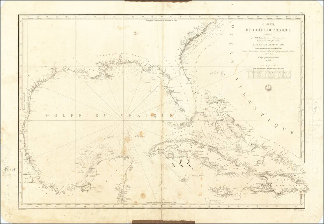
A Well Used Sea Chart of Florida, Gulf Coast and the Caribbean French Sea Chart of Florida, the Gulf Coast, Mexico, Yucatan, the Bahamas, Cuba and the western Caribbean, published in Paris in 1843. The chart was used as sea, with what appears to be a...
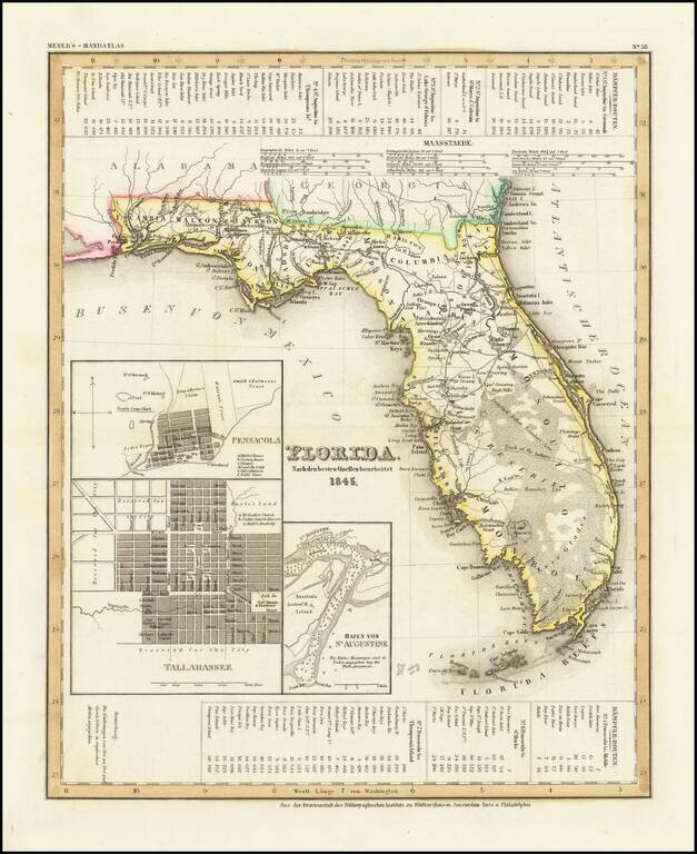
Scarce early map of Florida, published in the year was admitted to the Union. Shows early roads, towns, rivers, lakes, islands and other features. Mosquito County extends from Lake George to Lake Macaco and only Monroe, Hillsboro and Dade Counties are...
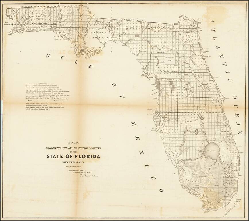
Fine example of this large format map of Florida, showing the extent of the surveys in the state of Florida. Shows extensive detail throughout Florida, including towns, forts, lakes, rivers, the Arredondo Grant, swamps, lighthouses, landings, etc....