Map size in jpg-format: 40.1135MiB
Click to open in high resolution (open in new tab).

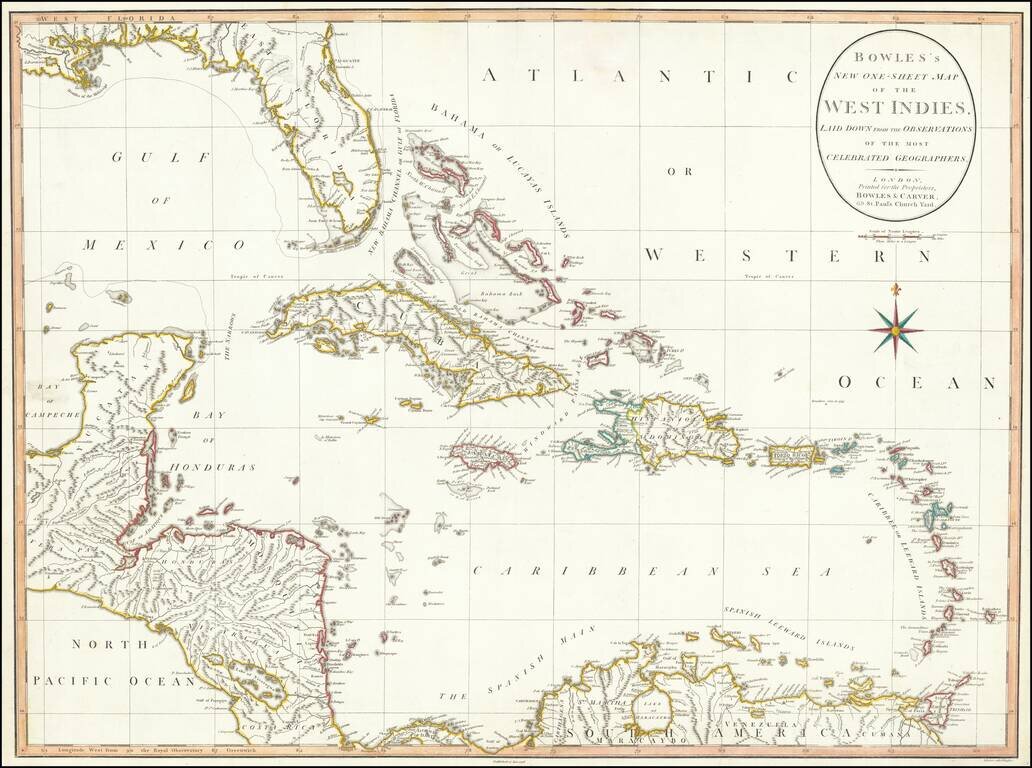
Large detailed map of Florida and the Caribbean, published by Bowles & Carver.
The map extends from Florida, the Yucatan and Central America to the Windward and Leeward Islands.
Centered on Cuba and the Bahamas.
The map references the "Supposed Lake of Mujaco." This is a unique reference to the Lake Okeechobee, which was more normally called Lake Mayaco at the end of the 18th Century.
If you are a student, write to us in telegram: @antiquemaps and indicate what material you need and for what work you need a map in high detail. We are ready to provide material on special terms. For students only!

![[Wall Map] West-Indische Paskaert waer in de graden der breedde over weder zyden vande middelyn wassende so vergrooten dat die geproportioneert syn tegen hunne nevenstaende graden de lengde.](/map/small/60169.jpg)
