
Rare old maps of the United States.
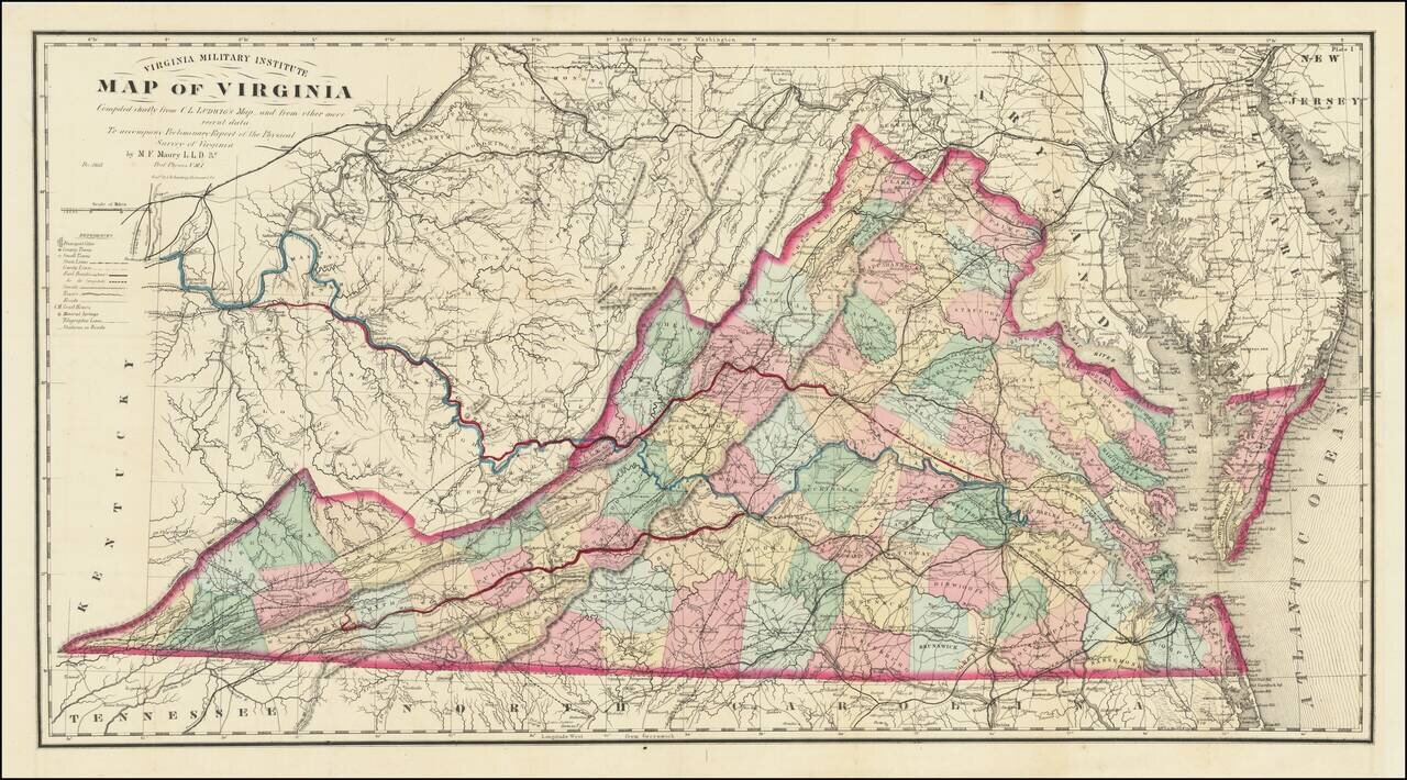
A Mathew Fontaine Maury - VMI - Rarity Nice example of the extremely rare third edition of the so-called Bucholtz-Ludwig map of Virginia. The Bucholtz-Ludwig map was originally based upon work done by Ludwig von Bucholtz, in connection with his...
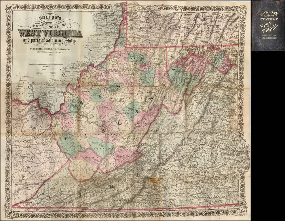
Early separately issued map of West Virginia, colored by counties. One of the earliest obtainable separate maps of West Virginia, following its becoming a state in 1863. There are very few separately issued maps of WV.
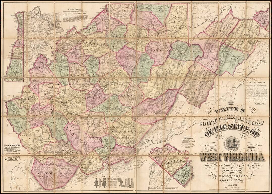
One of the First Large Scale Maps of West Virginia Fine large format map of West Virginia, published by real estate promoter M. Wood White in Grafton, West Virginia, and "Engraved & Printed by H.J. Toudy & Co., Phila. Pa." The map is...
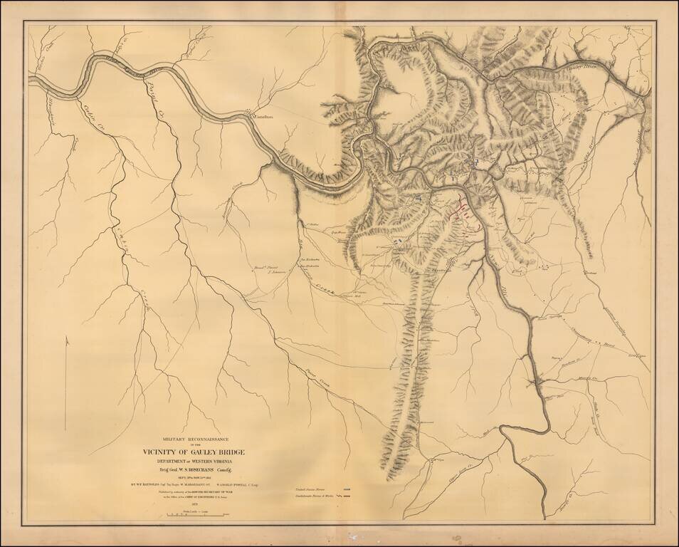
Color-lithographed map of the area near Gauley Bridge, (present-day) West Virginia. Gauley Bridge was the site of a minor battle during the Civil War, which resulted in a Union victory. "United States forces" are colored blue, and "Confederate forces...

Decorative and unusual trading card map from this famous series. Map is surrounded by decorative vignette, showing Oil refinery. Includes population statistics.
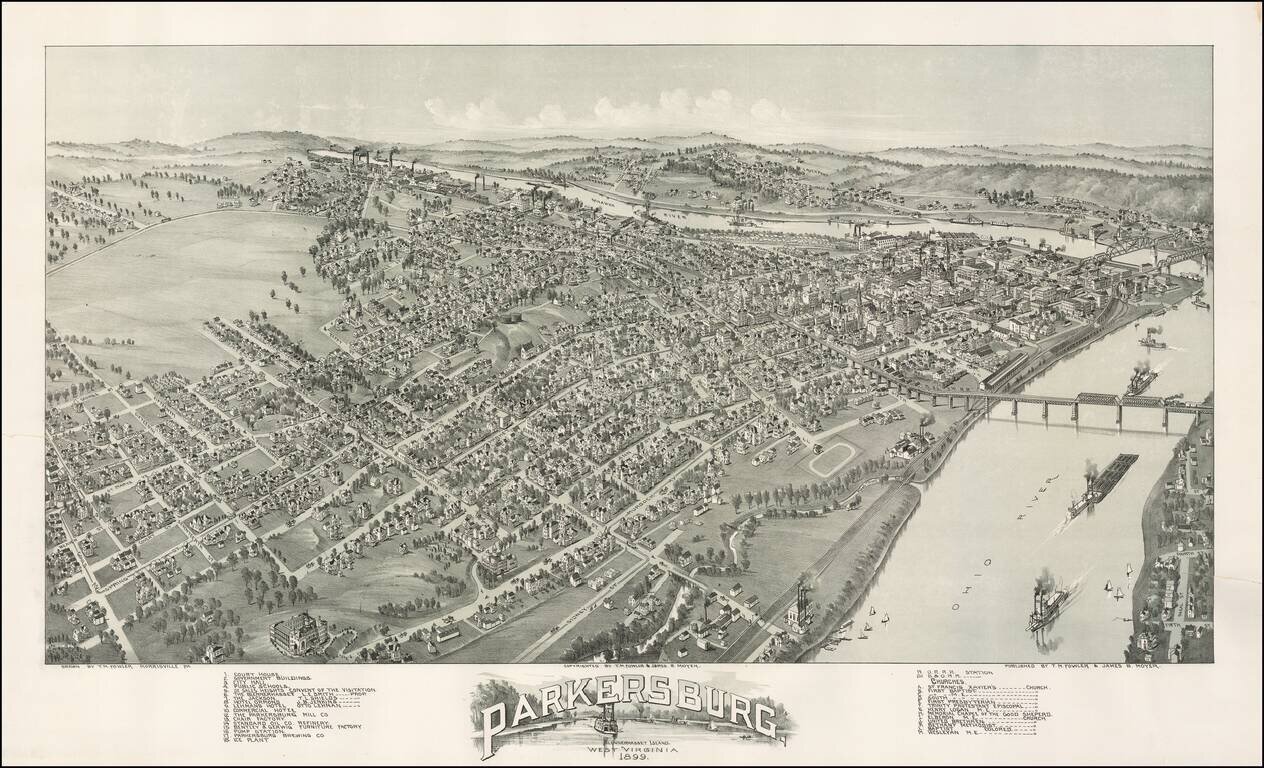
Striking view of the town of Parkersburg, West Virginia, approximately 40 miles north of Charleston, West Virginia. A stiking and highly detailed view, showing street names, buildings and the river. A classic late 19th Century view.
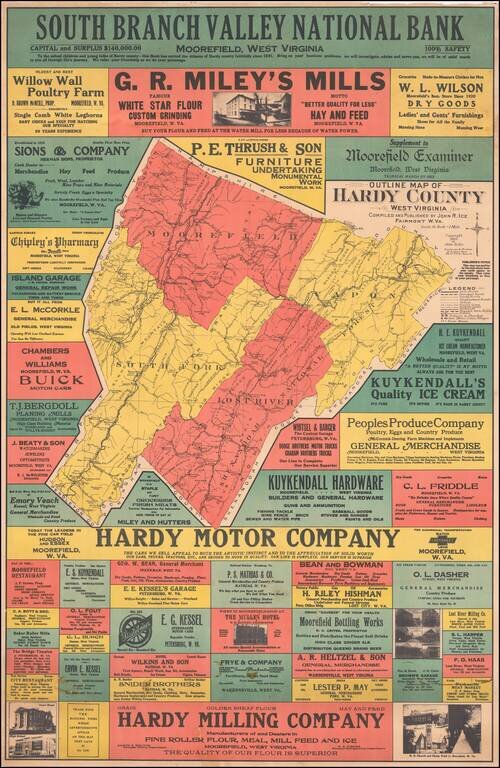
Rare promotional advertising map of Hardy County. Includes several dozen advertisements for local businesses.
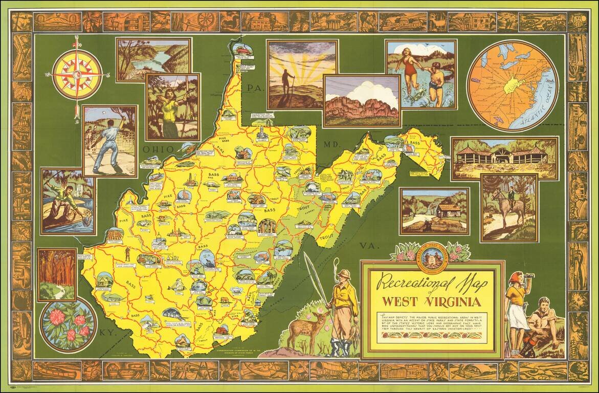
Scarce pictorial map of West Virignia, drawn by Smeltzer for the Conservation Commission of West Virginia, Division of State Parks. On the verso, there is a nice promotional tract for West Virginia's parks and state forests.
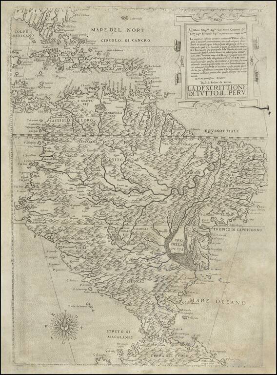
Forlani’s Map of South America—The Only Lafreri School Map of The Continent Rare map of South America by Paolo Forlani. It was the first map of South America to show the interior in considerable detail and is the only map of the continent produced...
![La Florida [with] Guastecan [with] Peruviae Auriferae Regionis Typus](/map/small/61587.jpg)
Ortelius’ Map of Florida—The First Separately Printed Map of Florida! An excellent example of Abraham Ortelius’ seminal map of Florida and the North American South, shown within a trio arrangement of maps focused on Central and South America....

Jacques Le Moyne's Landmark Map of Florida & The Southeast, Based On The Expedition of Laudonniere to Florida in 1564 Jacques Le Moyne's map of Florida and the Southeastern portion of the United States is one of the most important 16th Century...
![[St. Johns River - Florida] Der Franßosen Schiffahrt an den Fluß Maij](/map/small/64985.jpg)
Fine view on the mouth of the F. Maij (St. Johns River) just north of modern day Jacksonville, based upon original watercolor paintings by Jacques Le Moynes de Morgues, an official French artist, who accompanied two important French Expeditions to...

Nice example of the second edition of Herrera's map of Florida and the Caribbean, which first appeared in Herrera's Descripcion de las Indias Ocidentales, first published in Madrid in 1601. In describing the map, Burden notes: Of interest to us on...

The earliest obtainable maps of the Southeastern United States. De Laet's description of America is arguably the finest of the 17th Century. The map was almost certainly engraved by Hessel Gerritsz, based upon the work of Claesz in 1602, and Jacques...
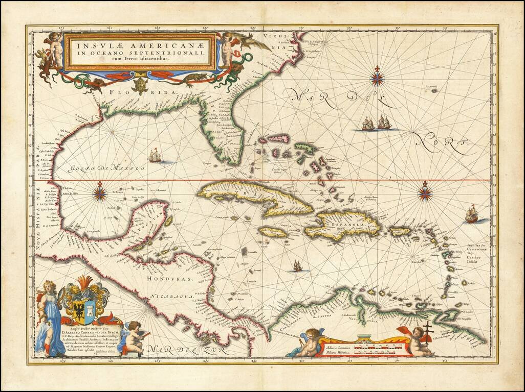
Blaeu's Chart of the Caribbean Nice example of Blaeu's chart of the Caribbean, based on a section of Blaeu's own West Indische Paskaert (ca. 1630) and Hessel Gerritsz' rare chart of 1631. The chart was the most accurate for its time and was used...

The First Sea Chart Focused on the Coast of California Rare first edition of the earliest map to focus on the California Coast, published in Florence by Robert Dudley. The map appeared in Dudley's landmark sea atlas, the Arcana del mare, the first...