
Rare old maps of the United States.
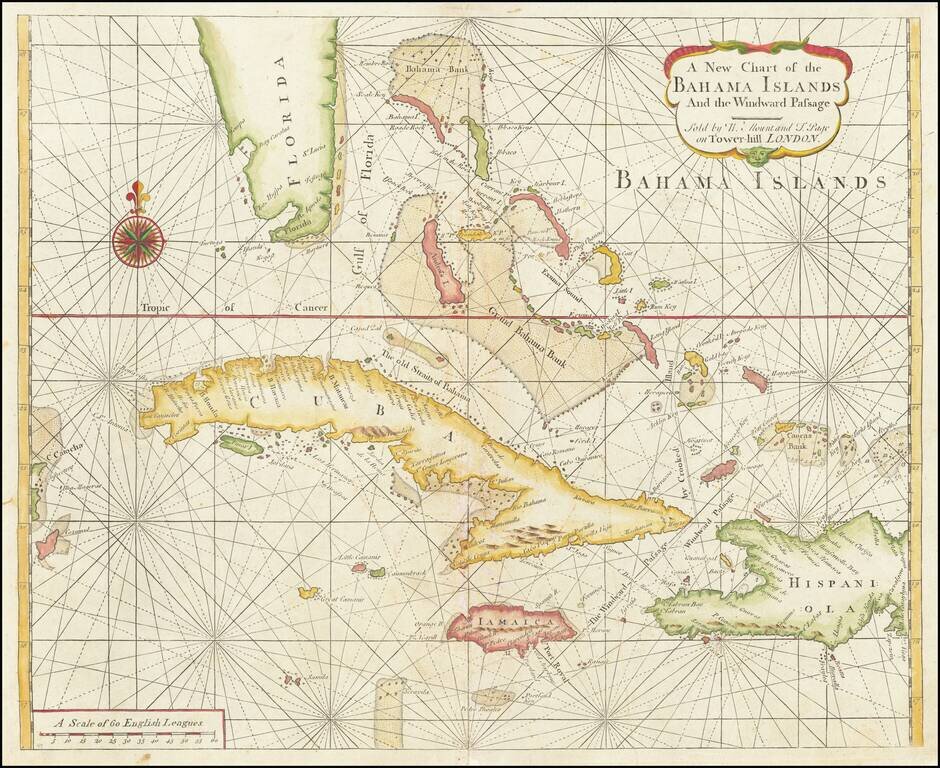
Scarce Early English Chart of the Bahamas from the Influential English Pilot, Fourth Book This chart by Mount and Page includes the tip of Florida, the Cayman Islands, Cuba, Jamaica, the western part of Hispaniola and Cozumel to the far west. The...
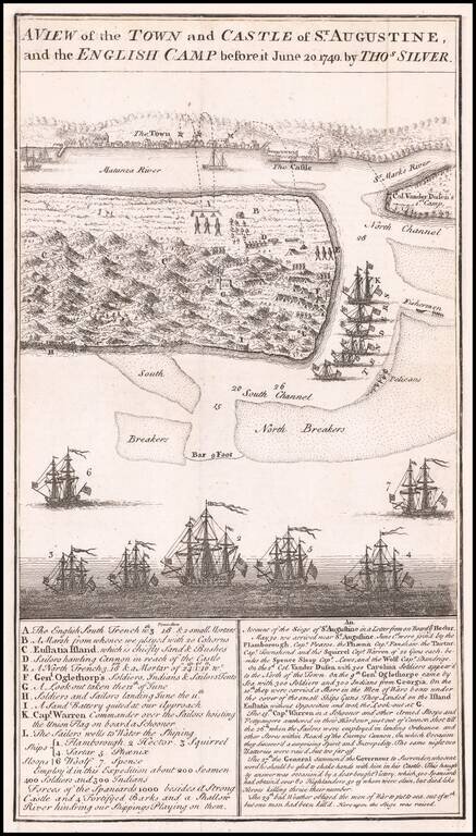
Antique Birdseye View of St. Augustine, Florida Detailed battle plan and view of the Town and Castle of St. Augustine, and the English Camp, showing the attacking forces of General James Oglethorp, during the English siege of St. Augustine in the...
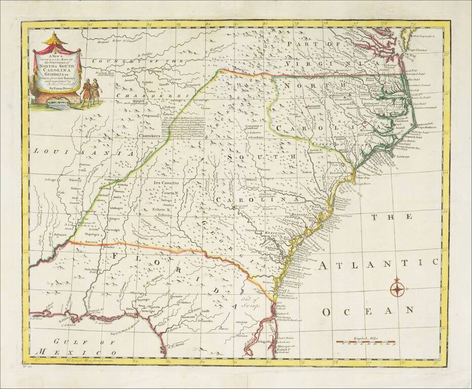
Striking example of Bowen's detailed map of the Carolinas, Georgia and most of Florida, extending west to the Country of the Cherokees and French Louisiana. The map is highly detailed and show many towns, forts, Indian Tribes, mountains, rivers,...
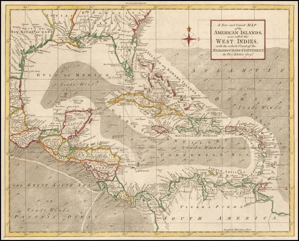
Detailed map of the Caribbean and Southeastern US, extending to Texas, Mexico, Central America and South America. Numerous annotations throughout.
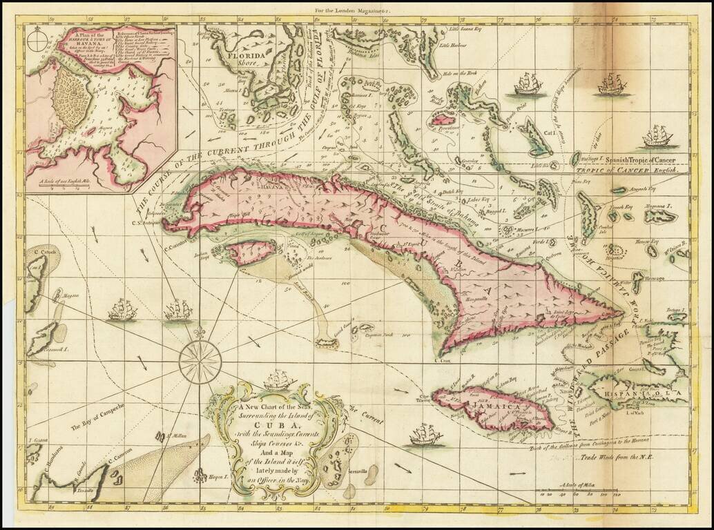
Scarce map of Cuba, the Bahamas, the southern tip of Florida and contiguous islands, highlighting the various trade routes in the Caribbean. "The Course of the Current Through The Gulf of Florida" is prominently labeled, as is the Track of the...
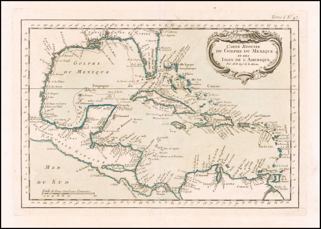
Detailed map of the Caribbean, published in Nicholas Bellin's Petit Atlas Maritime. The map covers The Gulf Coast, Florida, the Caribbean, Mexico, Yucatan and Central America.
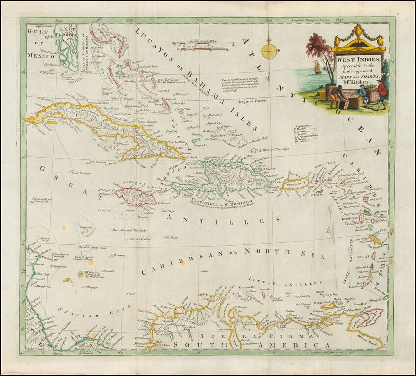
Decorative map of the Caribbean, extending from South Florida to the Northern edge of South America and the Windward and Leeward Islands. Nice detail in the Bahamas. Great Cayman and Little Caymans are shown. Decorative title vignette.
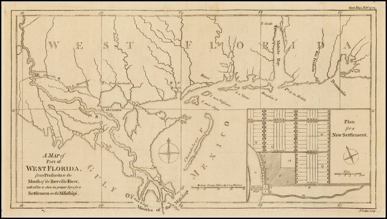
Nice detailed map of the Gulf Coast from Pensacola to the mouth of the Mississippi River, from the February 1772 edition of Gentleman's Magazine, with a nice inset plan for a New Settlement. Extends to west of New Orleans to include Plantations along...
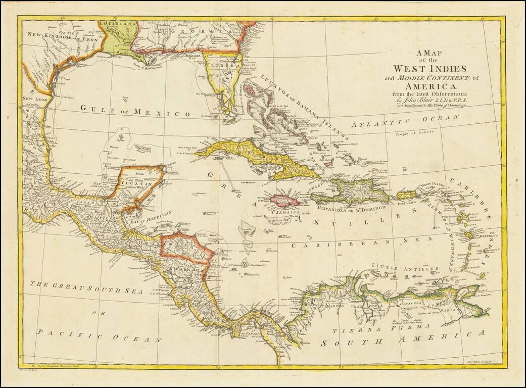
Detailed map of Florida, the Gulf Coast and Caribbean, centered on Cuba colored by regions. Florida is shown as an Archipelago. Georgia extends to the Mississippi River. Massive Kingdom of Leon (Texas). Nice detail in the Bahamas.
![The Coast of West Florida and Louisiana . . . [with] The Peninsula and Gulf of Florida or Channel of Bahama with the Bahama Islands . . .](/map/small/38977.jpg)
18th Century Florida & Gulf Coast Sea Chart Nice example of the Laurie & Whittle significantly revised and updated edition of Thomas Jefferys' 2-sheet map of Florida and the Gulf Coast, from Jeffreys' West India Atlas. This edition of the map...
![The Coast of West Florida and Louisiana . . . [with] The Peninsula and Gulf of Florida or Channel of Bahama with the Bahama Islands . . .](/map/small/66344.jpg)
Florida and the Gulf Coast at the outset of the American Revolution Nice example of this important early 2-sheet map of Florida and the Gulf Coast, from Jeffreys' West India Atlas. Jeffery's map is the earliest obtainable large format map to treat...
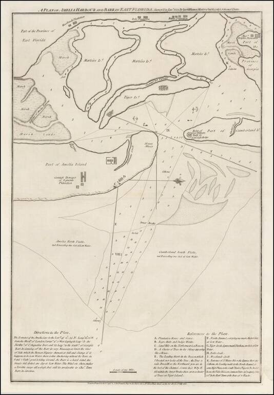
A Revolutionary War Florida Rarity. Fine wide margined example of Sayer & Bennett's chart of Amelia Harbor and Bar, based upon a survey conducted under the direction of Jacob Blamey in January 1775. The map is oriented with west at the top. On...
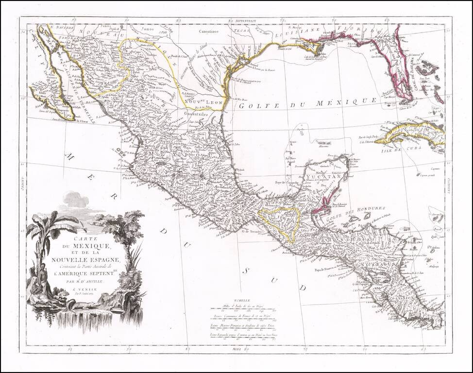
Striking map of Mexico, Texas and the Gulf Coast, including Florida, published in Venice. The map notes that it is based upon the work of J.B.B. D'Anville. Texas is named, with references to La Salle's visit to the region in 1685. Florida is shown...
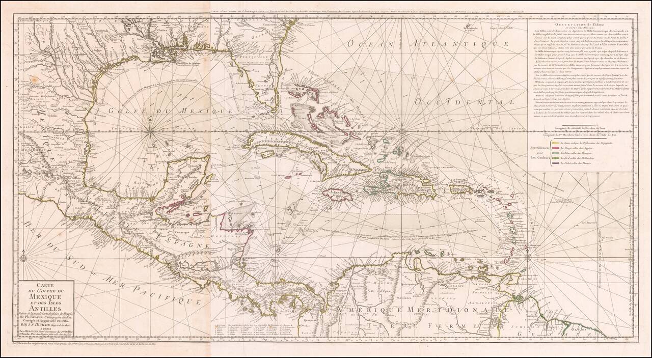
Striking, Intricate Map of the Caribbean Region Scarce and highly-detailed map of the Gulf Coast, Florida, Central America and the Caribbean from J.A. Dezauche, successor to Philippe Buache and Guillaume De L'Isle. The map is incredibly detailed, not...
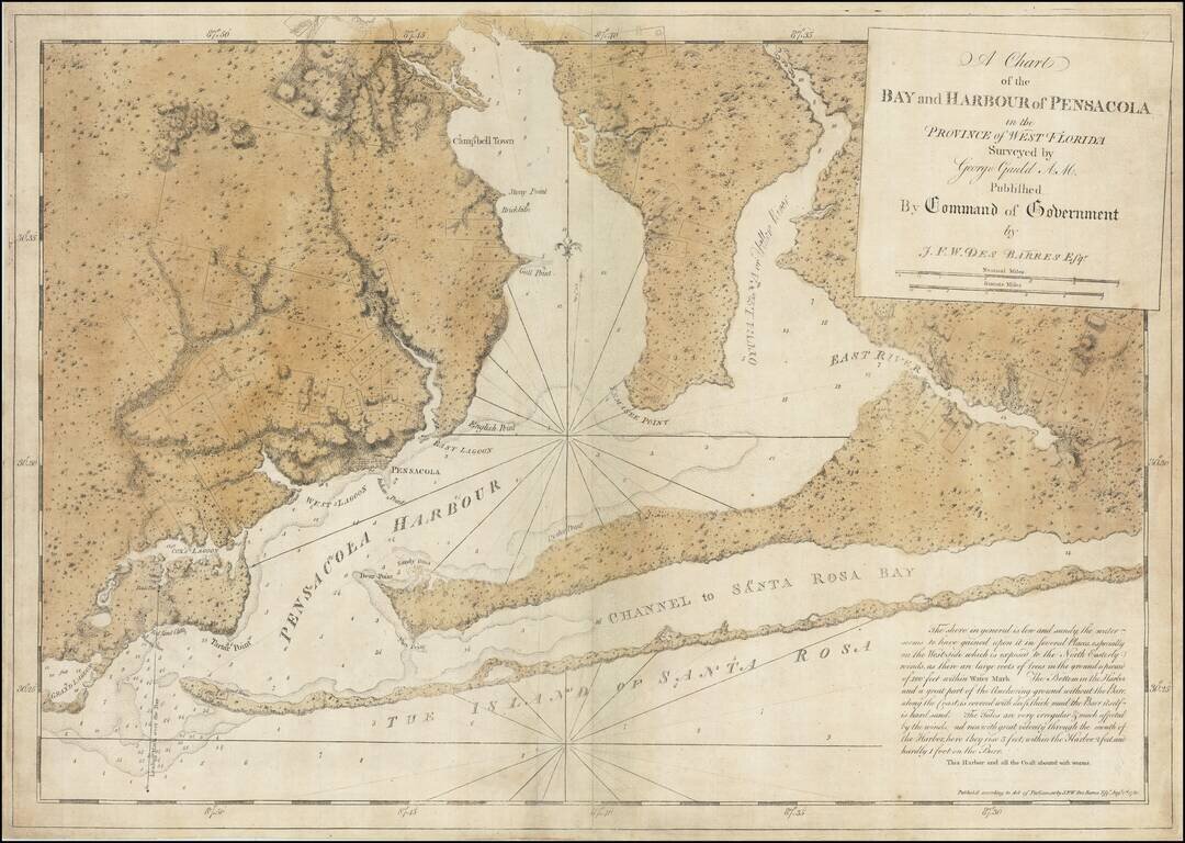
The Only George Gauld Chart Published During His Lifetime. Superb engraved chart of Pensacola Harbor in Florida, published during the American Revolution by J.F.W. Des Barres, from original surveys by George Gauld. The map extends from the eastern...
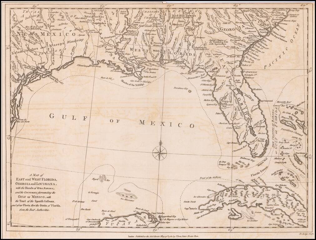
Antique Map of the Southeast United States During The American Revolution. Scarce Revolutionary War period map of the Southeastern part of the British Colonies in North America, Gulf Coast and Caribbean, illustrating the course of the Spanish Galleon...