
Rare old maps of the United States.
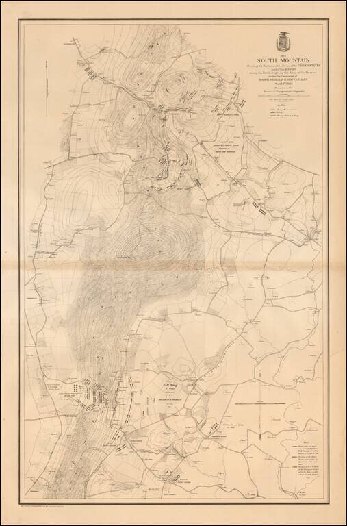
Large, detailed lithographed map of the Battle of South Mountain, a somewhat mixed Union Victory, which set the stage for the Battle of Antietam three days later. The Civil War Trust says of the Battle of South Mountain: After his success at Second...
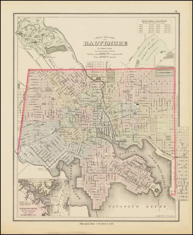
Detailed map of Baltimore, colored by wards and showing streets, rail lines, parks, buildings, stations, and a host of other details. Large inset of the Patapsco River and approaches. Includes a population table, showing the various census populations...
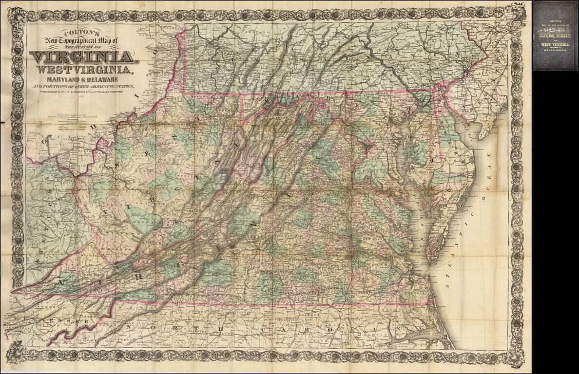
Fine large scale map of Virginia, West Virginia, Maryland and Delaware, published by Colton. This is the second edition of a map originally published in 1866 to supply a detailed representation of the area of the civil war. The geographical data was...

Fine large map illustrating the route of the Richmond & Louisville Railroad. Exceptionally detailed Railroad map of portions of Virginia, West Virginia, Kentucky and Tennessee, on a scale of 12 miles per inch. Timber and coal regions are noted,...
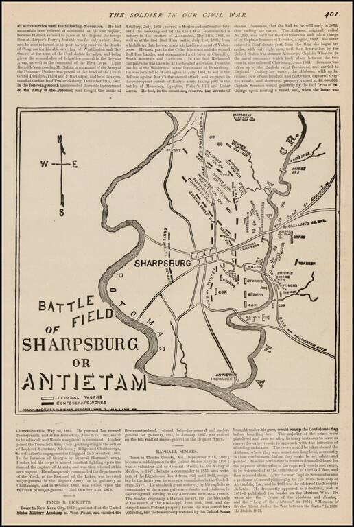
Fine sketch map of the Battlefield at Antietem, which appeared in The Soldier In Our Civil War, published by Frank Leslie. The map shows Confederate and Federal Works, various positions naming commanding officers, Roads and other important battle...
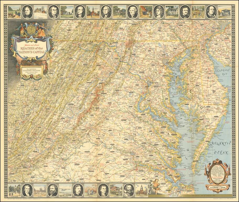
Entertaining map of the the Chesapeake Region, topped with portraits of 8 of the founding fathers and vignettes of important places in American history.
![[ Wilmington, Delaware -- Colonial Manuscript Map and Indenture ]](/map/small/36737.jpg)
Manuscript indenture with seal, signed by Peter Peterson and Rebecah R. Peterson, conveying land in the central part of Wilmington, Delaware, just southwest of Brandywine Creek and dated May, 1761. The land in question, bounded by Brandywine Creek,...
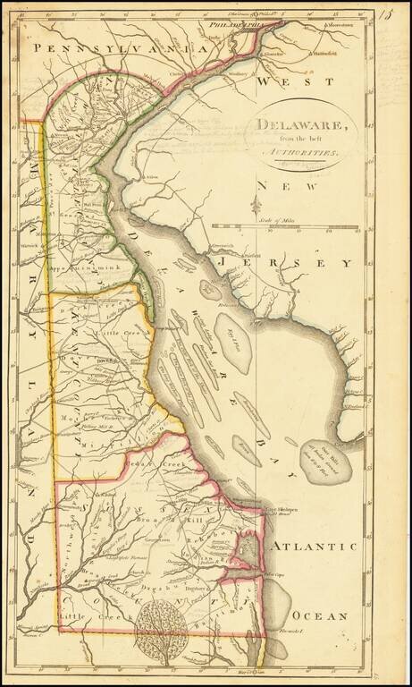
Including Extensive Early Pencil Annotations Annotated example of Matthew Carey's map of the State of Delaware, from the scarce 1816 edition of Carey's General Atlas. The map shows counties, early roads, towns and other details. One of the earliest...
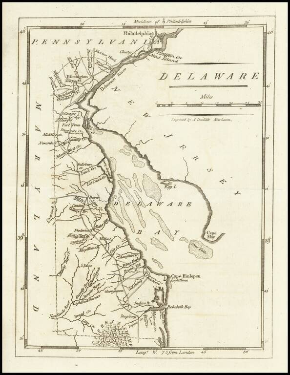
Nice example of Matthew Carey's early map of Delaware. A highly detailed map, which includes towns, roads, rivers and many other details.
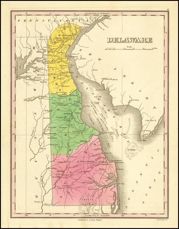
Nice example of this fine map of Delaware, from Finley's General Atlas. The map is hand colored by counties and showing towns, roads, rivers, mountains and other geographical features.
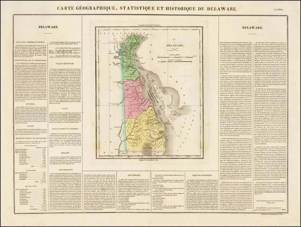
Nice example of the French edition of this early map of Delaware from Carey & Lea's Atlas. Includes wonderful contemporary details concerning the topography, indigenous lands, rivers, climate, towns, manufacturing, commerce, education, history,...
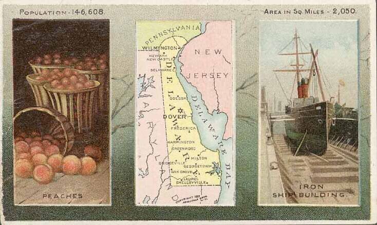
Decorative and unusual trading card map from this famous series. Map is surrounded by decorative vignette, showing Iron Ship Building and Peaches. Includes population statistics.
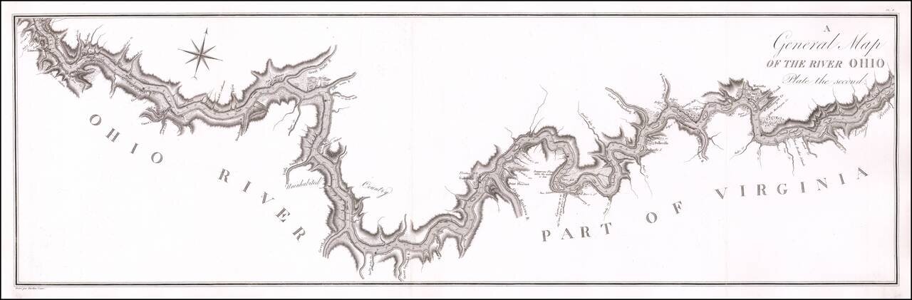
Antique Map of a Section of the Ohio River Prepared By A French Spy Important early map of the Ohio River from Maysville, Kentucky to just south of Wheeling, West Virginia, prepared by the French military officer and spy George Henri Victor Collot,...
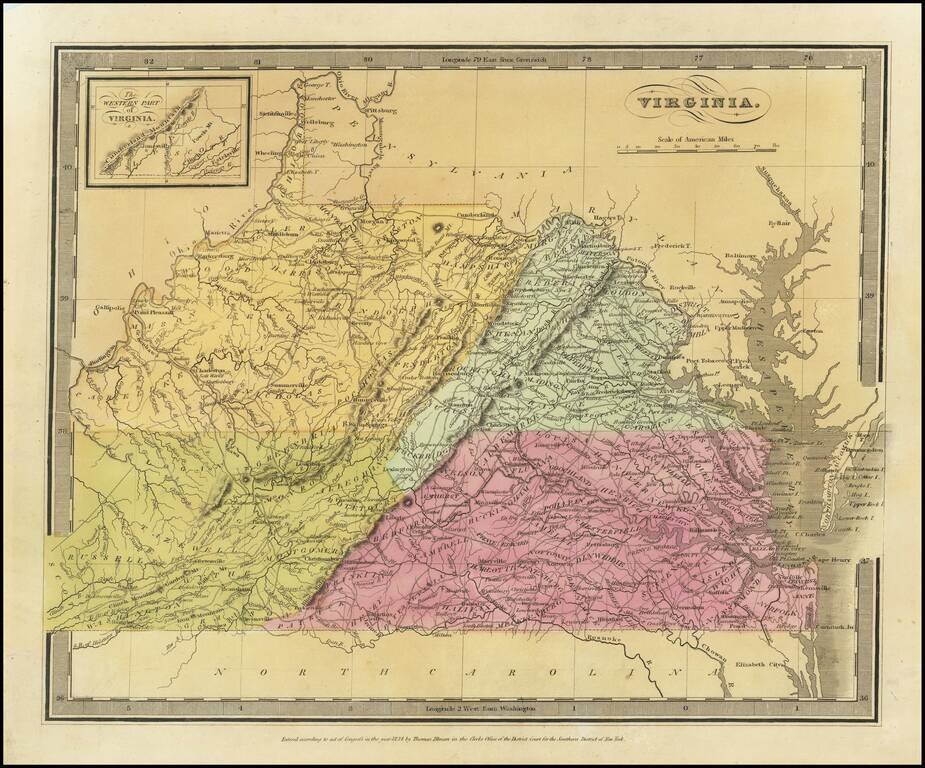
Striking full color map of Virginia, which first appeared in David Burr's Universal Atlas, in 1836. Burr is widely regarded as one of the most important names in American Cartographic history. Burr's Atlas was perhaps the most elegant American...
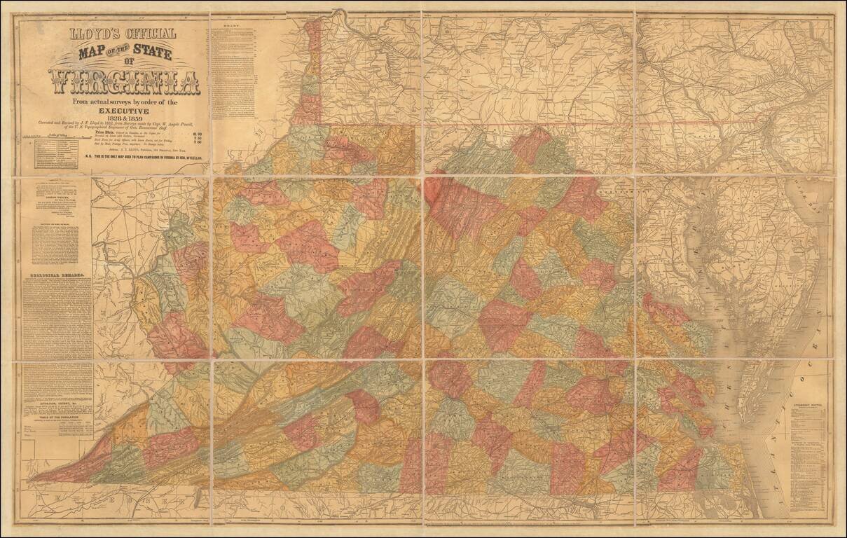
Important Large Map of Virginia With A Vitriolic Testimonial Added Nice example of the 1862 edition of JT Lloyd's large map of Virginia, the most widely distributed and influential map of Virginia during the Civil War period. Lloyd's map of Virginia...
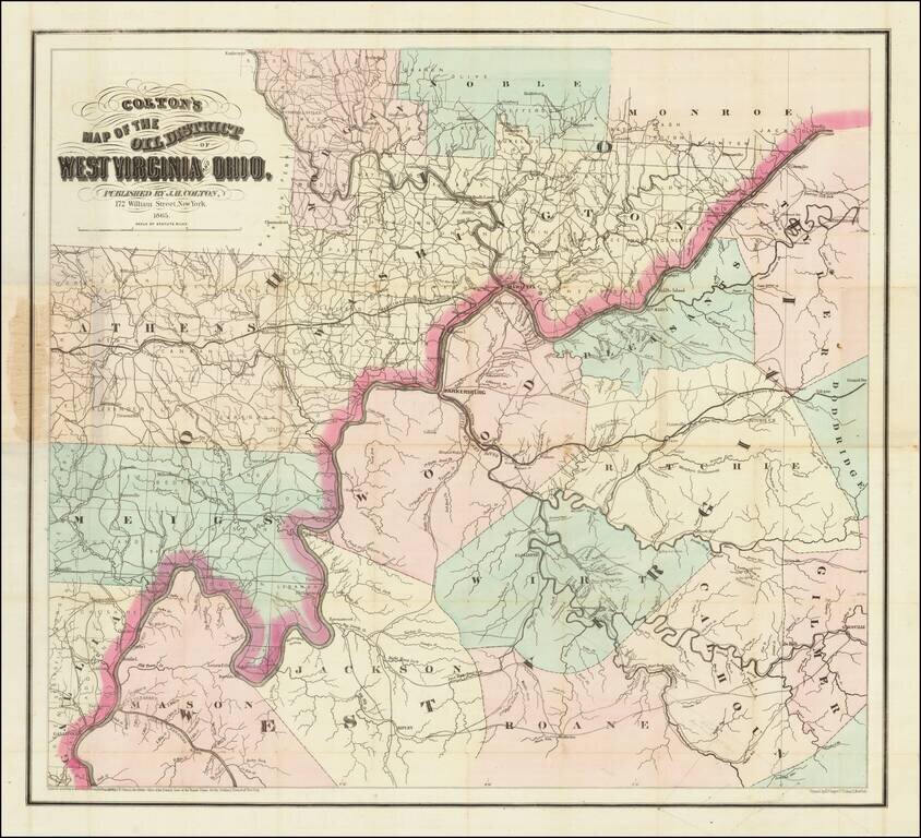
Scarce First State of Colton's Map of Some of the Earliest Oil Fields in the United States. Hand-colored lithographed map of the West Virginia oil region off the Little Kanawha River. Colton published the map in New York in 1865. The map shows a...