Map size in jpg-format: 77.3801MiB
Click to open in high resolution (open in new tab).
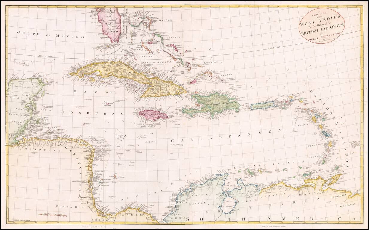
Fine large map of the South Florida and the Caribbean, published shortly after the American Revolution.
The map extends from South Florida and the Florida (Gulf) Stream and the Bahamas in the north to the Yucatan, Mosquito Coast, Windward Islands and the Guyanas in the southeast.
Includes a fine treatment of the Bahamas, Florida Keys, Virgin Islands and a number of the other, smaller islands in the Caribbean.
In addition to the Gulf Stream, other arrows show the prevailing currents in both the Atlantic and the Caribbean Sea.
The map was published in Edwards 2 volume work, The History, Civil and Commercial, of the British Colonies in the West Indies. . . , one of the most popular and influential works of its time. Edwards' work provides an excellent and complete general survey of the people, products, government, and history of the islands in the West Indies under British control. It is written from the point of view of a planter and provides information concerning the contemporary conditions, showing the state of affairs after the American war and before the abolition of the slave trade.
If you are a student, write to us in telegram: @antiquemaps and indicate what material you need and for what work you need a map in high detail. We are ready to provide material on special terms. For students only!

![[Wall Map] West-Indische Paskaert waer in de graden der breedde over weder zyden vande middelyn wassende so vergrooten dat die geproportioneert syn tegen hunne nevenstaende graden de lengde.](/map/small/60169.jpg)
