Map size in jpg-format: 215.459MiB
Click to open in high resolution (open in new tab).

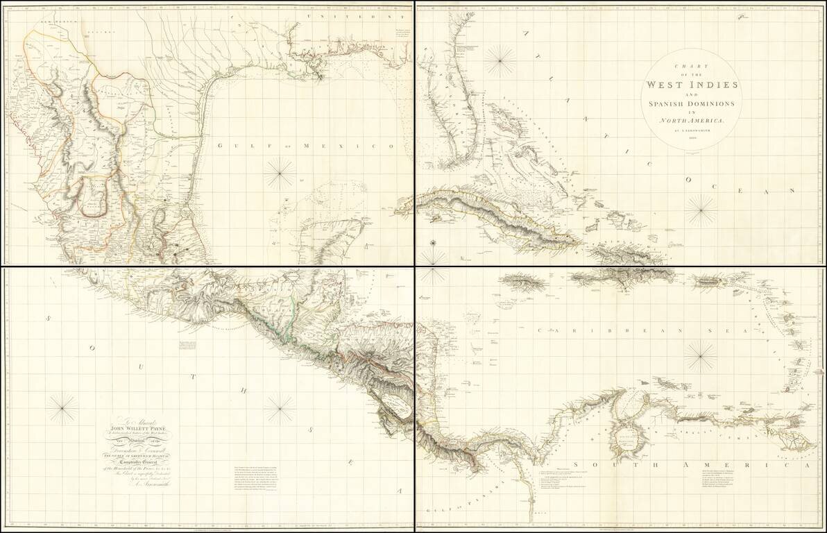
A Seminal Map of Florida, The Caribbean and Texas!
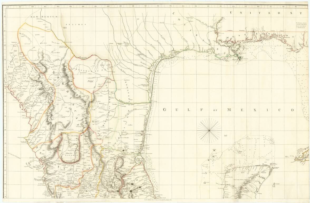
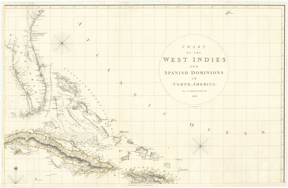
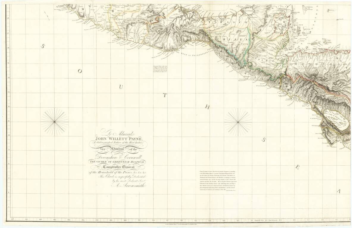
First edition of Arrowsmith's map of Mexico & the West Indies, and the only edition to extend to the Pacific, thereby showing modern Texas and parts of New Mexico and Arizona.
The map is dedicated to Admiral John Willett Payne (1752-1803), "A distinguished Native of the West Indies, Vice Admiral of the Coasts of Devonshire & Corwnwall, Treasurer of Greenwich Hospital, Comptroller General."
The treatment of Texas, Mexico and Central America is the best and most accurate to date. Preceding the maps of Humboldt & Pike, the map is noteworthy in its accurate depiction of the regions addressed by each of these explorers in the following decade.
Alexander von Humboldt spends the better part of 4 pages criticizing the map's accuracy. Rumsey notes that however that it is ironic that Humboldt would criticize Arrowsmith's use of Humboldt's map of Mexico in Arrowsmith's later maps of Mexico, when Arrowsmith created such a detailed and accurate map of the region in the 1803 edition, prior to Humboldt's map. Rumsey further notes that while Arrowsmith's map of Mexico issued in 1810 is a more accurate and detailed treatment of the region, the 1803 map is impressive in its accuracy and detail.
Streeter notes that the coast line follows generally the Carta Esferica of 1799, but with the longitude of Sabine Pass nearly correct, unlike the Carta Esferica.
The map was reduced in subsequent editions, following the issuance of Arrowsmith's case map of Mexico in 1810.
If you are a student, write to us in telegram: @antiquemaps and indicate what material you need and for what work you need a map in high detail. We are ready to provide material on special terms. For students only!

![[Wall Map] West-Indische Paskaert waer in de graden der breedde over weder zyden vande middelyn wassende so vergrooten dat die geproportioneert syn tegen hunne nevenstaende graden de lengde.](/map/small/60169.jpg)
