Map size in jpg-format: 29.0244MiB
Click to open in high resolution (open in new tab).
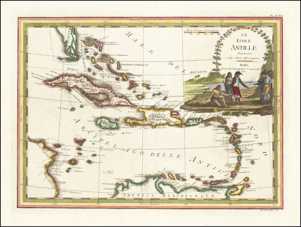
Antique Map of the Caribbean and South Florida
A striking color example of Cassini's scarce map of the Caribbean and south tip of Florida. The map is outlined in attractive reds, greens and yellows, while the cartouche is fully colored and appears to show negotiations between Native Americans and Europeans.
The map shows Florida is shown as an archipelago of elongated islands stretching from Palm Beach and culminating with the Florida Keys. The Antilles are shown in extensive detail from the Bahamas to Trinidad, although the projection causes north-south shortening. Many individual islands, towns, and features are named including the Cayman Islands. The map shows dotted lines that likely represent shoals and other areas of shallow water.
The vignette is decoratively and artfully designed, and the color scheme, on the whole, makes for an attractive map.
If you are a student, write to us in telegram: @antiquemaps and indicate what material you need and for what work you need a map in high detail. We are ready to provide material on special terms. For students only!

![[Wall Map] West-Indische Paskaert waer in de graden der breedde over weder zyden vande middelyn wassende so vergrooten dat die geproportioneert syn tegen hunne nevenstaende graden de lengde.](/map/small/60169.jpg)
