Map size in jpg-format: 52.2415MiB
Click to open in high resolution (open in new tab).

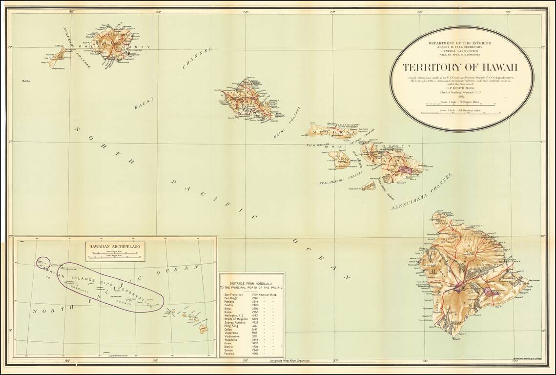
Detailed large format map of the Hawaiian Islands, published by the General Land Office.
Finely detailed map, showing counties, towns, bays, points, mountain, rivers, elevations, volcanoes, volcano houses, halfway houses and Lava flows from various eruptions (some dated), and other details. Includes a table of distances in nautical miles to various major ports of the Pacific Ocean.
If you are a student, write to us in telegram: @antiquemaps and indicate what material you need and for what work you need a map in high detail. We are ready to provide material on special terms. For students only!
![Map of Mexico, Central America, and the West Indies [Insets of Bermuda, Sandwich Islands, Jamaica and Panama Railroad]](/map/small/69133.jpg)