Map size in jpg-format: 29.8241MiB
Click to open in high resolution (open in new tab).

Hawaiian Rarity
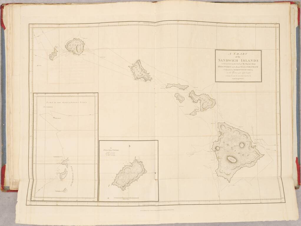
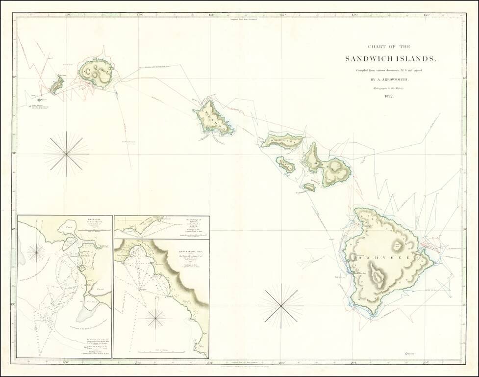
Rare sea chart of Hawaii, published by Aaron Arrowsmith (and his son Samuel), Hydrographer to the King and the most important English mapmaker of the 19th Century.
The map is compiled from manuscript charts and other material this remarkable large chart of the Hawaiian Islands prominently displays the tracks of Captain James Cook, before and after his death in 1778 and 1779, and George Vancouver’s voyages of 1798.
Mapping Hawaii
The first Britons to publish an encounter with Hawaii were James Cook and his crew on his third voyage. Intended to locate the elusive Northwest Passage, Cook and his men stopped at what he called the Sandwich Islands twice. The second visit cost Cook his life, but his ship and crew sailed home and his edited journal was published in 1784. It included 87 plates showing maps and illustrations. One of these was the first printed map of Hawaii, taken from manuscript sketches by Cook, Lieutenant Henry Roberts, and perhaps William Bligh, a master on the voyage, from 1778 and 1779. Cook's original recorded place names are compared to the revised names given by missionaries in a table below the title.
Other explorers also charted Hawaii, including the Frenchman La Perouse in 1786 and George Dixon and Nathaniel Portlock, veterans of Cook's third voyage, also in 1786. Spurred by the fur trade that was also brought to European attention by Cook, Americans, the Spanish, and Russians soon joined the French and British in frequenting, and charting, Hawaii.
According to Fitzgerald, the honor of the "first complete map" of Hawaii goes to George Vancouver, who served as midshipman on Cook's second and third expeditions (39). Vancouver visited Hawaii several times from 1792 to 1794. The resulting A Chart of the Sandwich Islands is credited to Vancouver's lieutenant, Joseph Baker, but more likely was the result of the measurements and observations of several officers.
By the time Vancouver's voyage had been published, in 1798, the British Admiralty had decided to centralize their chart collection and production and founded the Hydrography Office in 1795. It was put in the hands of Alexander Dalrymple, who was the Royal Society's first choice for the Transit of Venus expedition that was eventually to be commanded by Cook as his first Pacific voyage. All Vancouver's charts passed into the HO's holdings, which explains why the Baker chart was the basis for subsequent Admiralty charts of the Sandwich Islands, including this one.
Baker's influence is clear on this map, but so are contributions by Russian navigators and a Frenchman, Duperry. Louis Isidore Duperrey was a part of the French scientific voyage commanded by Louis de Freycinet (1817-1820). During the voyage, Duperry surveyed the harbors of Honolulu, Kailua, Kawaihae, and Lahaina. His chart of Kailua (Kairua is used on the chart) is included as an inset, which is interesting, since it originally recorded the latitude of the bay wrongly. Here, however, a new latitude for a local landmark have been inserted.
Includes 3 inset charts:
Rarity
The map is extremely rare. OCLC shows no institutional examples, however, we located examples in the University of Amsterdam (1826), Royal Geographical Society (1832), and British Library (1840). We also note a privately owned example dated 1830.
If you are a student, write to us in telegram: @antiquemaps and indicate what material you need and for what work you need a map in high detail. We are ready to provide material on special terms. For students only!
![Map of Mexico, Central America, and the West Indies [Insets of Bermuda, Sandwich Islands, Jamaica and Panama Railroad]](/map/small/69133.jpg)