Map size in jpg-format: 121.224MiB
Click to open in high resolution (open in new tab).
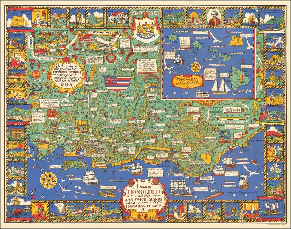
Marvelous rare pictorial map of Honolulu with inset of the Hawaiian Islands.
The map includes pictorial features on the map and in vignettes surrounding the map, noting that, "In this map you will find depicted in pictorial fashion the history, landmarks & customs of these colorful isles."
Alexander Samuel MacLeod, the Canadian-born artist who designed the map, trained at the California School of Design under Frank Van Sloun. In 1921, MacLeod arrived in Hawaii, where he worked in the art departments of the magazine Paradise of the Pacific and the local papers, The Honolulu Advertiser and the Honolulu Star-Bulletin.
MacLeod is best known for his Hawaiian landscapes and sympathetic representations of rural Hawaii's native population.
If you are a student, write to us in telegram: @antiquemaps and indicate what material you need and for what work you need a map in high detail. We are ready to provide material on special terms. For students only!
![Map of Mexico, Central America, and the West Indies [Insets of Bermuda, Sandwich Islands, Jamaica and Panama Railroad]](/map/small/69133.jpg)