Map size in jpg-format: 7434310B
Click to open in high resolution (open in new tab).
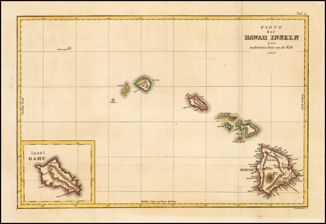
Rare German edition of this early map of Hawaii from D'Urville's Voyage pittoreque autour du Monde, one of the earliest printed maps to include the name Hawaii in its modern English spelling.
The map is engraved by Ambrose Tardieu, and shows Nihau, Tauai, Oahou, Morokai, Ranai, Mawi, Tahou Rawe, and Hawaii, along with Modou'manou and Tahoura. Wai-mea is named on Kauai, Hono-rourou, Wai-mea, Wai-aroua, Kolaau, and Wai-tili on Oahu, Lahaina and Wai-roukou on Maui (along with Moro-kini) and a plethora of names on the big island. Inset of the Island of Hawaii. Not listed in Fitzpatrick.
A finely engraved and striking map, which is far scarcer than the earlier Cook maps and one of, if not the earliest maps to use the name Hawaii to describe the entire chain of islands.
If you are a student, write to us in telegram: @antiquemaps and indicate what material you need and for what work you need a map in high detail. We are ready to provide material on special terms. For students only!
![Map of Mexico, Central America, and the West Indies [Insets of Bermuda, Sandwich Islands, Jamaica and Panama Railroad]](/map/small/69133.jpg)