logo

1855. Routes in Oregon and California. Map No. 1. From San Francisco Bay to the Northern Boundary of California from explorations and surveys made under the direction of Hon. Jefferson Davis . . . by Lieut. R.S. Williamson . . . and Lieut H.L. Abbot . . . 185

  • Routes in Oregon and California.  Map No. 1.  From San Francisco Bay to the Northern Boundary of California from explorations and surveys made under the direction of Hon. Jefferson Davis . . . by Lieut. R.S. Williamson . . . and Lieut H.L. Abbot . . . 185

Routes in Oregon and California. Map No. 1. From San Francisco Bay to the Northern Boundary of California from explorations and surveys made under the direction of Hon. Jefferson Davis . . . by Lieut. R.S. Williamson . . . and Lieut H.L. Abbot . . . 185 information:

Year of creation: 
Resolution size (pixels): 
 2014x2368 px
Disk Size: 
 811244B
Number of pages: 
 1
Place: 
 Washington

Print information. Print size (Width x height in inches):
Printing at 72 dpi 
  27.97 х 32.89
Printing at 150 dpi 
 13.43 х 15.79
Printing at 300 dpi 
 6.71 х 7.89

An example of detailing the file of this map of in a printable high-resolution:

Click to open in high resolution (open in new tab).
Attention! this is just the central piece (central area 960x960 px) of the map file!
This is an example, so that you can see and study the level of detail of a given map. The entire Map will be fully available after payment!

Routes in Oregon and California.  Map No. 1.  From San Francisco Bay to the Northern Boundary of California from explorations and surveys made under the direction of Hon. Jefferson Davis . . . by Lieut. R.S. Williamson . . . and Lieut H.L. Abbot . . . 185

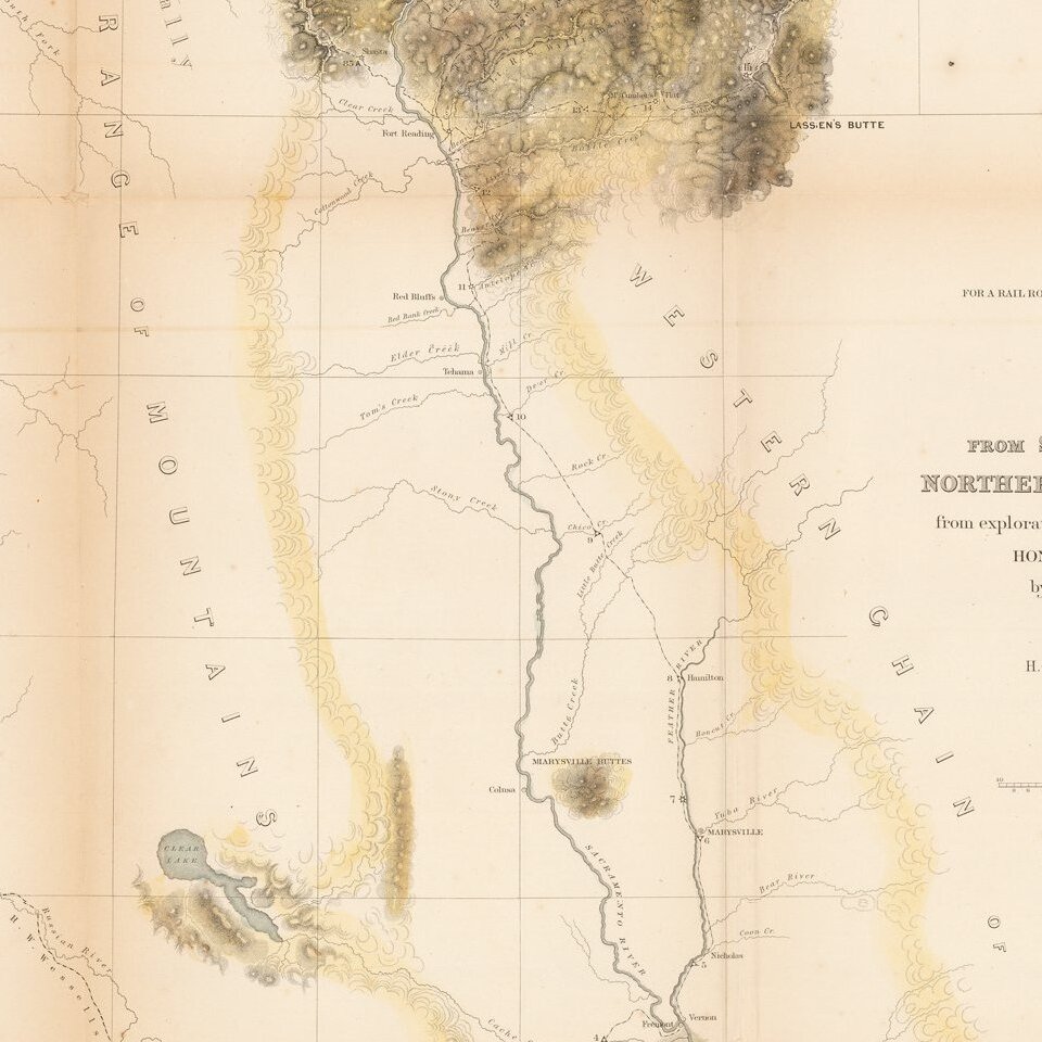
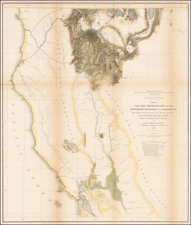
Important early survey map, covering the region between Crescent City and San Francisco Bay, showing the results of R.S. Williamson and H.L. Abbot's surveys in Oregon and California, in anticipation of the location of the first transcontinental railroad.

Portions of the map includes a portion of the Emigrant Trail, Warner's Route in 1849, several Williamson Routes, and Major Wessel's Route in 1852.the routes travelled by many place names, watershed details and fine hachure in the mountainous areas. The balance of the map is mostly in skeletal format with an area to the west noted as not explored 'instrumentally.' Details numerous explorations and names the survey crews. Locates the Emigrant Trail plus the earlier explorations of Warner and Williamson in 1849, and Wessell in 1852. Notes the place Warner was killed by Indians in 1849, during early reconnaissances with R.S. Williamson.

Wheat, C.I. (TM) 881.

Special conditions for students!

If you are a student, write to us in telegram: @antiquemaps and indicate what material you need and for what work you need a map in high detail. We are ready to provide material on special terms. For students only!

Item information:

Year of creation:
Size:
2014x2368 px
Disk:
811244B
Number of pages:
1
Place:
Washington
Author:
U.S. Pacific RR Surveys.
$14.99

Related item