Map size in jpg-format: 5.88866MiB
Click to open in high resolution (open in new tab).
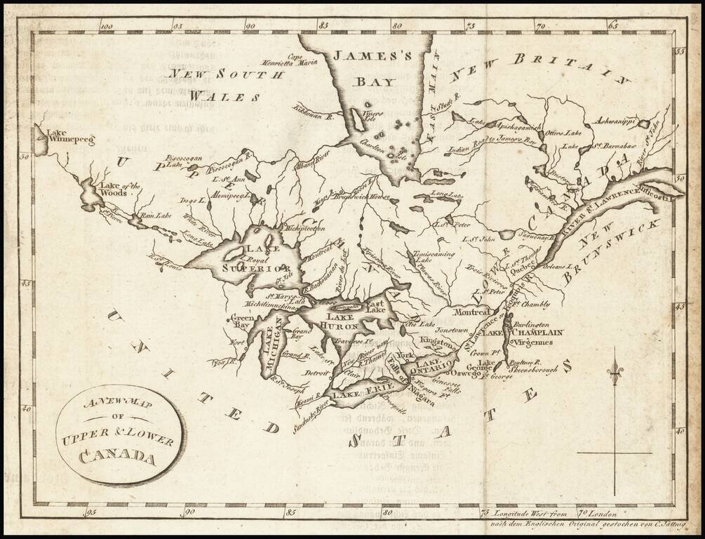
Interesting map of the Great Lakes and Canada, from a German edition of Isaac Weld's Travels Through the States of North America During the Years 1795-97, first published in London in 1798.
The map extends from the St. Lawrence to Lake Winnipeg, centered on Lake Huron. Detroit is named, as is Green Bay. The map shows a fort at the base of Green Bay, this would appear to be Fort Howard, dating the map to roughly the War of 1812.
The map focuses primarily on the lakes and rivers of Canada.
If you are a student, write to us in telegram: @antiquemaps and indicate what material you need and for what work you need a map in high detail. We are ready to provide material on special terms. For students only!
![[The First Maps in a la poupée Printed Color] Cartes en Couleur des Lieux Sujets aux tremblements de Terre Dans toutes les parties du Monde Selon le Sisteme de l’impulsion Solaire](/map/small/52293op.jpg)