Map size in jpg-format: 19.6071MiB
Click to open in high resolution (open in new tab).
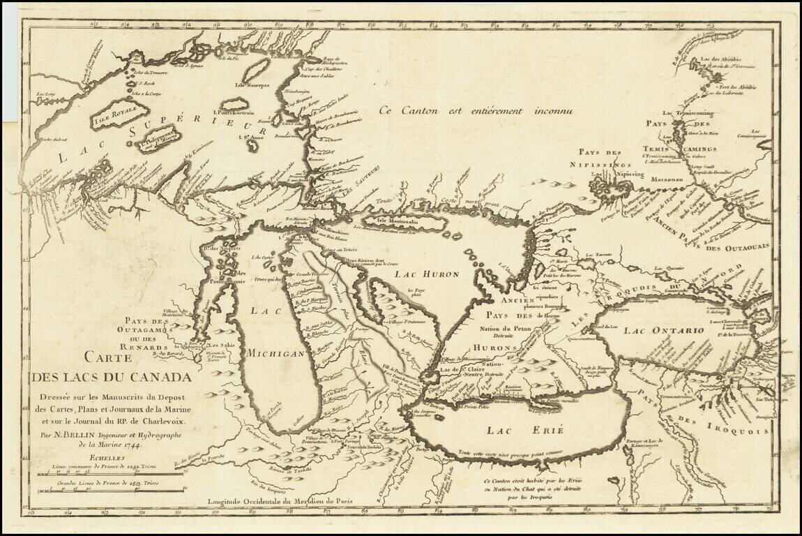
Fine example of Bellin's Landmark map of the Great Lakes region, published in 1744
Bellin's seminal early map of the Great Lakes represented a milestone in the progress of the mapping of the region. It is also one of the earliest appearances of Detroit, the Port of Chicago and several mythical islands in Lake Superior, which appeared for the next 100 years on various maps. The map was produced for Charlevoix's Histoire et description générale de la Nouvelle France. Compiled from the Chaussegros de Lery manuscripts, the map is also noteworthy for the fictitious mountain range in Michigan and is rich with Indian information, notes, early French forts and other early features.
In 1720 the Duke of Orleans sent the Jesuit scholar and explorer Pierre François-Xavier de Charlevoix to America to record events in New France and Louisiana and determine the best route to the Pacific Ocean. Charlevoix gathered geographic information from fur traders in Quebec and traveled through the Great Lakes and down the Mississippi River. After he returned to France, Charlevoix published his views on North America in his Histoire et description générale de la Nouvelle France, which has become one of the most important works on North America during the period prior to the French & Indian (Seven Years) War.
Thomas Jefferson owned a copy of Charlevoix's Histoire et description générale and recommended it, along with the accounts of Hennepin and Lahontan, as a "particularly useful species of reading." He referred to Charlevoix's book as he developed his own ideas of Louisiana and the Northwest.
A scarce early map to focus on the Great Lakes. The first obtainable example, preceded only by a 1742 proof copy noted by Kershaw.
If you are a student, write to us in telegram: @antiquemaps and indicate what material you need and for what work you need a map in high detail. We are ready to provide material on special terms. For students only!
![[The First Maps in a la poupée Printed Color] Cartes en Couleur des Lieux Sujets aux tremblements de Terre Dans toutes les parties du Monde Selon le Sisteme de l’impulsion Solaire](/map/small/52293op.jpg)