Map size in jpg-format: 1.84865MiB
Click to open in high resolution (open in new tab).
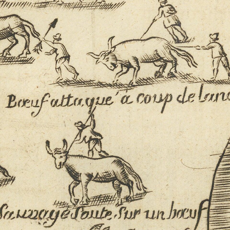
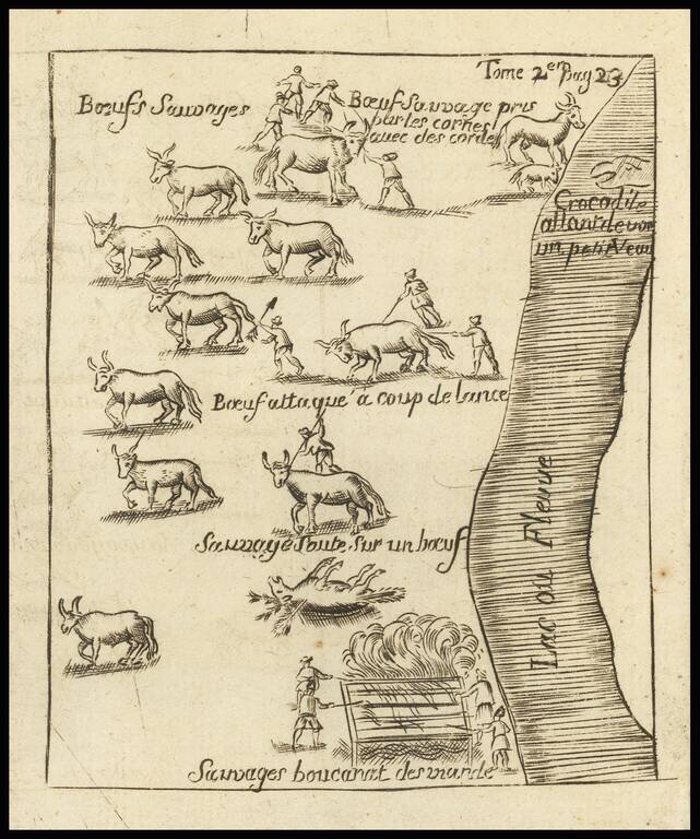
The Crocodile on Baron Lahanton's Longue River
This small map was prepared to illustrate a section of Baron Lahontan's imaginary west to east Long River (Riviere Longue), rising in distant western mountains and emptying into the upper Mississippi.
Lahontan's Long River was one of the most influential of all cartographic myths, affecting the cartographic landscape of the upper Mississippi, Plains and Rocky Mountain Regions, for nearly fifty years.
The present map shows one of a Crocodile at the top, along with methods of the local Indians hunting and cooking "Boeuf" (Buffalo).
Nouveaux Voyages Dans L'Amerique Septentrionale
Lahontan joined the French Marine Corps and was sent to New France in 1683. He quickly learned the Indian languages and became adept in wilderness survival. He was sent to command Fort St. Joseph, near the present site of Port Huron, Michigan. He spent much of his time in America exploring the region. In 1688 he joined a party of Chippewa Indians in a raid on the Iroquois and later abandoned his fort and went to Michilimackinac. During the following winter he explored the upper Mississippi valley where he allegedly discovered the "Longue River". After several other adventures, including a successful attack on five English frigates in the Gulf of St. Lawrence, he eventually deserted the French military and returned to Europe.
Lahontan's Nouveaux voyages dans l'Amérique septentrionale (1703) was an immensely popular if somewhat fanciful account of his travels. While acknowledging the western terminus of his travels, Lahontan presented Native American reports of a great river, flowing to high mountains, with a great saltwater body beyond the mountains. Lahontan's account of these reports convinced many of the world's greatest intellects of the existence of this mythical waterway, which resulted in his account being accepted and incorporated by most of the major mapmakers of the period.
The Riviere Longue was reported along with a short pass through the mountains from which another river flowed (presumably) into the Pacific. He included accounts of Indian tribes who lived on islands in a great lake near the source of the river, and tales of crocodiles filling the waterways. He also used the book, in the form of a dialogue with an Indian named Adorio (The Rat), for a controversial attack on what were then-accepted doctrines of Christianity. The earliest known cartographic representations of the Rocky Mountains are influenced by his work, namely De L'Isle's 1700 map of North America.
If you are a student, write to us in telegram: @antiquemaps and indicate what material you need and for what work you need a map in high detail. We are ready to provide material on special terms. For students only!
![[The First Maps in a la poupée Printed Color] Cartes en Couleur des Lieux Sujets aux tremblements de Terre Dans toutes les parties du Monde Selon le Sisteme de l’impulsion Solaire](/map/small/52293op.jpg)