
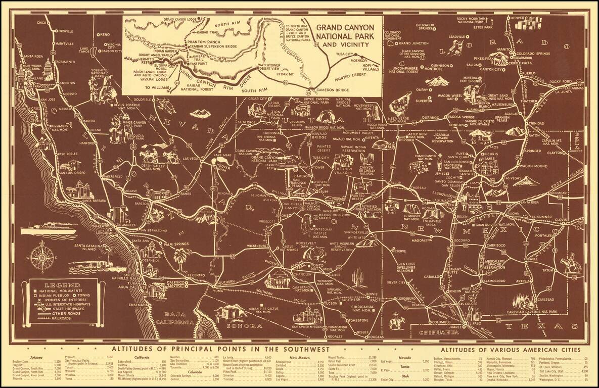
Scarce pictorial map of the American Southwest, published by Fred Harvey. The map provides a detailed pictorial image of the American Southwest, with an inset of the Grand Canyon. The verso includes a table of Indian Signs and Symbols, along with...
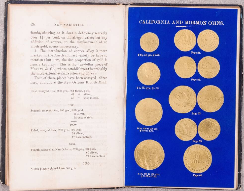
One of the Great American Numismatic Books of All Time, with Special Relevance for the California Gold Rush and Mormon Coins. Superb book on gold and coinage, by the official assayers of the Philadelphia Mint, Jacob R. Eckfeldt and William E. Du Bois....
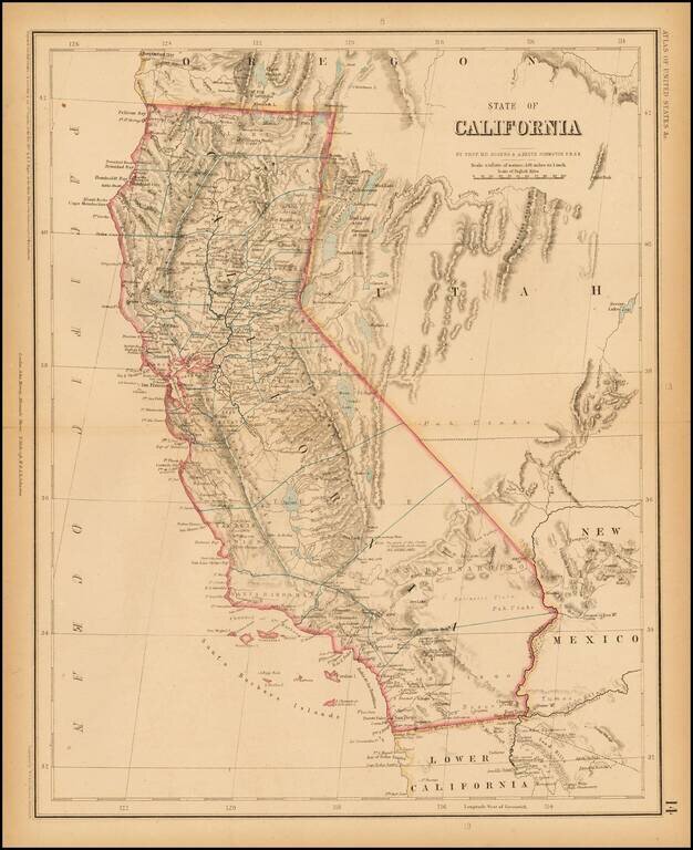
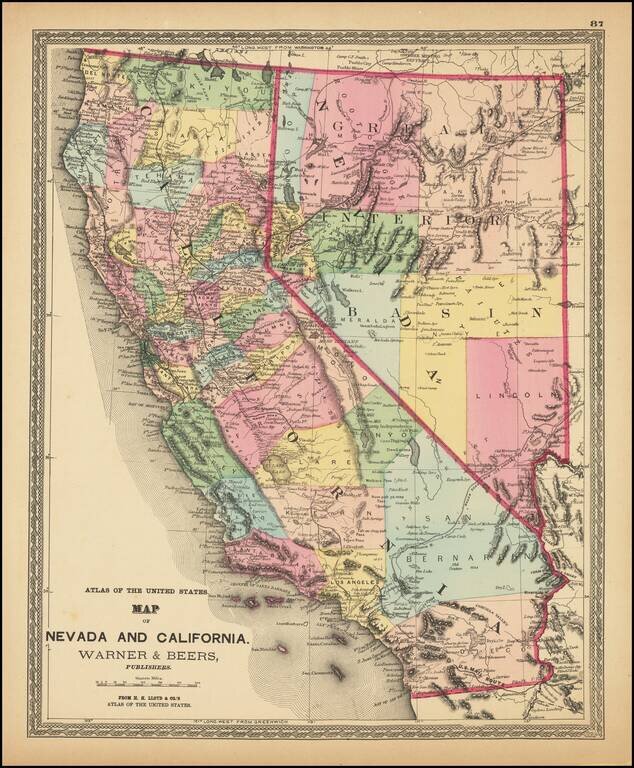
Rogers & Johnston' rare map of California, from the Atlas of the United States, perhaps the most coveted of all mid 19th Century American Atlases. This now rare atlas derives from a Wall Map first published in 1857 as a collaboration between...
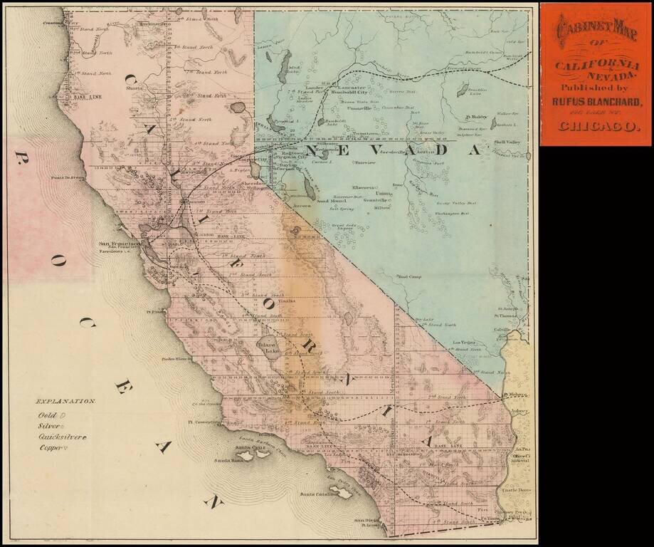
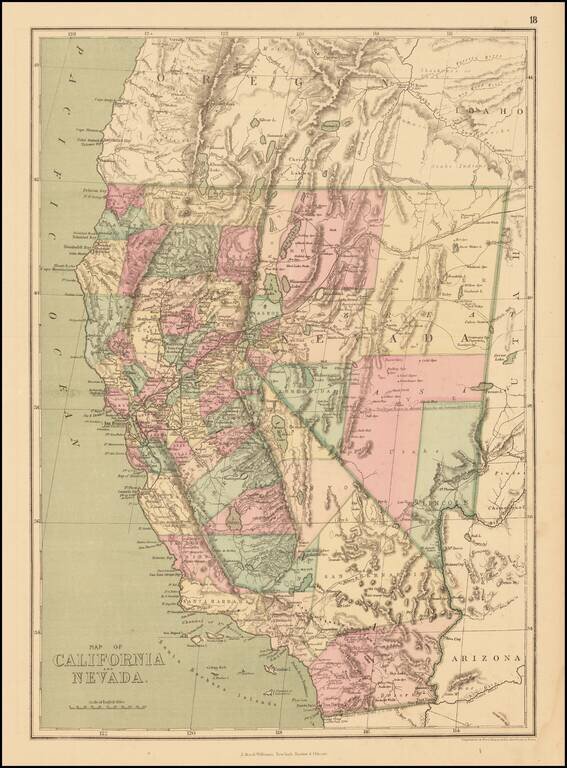
The Only Known Example of Blanchard's Pocket Map of California & Nevada Rare Pocket Map of California and Nevada, published in Chicago by Rufus Blanchard. Interesting pocket map of California and Nevada, published during boom times in Nevada,...
![[Nevada and parts of California, Utah and Arizona] Explorations and Surveys South of Central Pacific R.R. . . . Preliminary Topographical Map Map Embracing in Skeleton a Portion Only of the Notes from Surveys . . . 1871 (with original text)](/map/small/68848.jpg)
Detailed map of the Southwest, prepared at the outset of the Surveys West of the100th Meridian. The map is one of the few maps executed by Louis Nell during this time working for the War Department Topographical Engineers. Nell would later settle in...
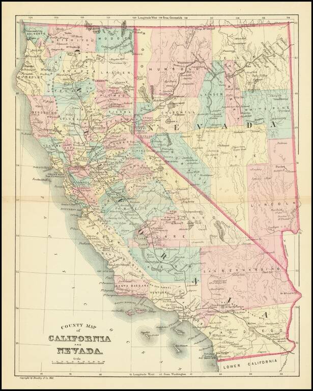
Fine example of HH Lloyd's striking map of California and Nevada. The map is colored by counties, and shows the US Mail Route, Wagon Route from LA to Salt Lake, Old Telegraph and Express Route, Transcontinental railroad lines, and other roads. Locates...
Detailed map of California and Nevada, colored by counties, published by J. David Williams in New York. The map shows towns, railroads, islands, rivers, mountains, roads, springs, sinks and a host of other details. Pre-dates the formation of Orange,...
![California and Nevada [Yosemite, Sacremento and SF Vicinity Insets]](/map/small/63484.jpg)
Highly detailed map of California and Nevada, with insets of the Yosemite Valley, Sacramento and SF Bay Vicinity. One of the earliest atlas maps to include an inset map of Yosemite and a plan of Sacramento. Many interesting early details, including...
Detailed map of California & Nevada, published by William Bradley. The map is colored by counties. Pre-dates the formation of a number of Southern California Counties, including Orange, Riverside and Imperial Counties.
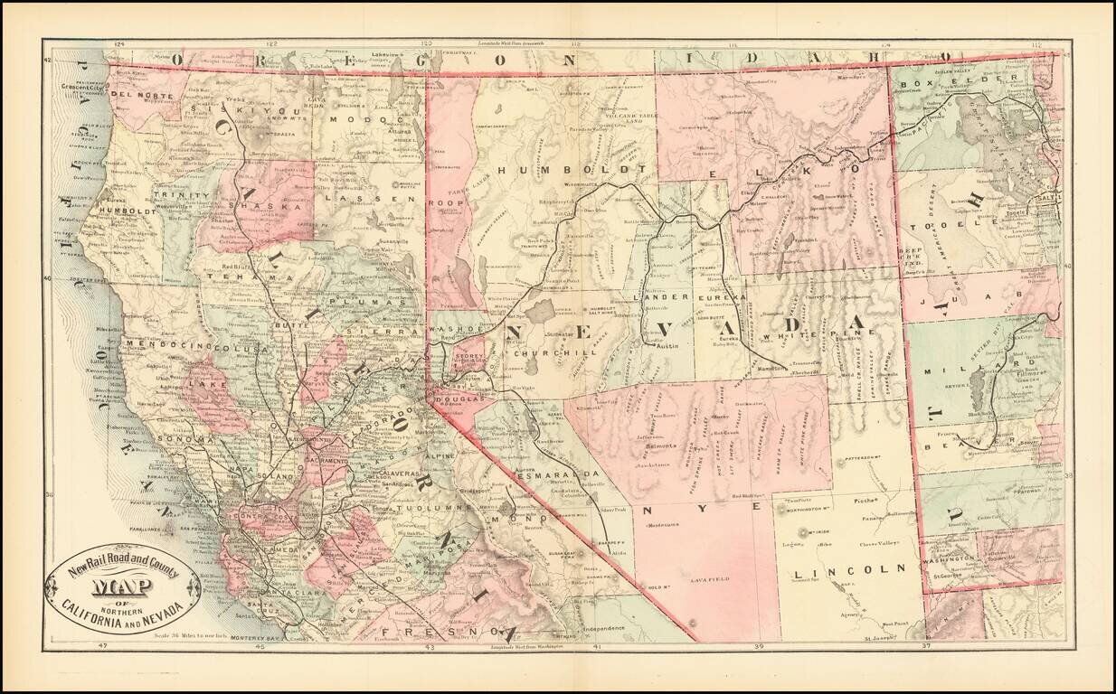
Scarce early map of Northern California and Nevada, focusing on the Railroad Lines then in operation. The map also shows a number of early towns, roads, mountains, lakes, mining regions and other important details. This is the first time we have...
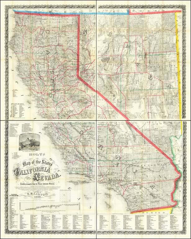
Mapping California and Nevada's Changing Watertable. Rare Late 1888 Edition of the Holt & Linton Map. Warren & Linton's rare and important antique map of California and Nevada, here in the late and substantially modified edition of 1888. In...
![[California & Nevada] California and Nevada Northern Half / California and Nevada Southern Half](/map/small/69248.jpg)
Remarkable large 2 sheet Railroad Map of California & Nevada, published by George Cram. Includes a list of about 20 Railroads, including some very rare names, including: Carson & Colorado RR Chino Valley RR Coronado RR (Narrow Gauge...
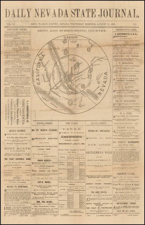
Scarce newspaper map of the area centered on Reno, Nevada, from the Daily Nevada State Journal, published in Reno, Nevada. The map is centered on Reno and shows Virginia City, Lake Tahoe, Truckee, Carson, Bodie, Aurora, Wadsworth, Susanville, Big...
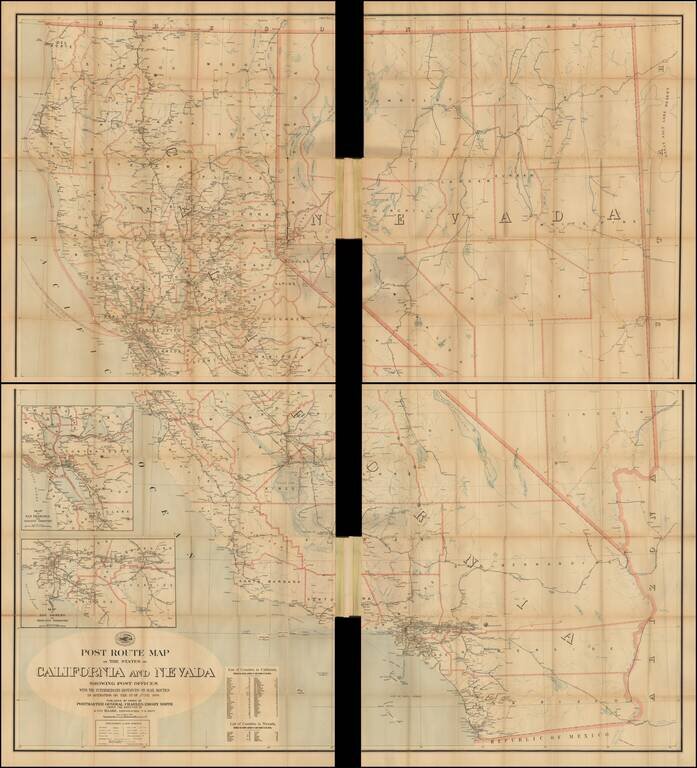
Official 1899 Postal Route Map for California and Nevada Scarce and remarkably detailed late 19th Century Postal map of Nevada and California, issued by the United States Post Office. Includes a large inset of the Los Angeles Basin and the Bay...
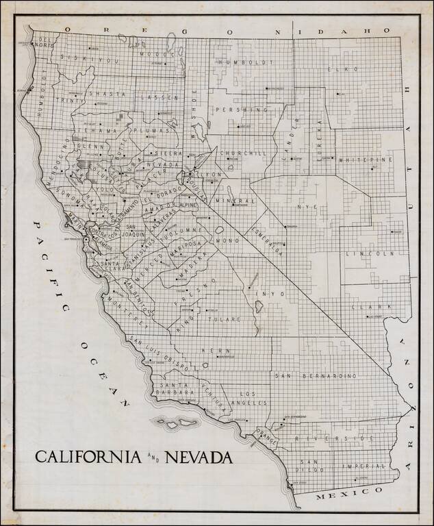
Early manuscript draft of a large format map of California and Nevada. The county configurations would appear to be circa 1908-1909, based upon shape of Glenn County. The guidelines in the title and other places are visible.
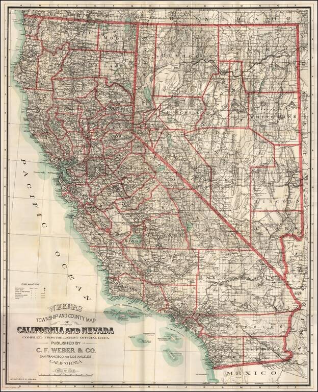
Fine large format map of California and Nevada, published in 1910 by C. F. Weber & Company, one of California's leading mapmakers at the beginning of the 20th Century. The detail of the map is quite good, especially in the mining regions of...