Map size in jpg-format: 63.8179MiB
Click to open in high resolution (open in new tab).
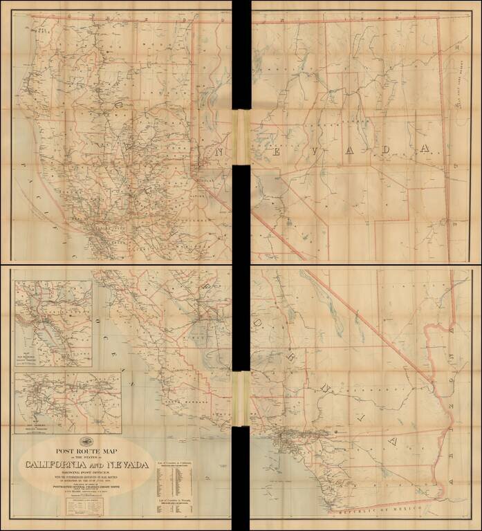
Official 1899 Postal Route Map for California and Nevada
Scarce and remarkably detailed late 19th Century Postal map of Nevada and California, issued by the United States Post Office.
Includes a large inset of the Los Angeles Basin and the Bay Area.
Two insets list the counties. The Explanation identifies the various mail services:
A separate key for Mail Messengers and discontinued mail offices are noted, as are Electric and Cable Cars, along with Rural Free Delivery Routes.
If you are a student, write to us in telegram: @antiquemaps and indicate what material you need and for what work you need a map in high detail. We are ready to provide material on special terms. For students only!

![Mexique par Th. Duvotenay…1843 [Republic of Texas]](/map/small/67925.jpg)
