logo

1882. New Railroad and County Map of Northern California and Nevada

  • New Railroad and County Map of Northern California and Nevada

New Railroad and County Map of Northern California and Nevada information:

Year of creation: 
Resolution size (pixels): 
 12633x7862 px
Disk Size: 
 28.3919MiB
Number of pages: 
 1
Place: 
 New York
Author: 

Print information. Print size (Width x height in inches):
Printing at 72 dpi 
  175.46 х 109.19
Printing at 150 dpi 
 84.22 х 52.41
Printing at 300 dpi 
 42.11 х 26.21

An example of detailing the file of this map of in a printable high-resolution:

Click to open in high resolution (open in new tab).
Attention! this is just the central piece (central area 960x960 px) of the map file!
This is an example, so that you can see and study the level of detail of a given map. The entire Map will be fully available after payment!

New Railroad and County Map of Northern California and Nevada

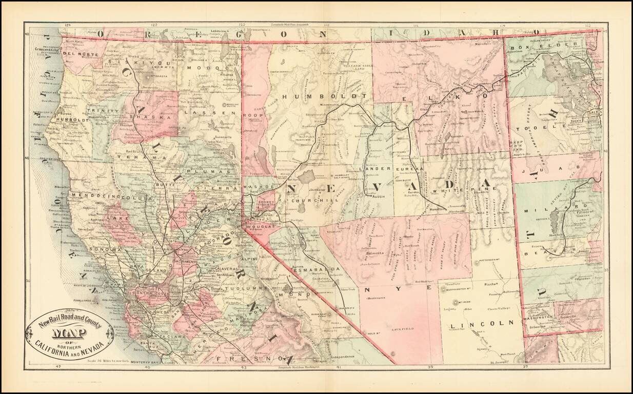
Scarce early map of Northern California and Nevada, focusing on the Railroad Lines then in operation.

The map also shows a number of early towns, roads, mountains, lakes, mining regions and other important details.

This is the first time we have offered the map for sale and the first time we have seen the map in 20 years.


Special conditions for students!

If you are a student, write to us in telegram: @antiquemaps and indicate what material you need and for what work you need a map in high detail. We are ready to provide material on special terms. For students only!

Item information:

Year of creation:
Size:
12633x7862 px
Disk:
28.3919MiB
Number of pages:
1
Place:
New York
Author:
HS Stebbins.
$14.99

Related item