logo

1873. Map of California and Nevada

  • Map of California and Nevada

Map of California and Nevada information:

Year of creation: 
Resolution size (pixels): 
 8222x11141 px
Disk Size: 
 28.8952MiB
Number of pages: 
 1
Place: 
 New York
Author: 

Print information. Print size (Width x height in inches):
Printing at 72 dpi 
  114.19 х 154.74
Printing at 150 dpi 
 54.81 х 74.27
Printing at 300 dpi 
 27.41 х 37.14

An example of detailing the file of this map of in a printable high-resolution:

Click to open in high resolution (open in new tab).
Attention! this is just the central piece (central area 960x960 px) of the map file!
This is an example, so that you can see and study the level of detail of a given map. The entire Map will be fully available after payment!

Map of California and Nevada

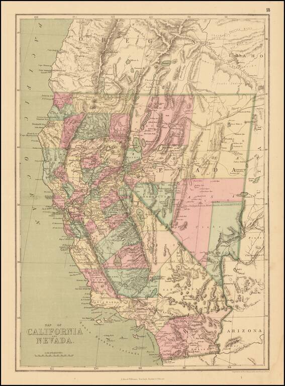
Detailed map of California and Nevada, colored by counties, published by J. David Williams in New York.

The map shows towns, railroads, islands, rivers, mountains, roads, springs, sinks and a host of other details. Pre-dates the formation of Orange, Riverside and Ventura Counties, among others.

Many counties still not shown. Includes many early county configurations which predate the formation of the modern counties.


Special conditions for students!

If you are a student, write to us in telegram: @antiquemaps and indicate what material you need and for what work you need a map in high detail. We are ready to provide material on special terms. For students only!

Item information:

Year of creation:
Size:
8222x11141 px
Disk:
28.8952MiB
Number of pages:
1
Place:
New York
Author:
J. David Williams.
$14.99

Related item