
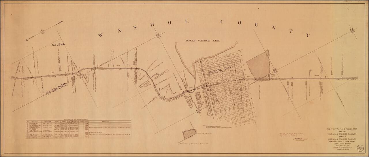
An Early Western Town Destroyed By The Arrival of the Railroad Interesting map of the area around Washoe City, published by the Virginia & Truckee Railway. Now nearly a ghost town, Washoe City was founded in 1860 as a lumbering camp for Virginia...
![A Hysterical Map Of Lake Tahoe Wild and Woolly Nevada With Its Wide Open Places [With Original Envelope!]](/map/small/68358.jpg)
Hysterical Tahoe With Original Mailing Envelope! Fine example of this rare pictorial map of Lake Tahoe, "Drawn in Broken English by Jolly Lindgren." This comic pictorial map is full of puns and comic vignettes related to Lake Tahoe. The Legend...
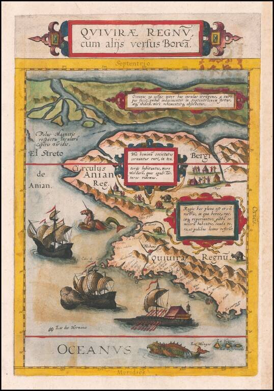
The Benevento Copy. The Earliest Printed Map of the Northwest Coast of North America Fine old color example of this rare, important map depicting the west coast of North America, derived from Plancius's world map of 1592. De Jode's map is one of the...
![Limes Occidentis Quivira et Anian. 1597 [Pacific Northwest & Northwest Passage]](/map/small/71207.jpg)
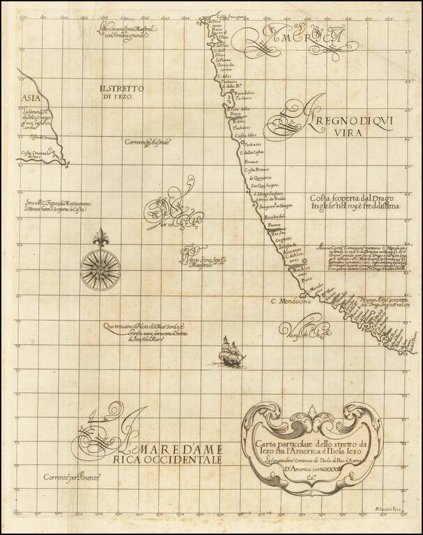
The Second Printed Map of the Northwest of North America, including the Northwest Passage. This is a fine example of Wytfliet's map of the Northwest Coast of North America, the second printed map to focus on the region which would become Alaska and...
![[California Coastline] Carta particolare della America e parte maestrale dal C: di Cedros… D'America carta XXXII](/map/small/58075.jpg)
The Earliest Obtainable Sea Chart of the Coastline of California Fine example of the first edition of Robert Dudley's chart of the California Coastline, the earliest obtainable chart of the region and the first printed map to note the prevailing...
"The First Printed Sea Chart of the Northwest Coast of North America" (San Francisco to Vancouver Island) Rare early sea chart of the Pacific Northwest, from Sir Robert Dudley's Dell'Arcano del Mare. The chart shows all of the American Pacific coast...
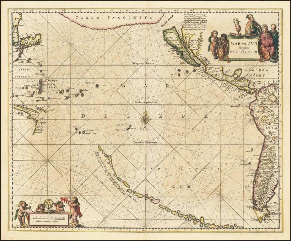
A fine example of Jansson's sea chart of the Pacific, the first chart of the Pacific to show California as an island and the earliest sea chart of the Pacific to appear in a Dutch Atlas. A long chain of islands appears in the South Pacific, which are...
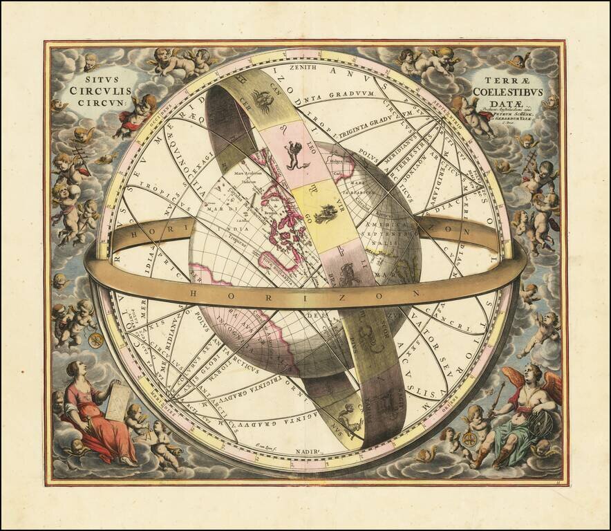
Striking original hand-color celestial chart, showing a Ptolemaic model of the Universe, with the earth in its relation to the plane of the ecliptic, from the 1708 Valk & Schenk edition of Andreas Cellarius' Harmonia Macrocosmica seu Atlas...

Fine example of Johannes Van Loons' sea chart of the Pacific Ocean, extending from Australia, New Zealand and Japan to California. Van Loon's chart is among the earliest regional maps to focus on the Dutch discoveries in New Zealand and Australia. Van...
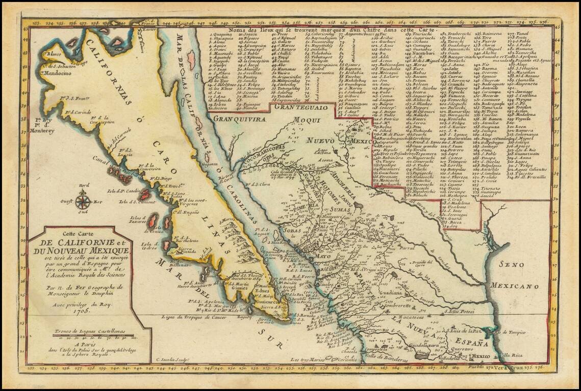
De Fer’s Map of the Southwest Based Upon the Earliest Reports of Father Kino -- One of the Few Regional Maps to Show the Island of California Scarce second state of De Fer's map of California, bearing the date 1705. This is one of a select few...
Truly beautiful example of a historically important 18th century map of California. Bauche's mapsheet comprises three mappings of California as a peninsula, following the discoveries of Eusebio Kino, the Italian Jesuit missionary. Bauche includes the...
![[The 5 Californias] Carte De La Californie Suivant 1. La Carte manuscrite de l'Americque de Mathieu Neron Pecci olen dressee a Florence en 1604, 2. Sanson 1656 . . .](/map/small/67157.jpg)
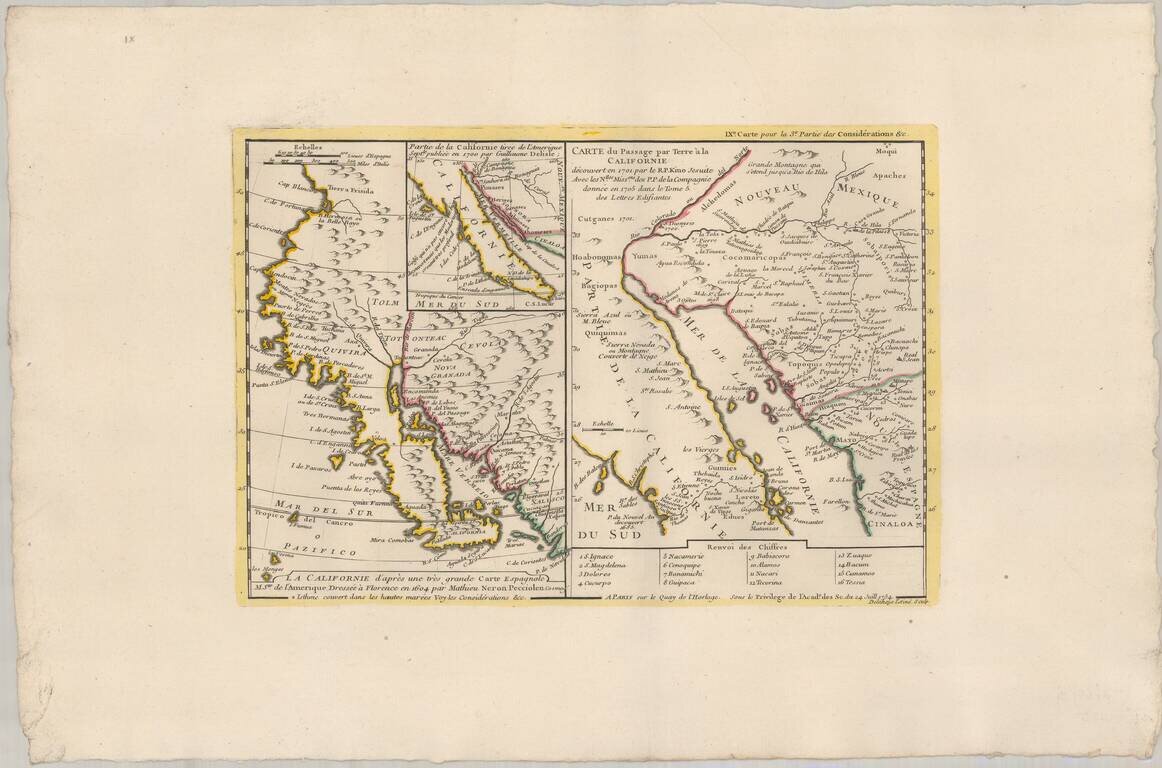
Survey of the Fine Early Maps of California A historically important depiction of the 5 most influential cartographic depictions of California, showing the evolution of how California was mapped between 1604 and 1767. The earliest map is (upper...
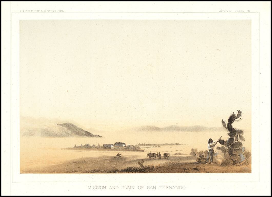
The earliest view of the Mission of San Fernando and the Valley, which accompanied Vol. V of the Reports of Explorations and Surveys to Ascertain The Most Practicable Route To the Pacific.
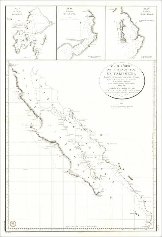
Baja California Immediately After Mexican Independence Rare large scale map Baja California, prepared by the French Government, based upon a Spanish Chart published the preceding year. In addition to all of Baja California, the map depicts the area...
![[Pacific Whaling] A New Chart of The Pacific Ocean, Exhibiting The Western Coast of America from Cape Horn to Beerings Strait, The Eastern Shores of Asia Including Japan, China . . . according the most Modern Surveys . . . Additions to 1836 (Large Insets](/map/small/56007.jpg)
With Manuscript Tracks Showing the Course of An American Whaler in the Pacific. Fine example of Norie's monumental sea chart of the Pacific Ocean. The chart is noteworthy for the large insets maps of San Francisco, San Diego, Hawaii, Honolulu and...
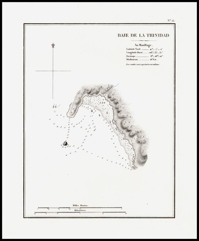
The earliest separately issued map of Trinity Bay, which appeared in Duflot de Mofras' report of his travels on the West Coast of North America. In 1839, Eugene Duflot de Mofras, was assigned to the embassy in Mexico City and instructed to visit the...