
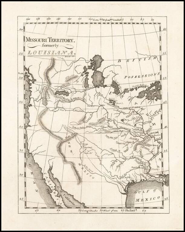
One of the Earliest Maps To Incorporate Lewis & Clark's Reports From Their Expedition Across America To The Pacific Reduced size example of Matthew Carey's map of Missouri Territory, published shortly after the return of Lewis & Clark and in...
![[Provincia de Texas] A Map of Louisiana and Mexico. Carte de la Louisiane et Mexique . . . 1820](/map/small/39611dd.jpg)
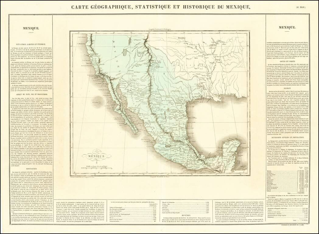
An Early Appearance of the Provincia de Texas Rare separately issued map of Mexico, Texas, Louisiana, Mississippi, Southern California, Southern Arizona, Southern New Mexico and parts adjacent, published in Paris by Tardieu. As noted on the map This...
Mexico Shortly After Independence From Spain Striking example of Buchon's map of Texas, Upper California and Mexico, from the French edition version Carey & Lea's American Atlas. Both Lake Timpanogos and Teguayo are shown, with still a hint of a...
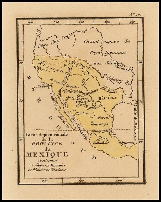
Rare map of Texas, Upper California and Mexico from Louis Denis' Atlas Universel indiquant les établissemens des Jésuites: avec la manière dont ils divisent la terre, suivi desévénemens remarquables de leur histoire. Denis' atlas illustrates the...
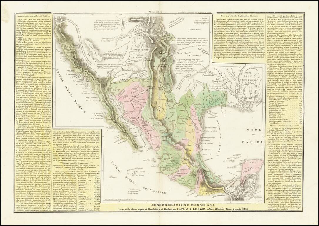
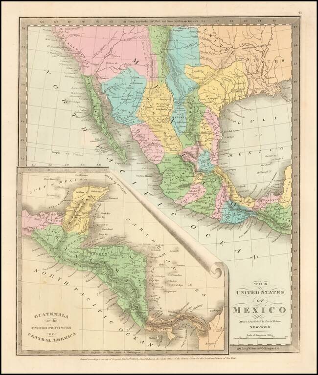
The Reorganization of Mexico Under the Seven Laws & The Republic of Texas A scarce Italian edition of Le Sage's map of Mexico, Upper California and Texas, based largely on Alexandre von Humboldt's map of 1812. The map is richly annotated with...
Scarce map of Texas, Upper California, Mexico, etc. from the first edition of David Burr's Universal Atlas. While the map bears the copyright date of 1832, this example is published in 1836. One of the earliest American maps to show Texas in its...
![Mexico & Guatemala [Showing pre-Republic of Texas (Coahuila and Texas)]](/map/small/71256.jpg)
Detailed map of Mexico and the Southwest, featuring Texas and Coahuila, on the eve of Texas Independence. The Austins Colony appears prominently in Texas, along with Austin's Grant, Washington, Houston, Goliad and a number of other early settlements....
![Carte Des Etats-Unis Du Mexique…1838 [Republic of Texas]](/map/small/70909.jpg)
Fine example of Alexandre Emile Lapie's map of the Republic of Texas, New Mexico, Upper California and Mexico. One of the best large format maps of Mexico, Texas and Upper California to appear in a commercial atlas in the 1830s. Texas is clearly...
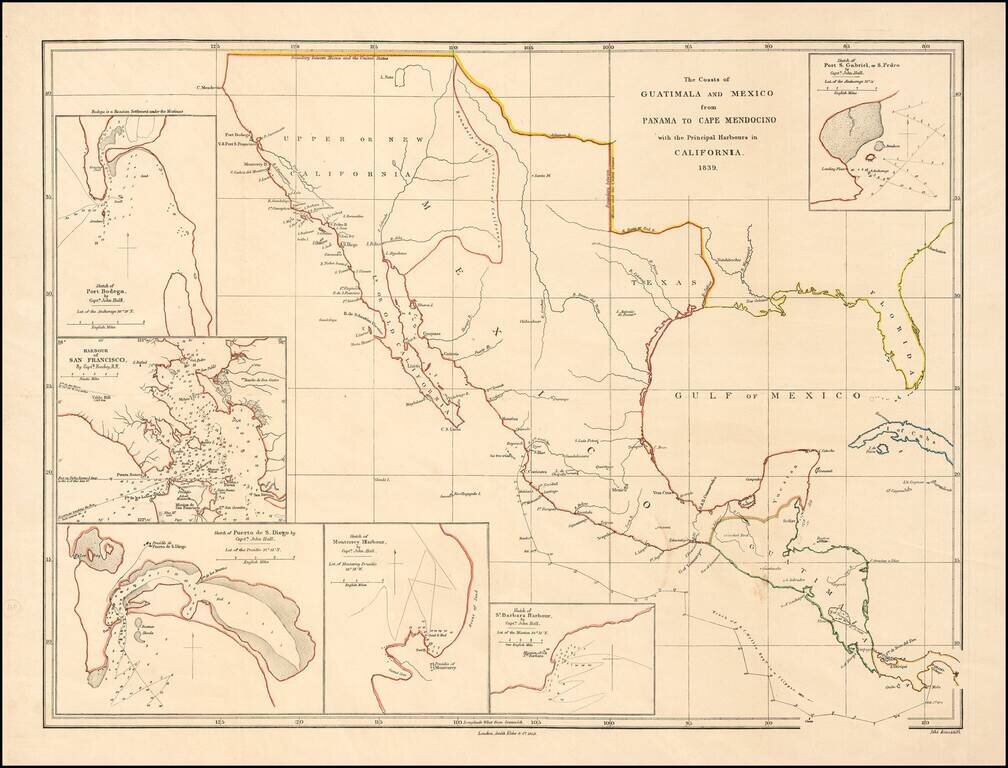
Rare early map of Mexico and Upper California, focusing on the harbors along the California Coast. Includes some of the earliest harbor plans for: Santa Barbara San Gabriel or San Pedro San Diego San Francisco Monterrey Bodega Bay Rumsey...
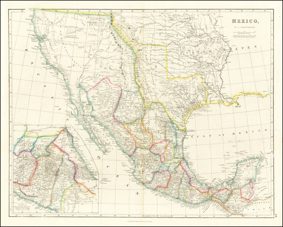
Mexico & The Republic of Texas Striking example of Arrowsmith's Map of Mexico, from the London Atlas, including the Republic of Texas in its largest configuration. The map provides a fantastic example of the Republic of Texas in earliest Republic...
![Mexique par Th. Duvotenay…1843 [Republic of Texas]](/map/small/67925.jpg)
Detailed map of Texas, Upper California, the Plains and Mexico, published in Paris. The map prominently shows the Republic of Texas, a mythological Lake Teguayo and pre-Fremont Western United States. Western border of Texas includes an odd eastern...
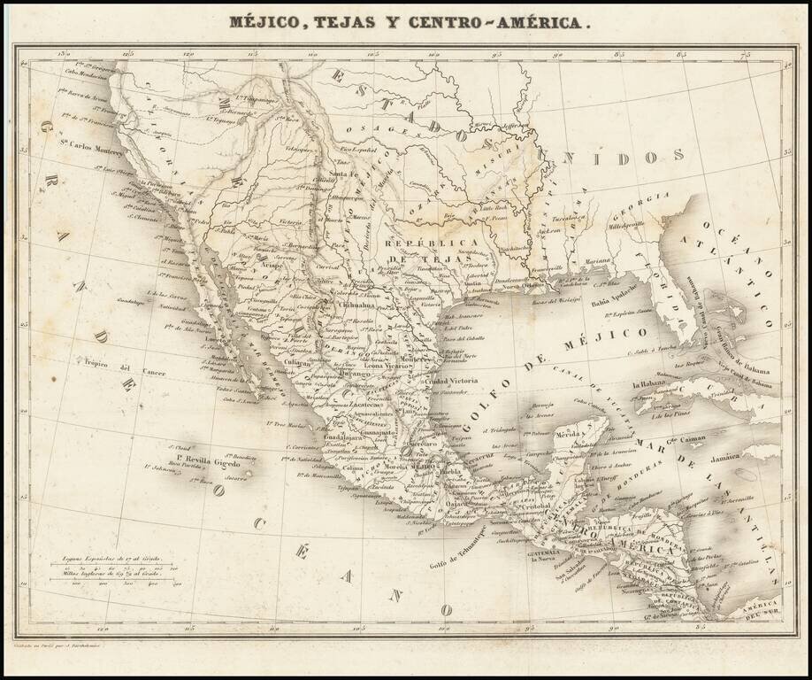
Rare map showing the Republic of Texas (República de Tejas), one of only a few maps to specifically refer to Texas as "Republic of Texas," during the period between 1836 and 1845. The map was originally published in Sanchez de Bustamante's Nuevo...
![Mexico, Mittel-America, Texas [Republic of Texas]](/map/small/64181.jpg)
Nice example of Carl Flemming's detailed map of Texas and the Southwest, published shortly after Texas was annexed by the United States in 1845. The map was issued immediately after the annexation of Texas and prior to the creation of Utah and New...
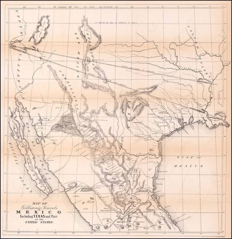
Transcontinental Railroad Routes To San Francisco in 1846! Scarce map of Texas, Upper California, Mexico and the Southwestern United States, prepared for Gilliam's Travels over the Table Lands and Cordilleras of Mexico during the Years 1843 and 44....

Including Manuscript Additions of the Overland Route To California and Other Important Points. Nice example of Mitchell's seminal map of Texas, Oregon, Upper California, Missouri Territory and a massive Indian Territory (covering most of Kansas and...
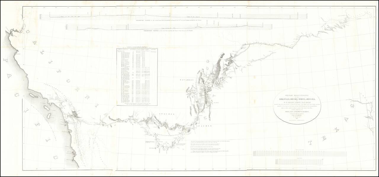
Fine example of the William Emory's milestone mapping of the Southwestern United State, from Ft. Leavenworth to the West Coast, from Emory's Notes of a Military Reconnaissance, from Fort Leavenworth, in Missouri, to San Diego, in California . . ., one...