
![Map showing the scene of General Hancock's operations in the Indian Country, the Forts, Military Stations, Pacific Railroads, etc. [Harper's Weekly. June 15,1867]](/map/small/70224.jpg)
Fine map of the Western United States, published in Harper's Weekly The map focuses on General Hancock's military operations against the Native Americans in Indian Territory. The map highlights the the forts, military stations, and railroads in the...
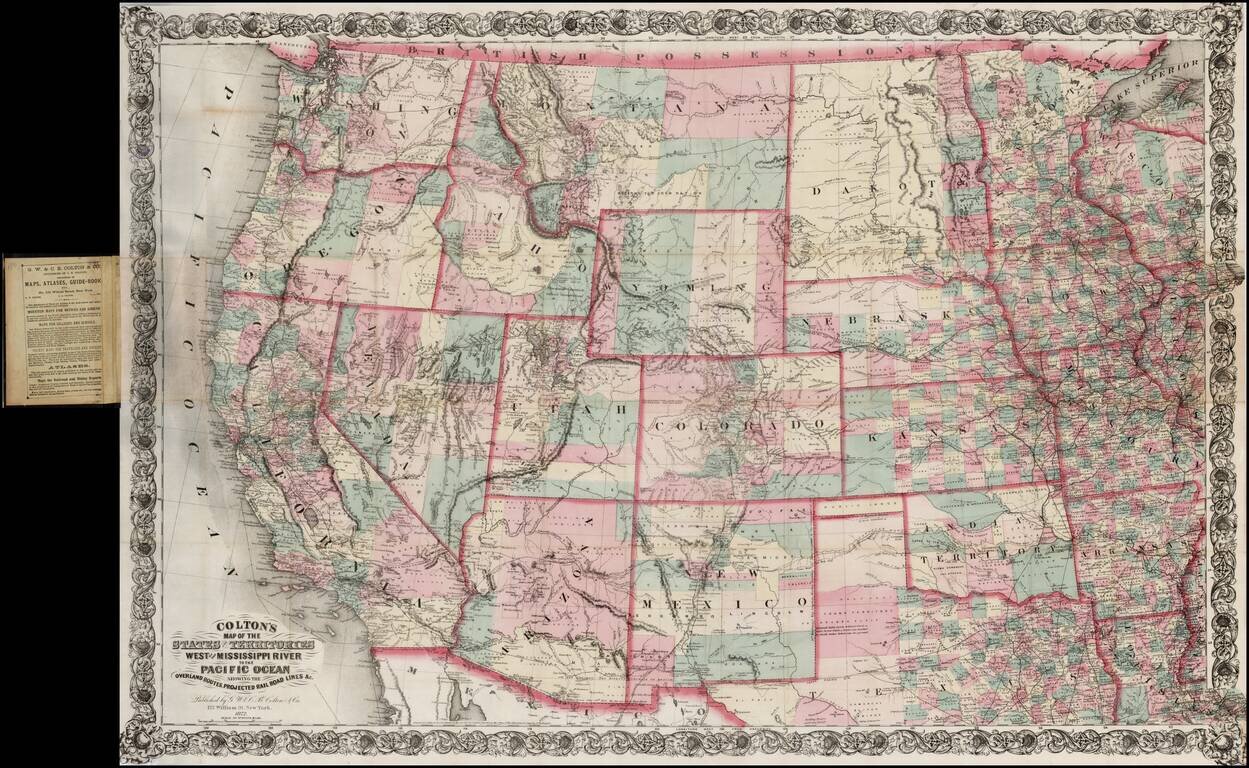
Large scale pocket map of the Transmississippi West. Fine example of Colton's large format map of the West, colored by Counties and focusing on the projected railroad lines west of the Mississippi River, shortly before the first appearance of...
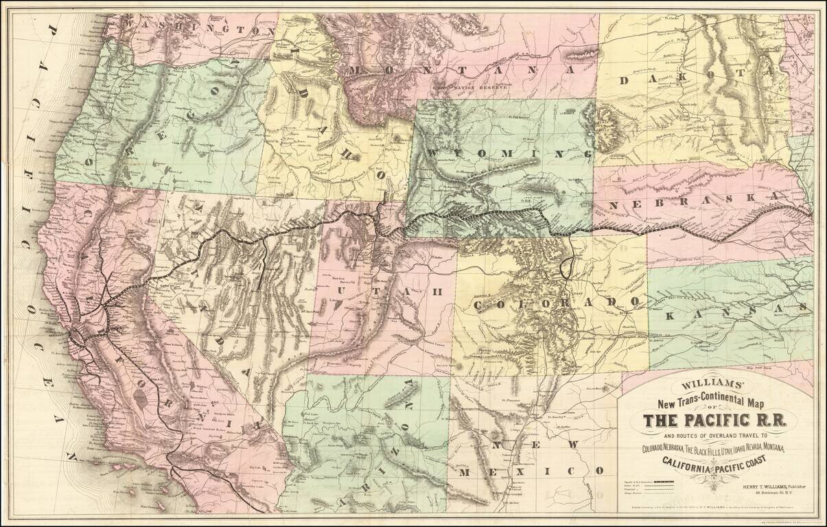
Rare first edition of this striking large format map of the West, published by Henry T. Williams, with handwritten notes, including a note relating to the notorious stagecoach robber, Black Bart, who operated in northern California and southern Oregon...
![[Union Pacific Railway Map]](/map/small/55008.jpg)
Fine large format map of the routes of the Union Pacific Railroad, published in May 1885 by Rand McNally & Company. The map is colored by counties and locates rail lines, stations and other details. The wide black lines locate the lines of the...
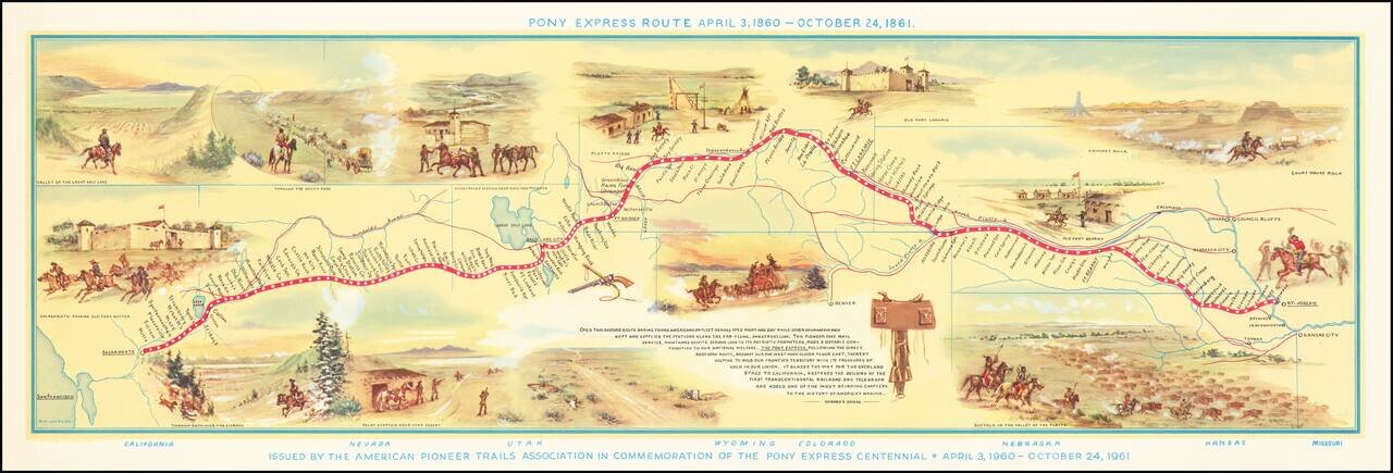
Fine pictorial map of the Pony Express Route, issued by the American Pioneer Trails Assocation in to commemorate the Centennial of the Pony Express. As noted by David Rumsey: Shows route of Pony Express with names and location of relay stations....
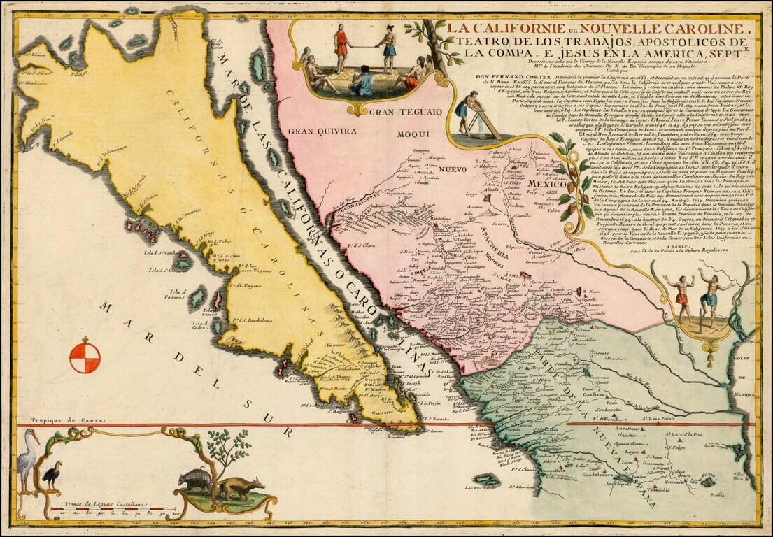
Largest Separate Representation of the Island of California Striking large-format map of the island of California—the largest separate representation of the island of California on a printed map. It is a later representation of the island (1720),...
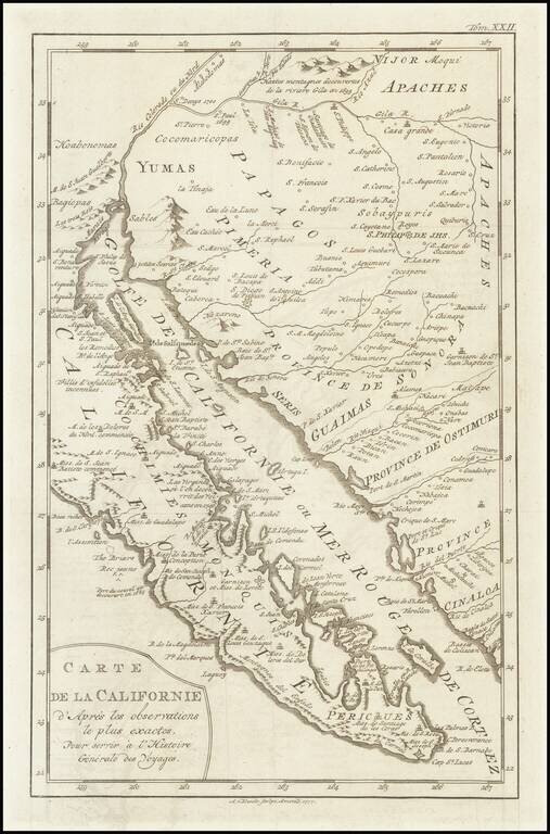
A scarce map of Baja California, northwestern Mexico, and southern Arizona. The map is detailed, showing many settlements, mountain ranges, islands, missions, and much more. California is shown as a peninsula. The California as an Island in its most...
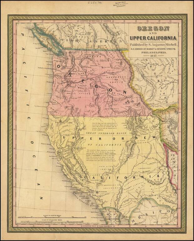
Rare 1847 edition of the best atlas map of the Western United States issued prior to the Civil War, reflecting Americans' contemporary knowledge of the West. The map shows the Spanish Trail, Lewis & Clark's Canoe Route, Oregon Trail, early roads,...
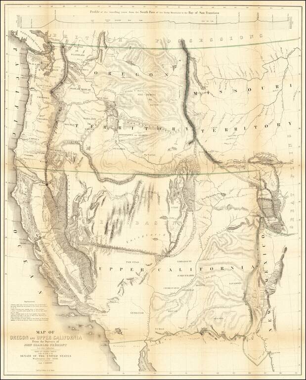
Nice example of Fremont's map of the region west of the Rocky Mountains, widely regarded as the most important and influential map the American West published in the middle of the 19th Century. This example includes the text of the Geographical Memoir...
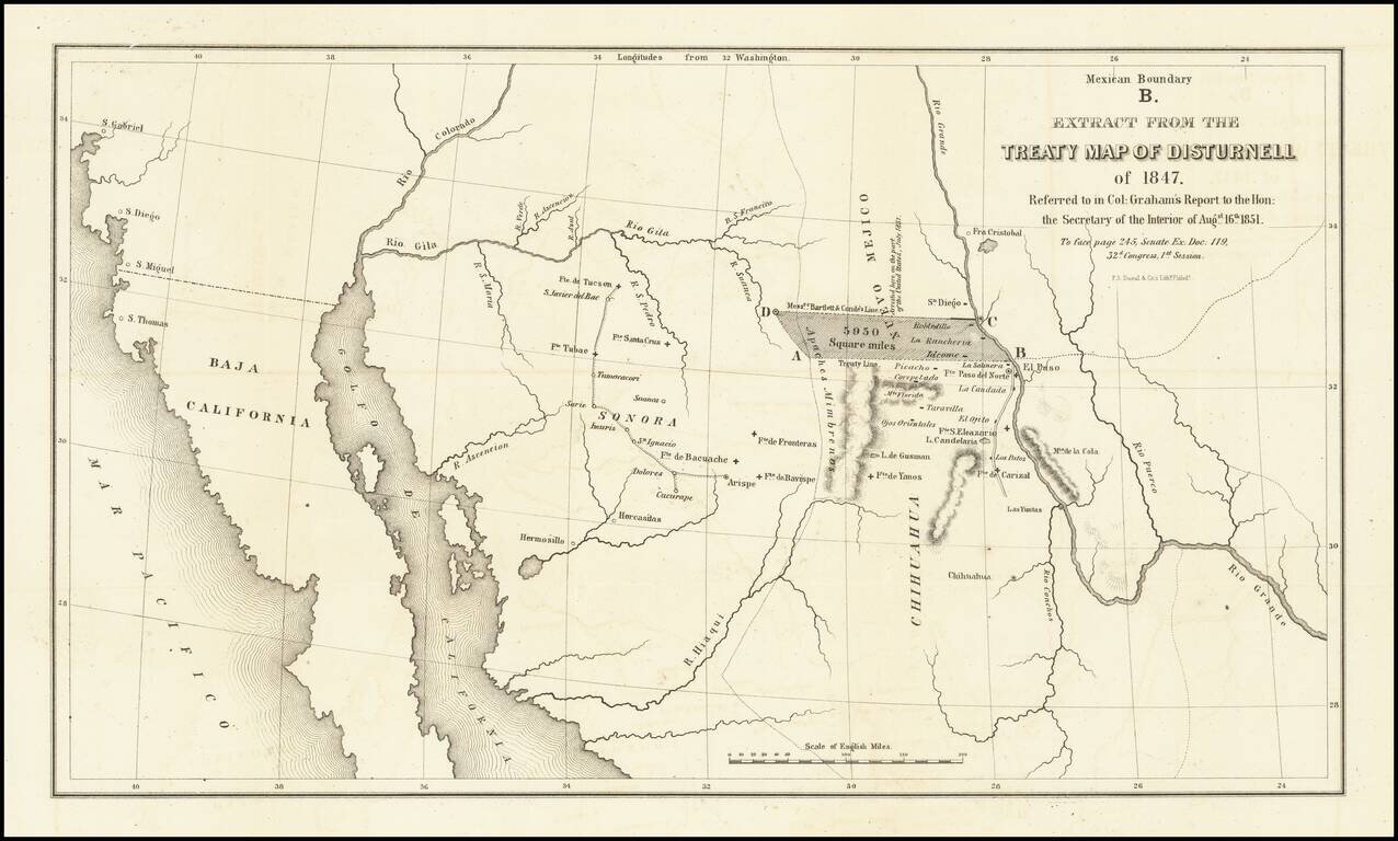
Important map illustrating the region between the Rio Grande and the Colorado River, with forts and towns marked, mainly intended to illustrate the error made by Bartlett in setting the line from the Rio Grande to the Continental Divide too far north,...
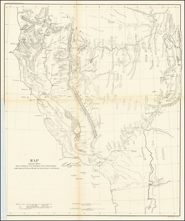
A Search For The Best Routes To The West. "[O]ne of the most interesting maps of the West" - Wheat 868 This is a scarce map which accompanied the Report of Capt. R. Ingalls on the March of L. Col. Steptoe from Ft. Leavenworth to California, in 1854...
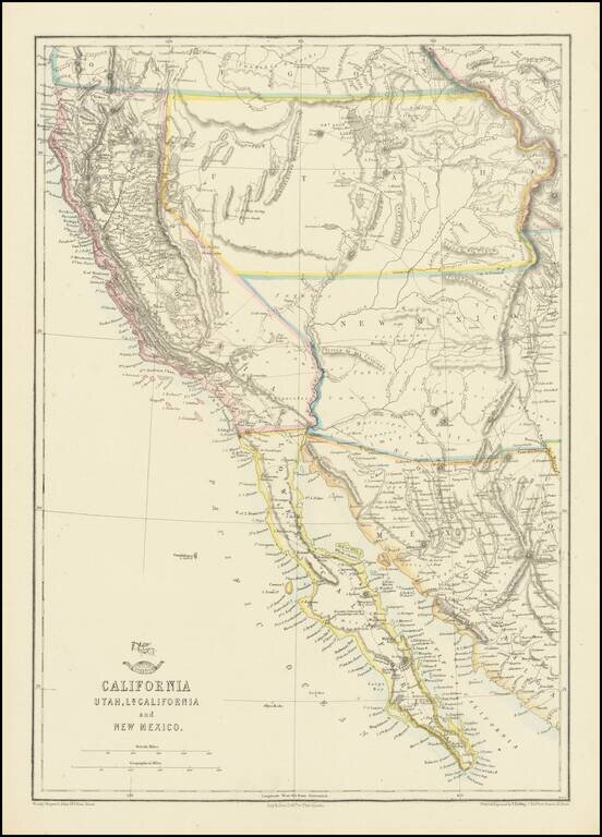
Nice example of the Ettling / Weekly Dispatch map of California and the Southwest, one of first atlas maps published in Europe to focus on the Territories of Utah and New Mexico. The map includes an excellent post Gadsden Purchase treatment of...
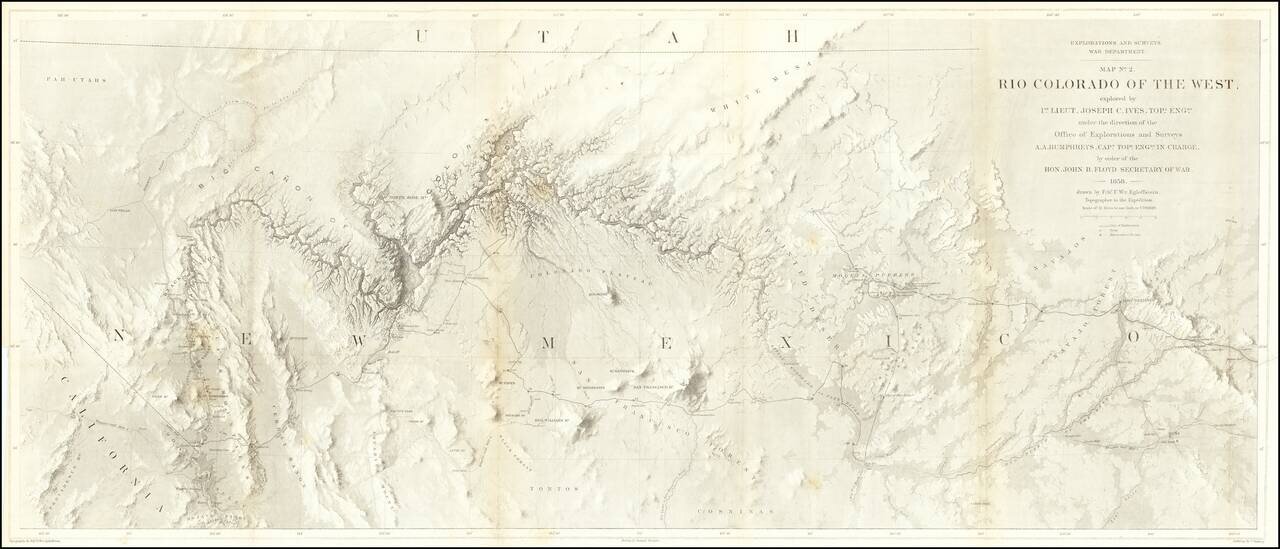
The Earliest Scientific Mapping of the Grand Canyon and Environs. This map is the centerpiece of one of the most important exploring efforts of the American Southwest. The map is one of three maps which accompanied the Report upon the Colorado River,...
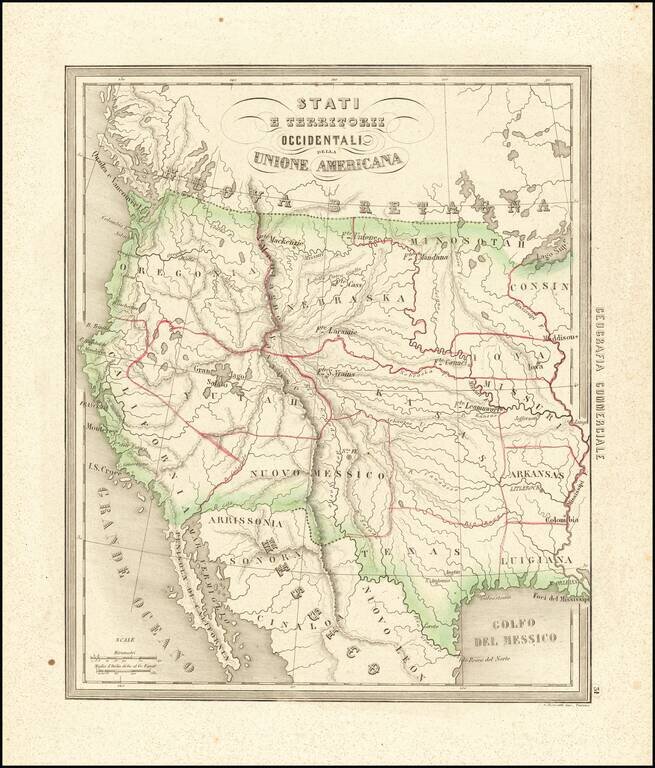
Rare and fascinating map of the Transmississippi West, from Marmocchi's Il Globo--Atlante di carte geografiche . . . , published in Genoa. The map is engraved by Bonatti in Turin. Despite the dating, the map show a pre-Gadsden Purchase border with...
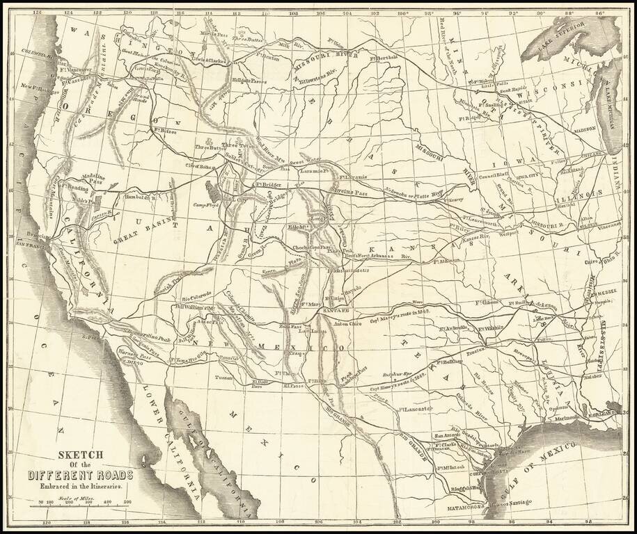
Scarce wood-engraved map of the overland routes to the West discussed in Marcy's The Prairie Traveler: A Hand-Book for Overland Expeditions, with Maps, Illustrations, and Itineraries of the Principal Routes Between the Mississippi and the Pacific...
![New Map of the State of California and Nevada Territory Exhibiting the Rivers, Lakes, Bays and Islands, with the principal Towns, Roads, Railroads and Transit Routes to the Silver Mining Districts of Nevada Territory. . . 1863 [Pocket Map]](/map/small/37306.jpg)
Fine example of Ransom & Doolittle's rare pocket map of California & Nevada Territory, published in San Francsico by Warren Holt and focusing on the routes into Nevada and the recently-discovered mining regions. One of the most interesting and...