logo

1910. Webers Township and County Map of California and Nevada Compiled From The Latest Official Data . . . 1910

  • Webers Township and County Map of California and Nevada Compiled From The Latest Official Data . . . 1910
  • Webers Township and County Map of California and Nevada Compiled From The Latest Official Data . . . 1910

Webers Township and County Map of California and Nevada Compiled From The Latest Official Data . . . 1910 information:

Year of creation: 
Resolution size (pixels): 
 16602x20433 px
Disk Size: 
 75.9472MiB
Number of pages: 
 2
Place: 
 San Francisco & Los Angeles
Author: 

Print information. Print size (Width x height in inches):
Printing at 72 dpi 
  230.58 х 283.79
Printing at 150 dpi 
 110.68 х 136.22
Printing at 300 dpi 
 55.34 х 68.11

An example of detailing the file of this map of in a printable high-resolution:

Click to open in high resolution (open in new tab).
Attention! this is just the central piece (central area 960x960 px) of the map file!
This is an example, so that you can see and study the level of detail of a given map. The entire Map will be fully available after payment!

Webers Township and County Map of California and Nevada Compiled From The Latest Official Data . . . 1910

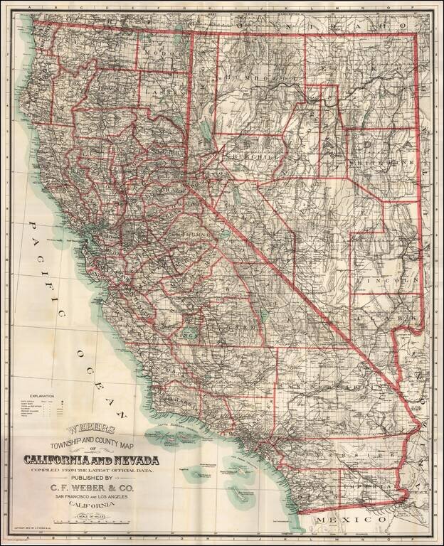
Fine large format map of California and Nevada, published in 1910 by C. F. Weber & Company, one of California's leading mapmakers at the beginning of the 20th Century.

The detail of the map is quite good, especially in the mining regions of Nevada, with an excellent accounting of the towns, roads and regional topography. The mining boom in areas like Tonopah, Beatty, Rhyolite and Goldfield is less than 10 years old and still going very strong.

The map is subdivided into townships and counties, and identifies:

  • State Capitols
  • County Seats
  • Towns and Post Offices
  • Railroads
  • Proposed Railroad Lines
  • Wagon Roads
  • Trails

The newly created Imperial County is shown in California (1907),

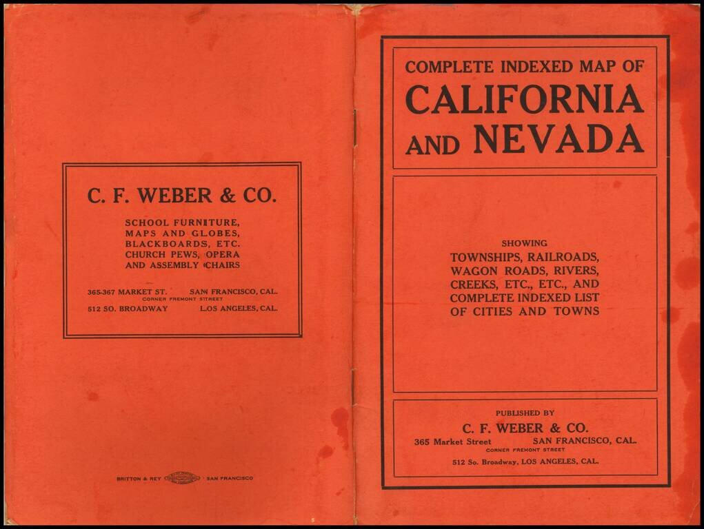
The cover title of the wrappers reads "Complete indexed map of California and Nevada: showing townships, railroads, wagon roads, rivers, creeks, etc., etc., and complete indexed list of cities and towns."


Special conditions for students!

If you are a student, write to us in telegram: @antiquemaps and indicate what material you need and for what work you need a map in high detail. We are ready to provide material on special terms. For students only!

Item information:

Year of creation:
Size:
16602x20433 px
Disk:
75.9472MiB
Number of pages:
2
Place:
San Francisco & Los Angeles
Author:
C.F. Weber Co..
$21.99

Related item