Map size in jpg-format: 31.6721MiB
Click to open in high resolution (open in new tab).
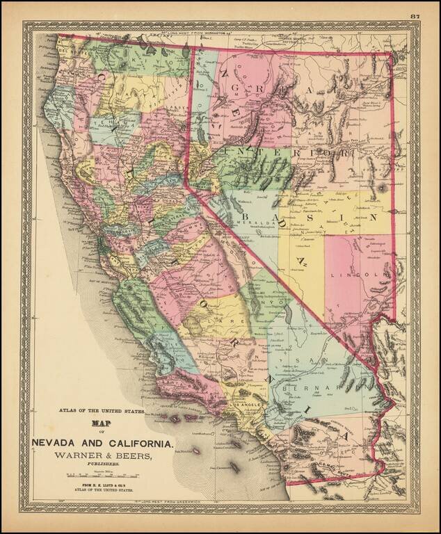
Fine example of HH Lloyd's striking map of California and Nevada.
The map is colored by counties, and shows the US Mail Route, Wagon Route from LA to Salt Lake, Old Telegraph and Express Route, Transcontinental railroad lines, and other roads. Locates towns, rivers, mountains, lakes, Indians, Forts, mines Missions and many other early details. Predates Riverside, Imperial, Orange, Ventura and a number of other counties. Las Vegas is still an Old Mormon fort. Massive Grand Interior Basin named in Nevada.
An excellent and surprisingly scarce early map. HH Lloyd's Atlas of the United States was never issued as a separate Atlas. Its only appearance is as a supplement to County and State atlases published by Warner & Beers.
If you are a student, write to us in telegram: @antiquemaps and indicate what material you need and for what work you need a map in high detail. We are ready to provide material on special terms. For students only!

![Mexique par Th. Duvotenay…1843 [Republic of Texas]](/map/small/67925.jpg)
