
Interesting map of the southwest, hand colored by counties and showing a number of interesting territorial anomalies. Nevada has its lower corner truncated, leaving Las Vegas in Arizona. In each of the states and territories, the county configurations...
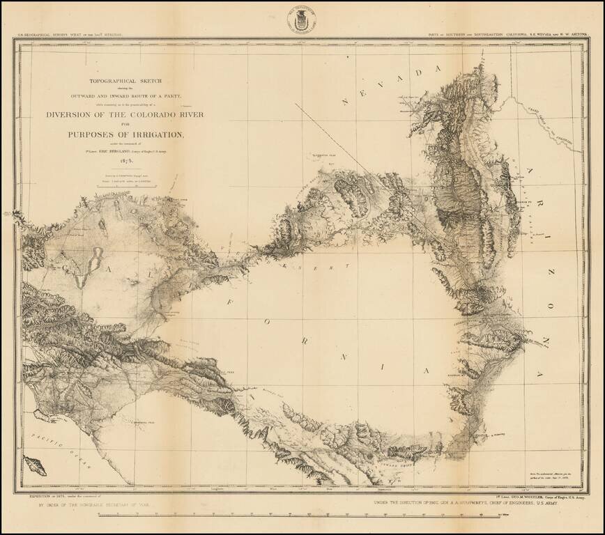
Highly detailed US Geographical Survey Map, tracing the expedition route from Ehrenberg and the Willow Spring area to Los Angeles, via the Coachella Valley and San Bernardino, the North into the Mojave Desert and on toward modern day Las Vegas. The...
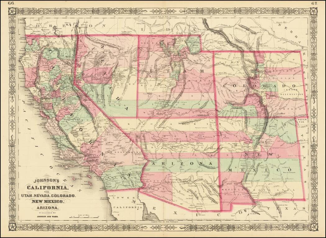
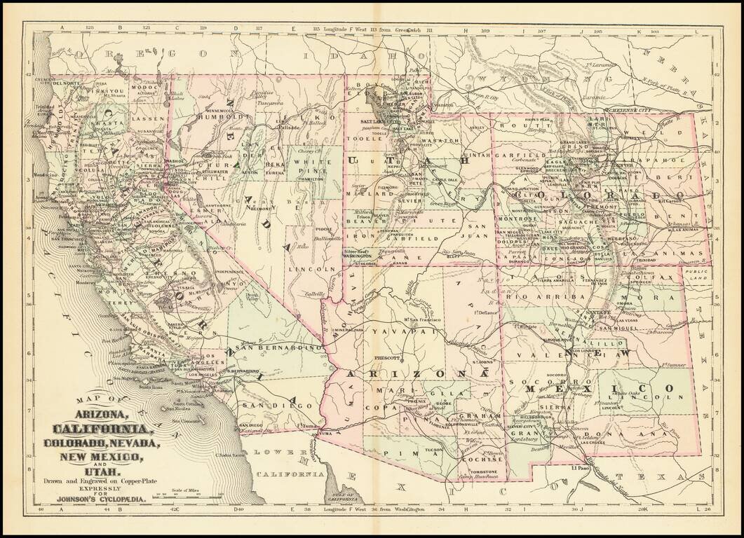
Interesting map of California and the Southwest hand colored by counties and showing a number of interesting territorial anomalies. Nevada has its lower corner truncated, leaving Las Vegas in Arizona. Utah extends approximately 1 degree too far to the...

Rare 1876 edition of Bancroft's map of California & the Southwest. The map is hand colored by counties and shows tremendous detail, one of the best maps of the Western United States published West of the Mississippi during the period. Early roads,...
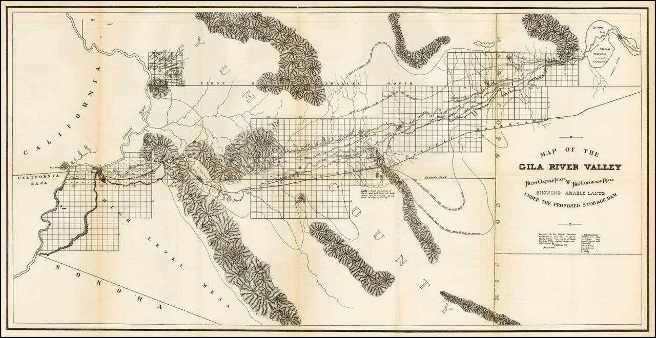
Scarce regional map of the region extending from Yuma and the Colorado River to Oatman Flat, which at the time was the site of a proposed reservoir. The map was prepared by the Citizens Executive Committee on a proposed reservoir and irrigation of Yuma...
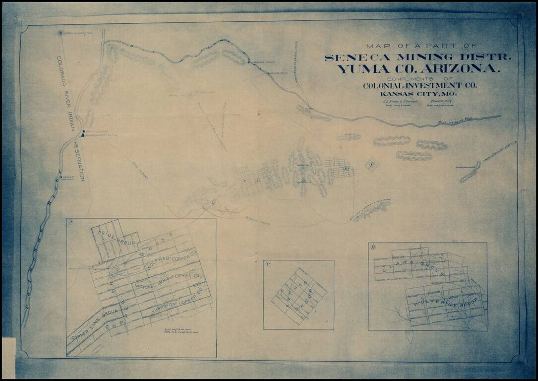
Early blueprint copy of part of the Seneca Mining District in Yuma County, showing the lands south of the Bill Williams Fork and east of the Colorado River.
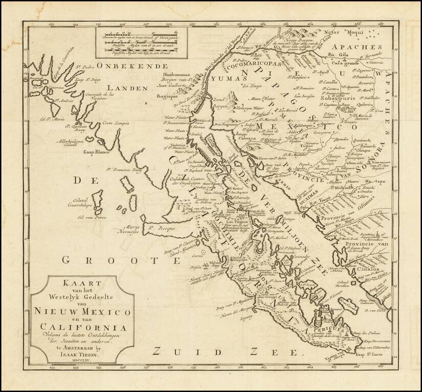
One of the Earliest Obtainable Maps of Southern California and Baja California Fine old color example of this early map of Baja California and parts of Alta California, Arizona and Sonora. Isaac Tirion's map of Baja California is one of the best...
![[Southern California, Arizona, Baja & Sonora] Amer. Sep. No. 53 Partie De La Vielle Californie](/map/small/47400.jpg)
Early mapping of Southern California, southwestern Arizona, northern Baja California and Sonora, published in Brussels. The California Coastline is shown from San Juan Capistrano in the north to the Bay of San Francisco in Baja Norte, centered on San...
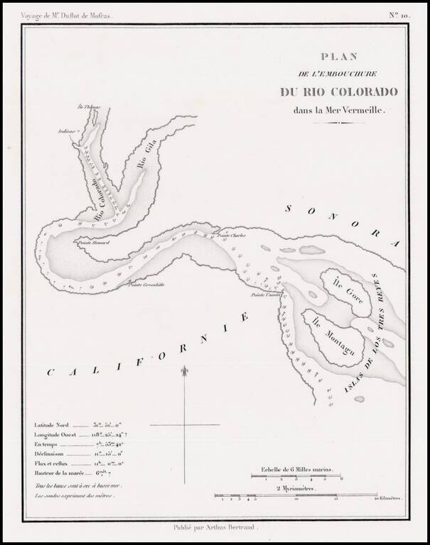
Rare early map showing the confluence of the Gila River and the Colorado River, along with the Northern tip of the Gulf of California, then also known as the Red Sea, because of the color of the water which flowed from the Rio Colorado (Red River) into...

The Second Issue of Fremont's Map of the West--Issued Following the Discovery of Gold in California Nice example of Fremont's seminal map of the West, which focuses on California, Arizona, Utah and Nevada. Wheat dedicates 13 pages and 2...
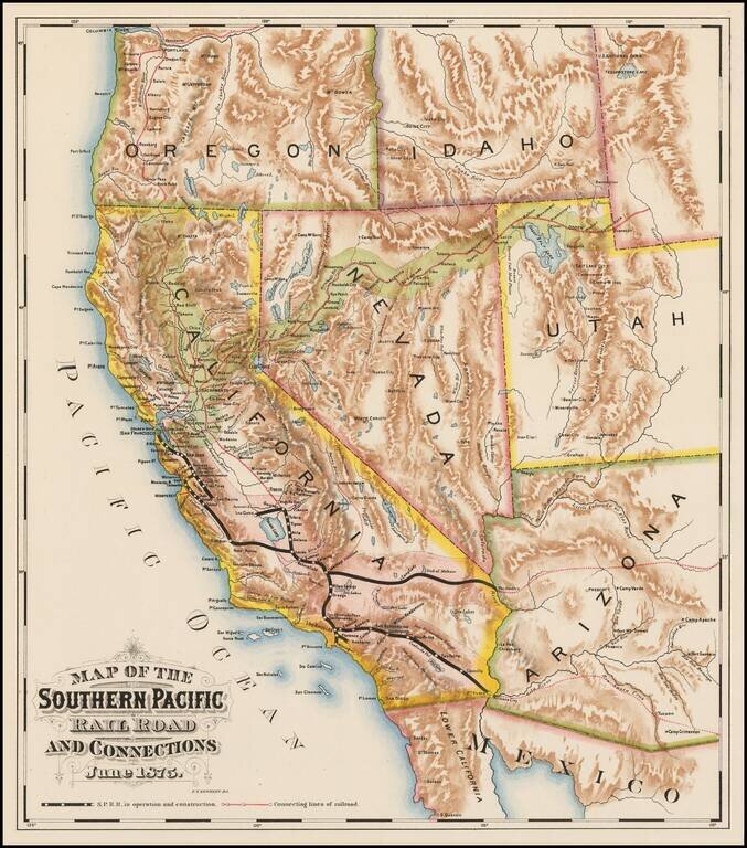
Fine colored chromolithographic example of the earliest known map focused on the general lines of the Southern Pacific Railroad, published more than a year before the line was completed through Los Angeles. Rare promotional map for the Southern...
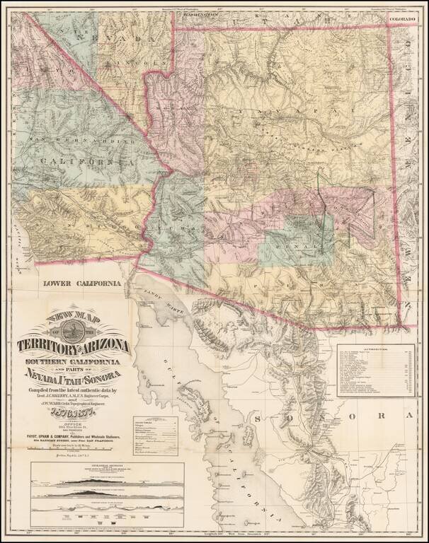
The Finest Large Format Map of Arizona, Southern California and Southern Nevada from the 1870s. Large and striking map centered on Arizona with pieces of the adjacent states and territories, at a time when Arizona was undergoing a mineral boom, and...
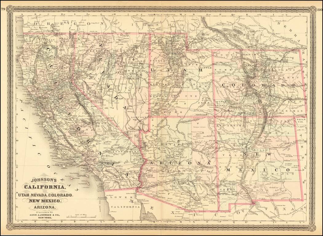
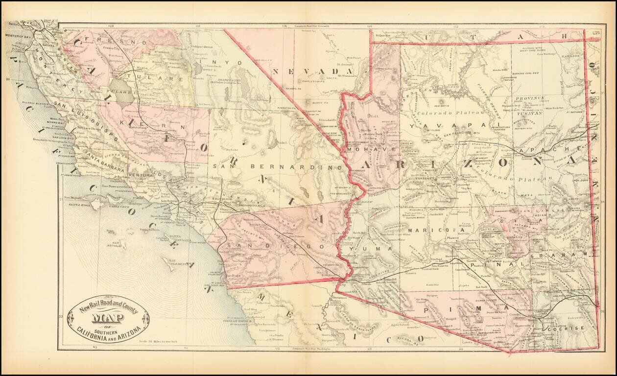
Detailed map of California and the Southwest, colored by Counties.
Scarce early map of Southern California and Arizona, focusing on the Railroad Lines then in operation. The map also shows a number of early towns, roads, mountains, lakes, mining regions and other important details. This is the first time we have...
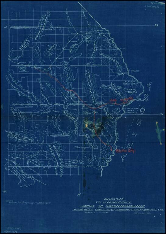
Detailed map of part of Southeastern California (Eastern Imperial and San Bernardino Counties), showing the projected railroad lines connecting Blythe City, Parker, Arizona, and Bengal, on the main line of the Santa Fe Railroad between San Bernardino...
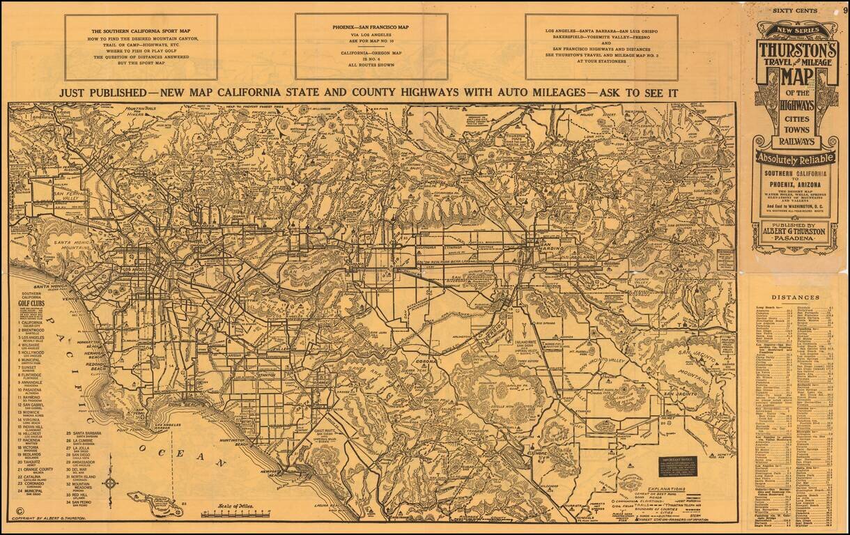
An Early Road Map of the Southwest Fantastic early automobile map of the Desert Regions between Southern California and Phoenix, published in 1915 by Albert G. Thurston and drawn by D.C. McClain. The desert map is quite extraordinary, providing a...